Category: Featured Blog

Wet But Warm Week Ahead

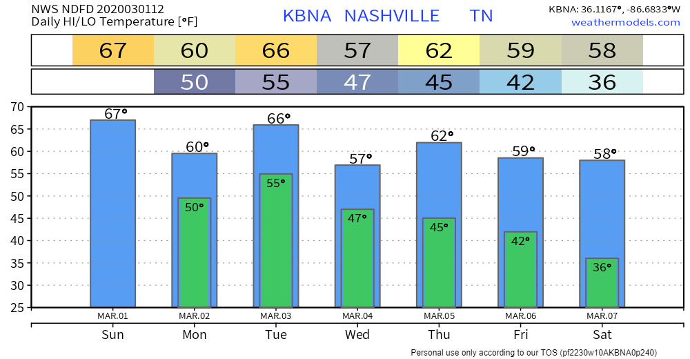
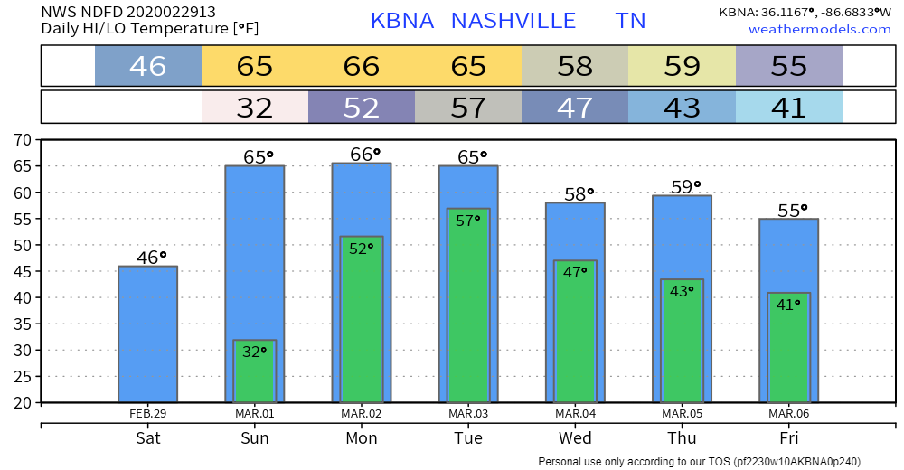
Off and On Rain Begins Monday

… and off and on rain will carry on throughout the week.
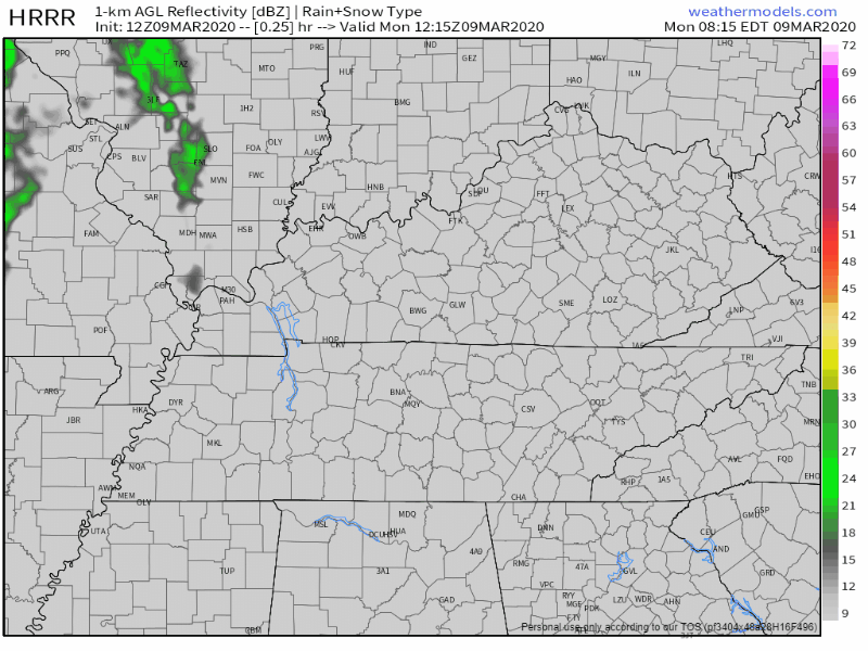
TIMING

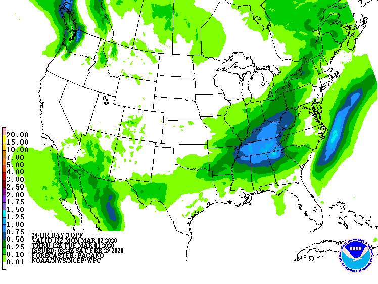
The HRRR model thinks scattered showers will begin Monday night (tonight) around 9 or 10pm:

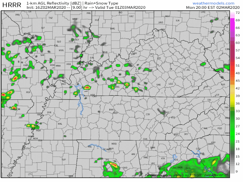
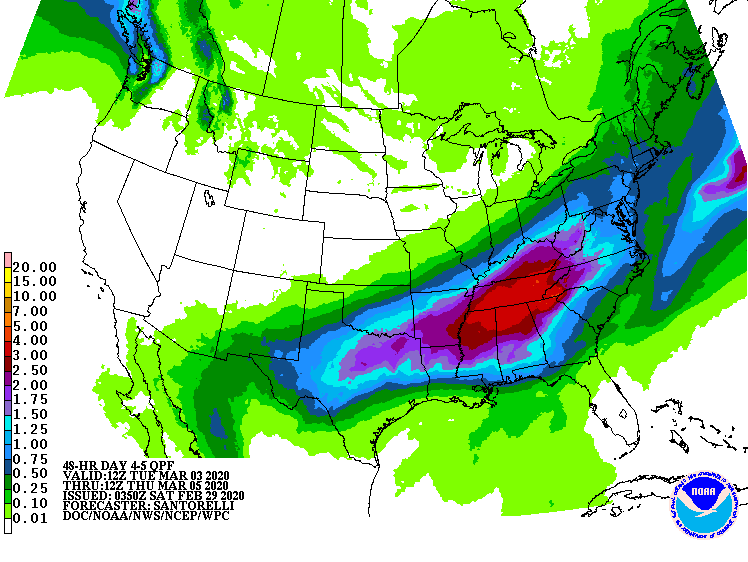
The GFS model also thinks rain begins later this evening with a break after Tuesday morning, heavier rain Wednesday afternoon, and then more off and on showers through Friday: read more

Rain This Week

Comfortable Sunday

Beautiful weather ahead for today:

Keep in mind that as today makes a great day for clean-up efforts, crews will be out working. Volunteers are greatly appreciated, but please do not park on tornado-impacted streets as it will already be very busy in these areas. Commercial trucks and clean-up crews need room to work, so be please mindful of them. If you park in their way, they can’t work. read more

Tornado rating info and other comments, then the forecast – going to get cold, next rain event early next week.

Preliminary Tornado Rating Map; This Doesn’t Include the EF-4 in Putnam County.

It was one supercell producing at least two strong tornadoes.

Our tornado was rated EF-3. Ratings refer to the highest damage reported; this one had EF-0, EF-1, EF-2, and EF-3 damage at various points, but it’s called “EF-3” because that got the highest rating. EF-3 damage was in Germantown, Donelson, and East Nashville. Here’s the zoom on Nashville/Davidson County: read more

Strong to Severe Storms Possible Tonight, More Rain Through Thursday, Dry And Cooler Weekend

Isolated Showers This Afternoon, Strong to Severe Storms Possible Tonight

We’ve gotten a break from the rain for a few hours this afternoon. Clouds will stick around, so not much sun there for us today, but regardless we’ll be up to 64° for the high. Strong to severe storms will move in from the west this evening. Here’s more on that from the NWS-Nashville: read more

Heavy Rainfall Concern Early Next Week

Headlines

  • 4″ to 6″ of rain (some may see a bit more) is the current forecast from Sunday night through Wednesday; however, timing and rainfall totals are uncertain because models disagree. We may need to decrease or increase these totals.
  • Flooding is possible and rises on area river, streams and creeks are likely by Tuesday night

Beautiful Weekend; Mild Temps All Week

No concerns for any outdoor weekend activities.

Then Rain Arrives, 3 Days Of It, Starting Monday.

Total rainfall Monday around 1″.

There is a chance for some strong storms on Monday and Tuesday with instability on the rise, but heavy rainfall is the main concern. read more