
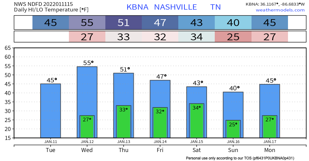
Normal January temps are really sticking. Today and tomorrow will stay dry and cool with overnight lows dancing around the freezing mark.
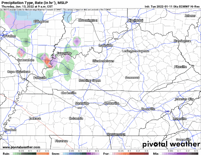
Our area could see some showers Thursday. Euro model below shows some of us getting sprinkles in the afternoon time. GFS has any precipitation staying clear of our area. If this system lingers and ends up in our area later that night, a flurry may be in the mix. Chances aren’t high, so for now expect some sprinkles.
For the weekend, models disagree on how our next weather maker will play out. At this range, the major computer models we refer to are the GFS and the Euro. At the moment, they show two differing solutions, which is not unexpected. Draw few conclusions.
Looks like any precip we do get will be gone Saturday night/Sunday.
Quick References:
Weather changes constantly.
Follow @NashSevereWx on Twitter for any changes to this forecast.
Live coverage during tornado and severe thunderstorm warnings:
Look good.
Support the mission.
We are 100% community supported. No ads. No subscription fees. Keep it free for everyone.
Categories: Forecast Blogs (Legacy)
You must be logged in to post a comment.