
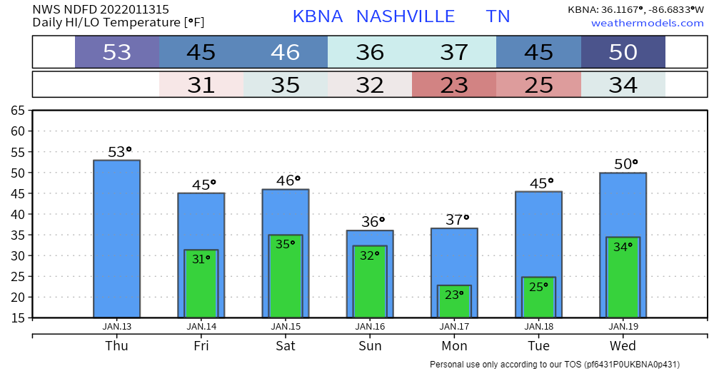
Not much change to the forecast for today. More cloud coverage throughout the day plus some scattered sprinklers. Timing: this afternoon. Cooler and dry tomorrow with highs in the mid 40s. Look for wind chills to hang out below 40.
Models are starting to come into some agreement on the general setup for the winter weather maker for this weekend. What they don’t agree on quite yet is the exact track of the system, which will dictate how several variables play out, including what type of precip we’ll get, when the changeover from one type of precip to another occurs and how much of each precip type we’ll get.
Latest GFS and Euro runs starting to show more similar scenarios:
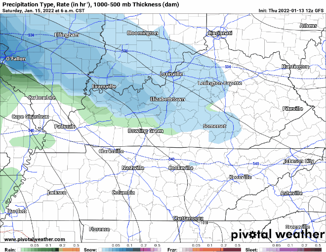
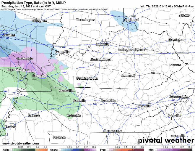
Right now, this looks like an event where precip starts as rain on Saturday, then transitions to snow late Saturday night. Check out our Twitter thread for more details:
NWS summarizes the variables currently in play.
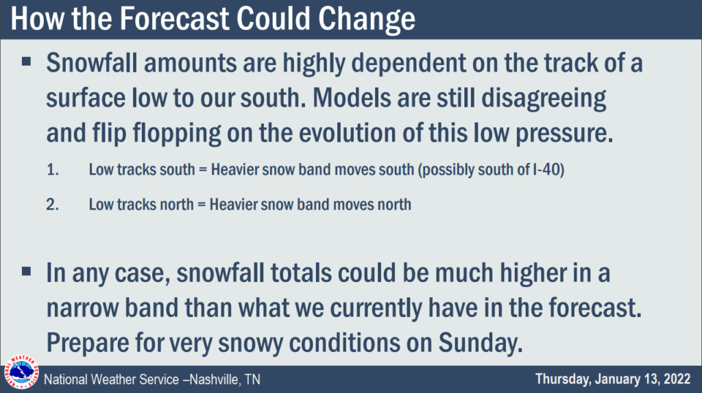
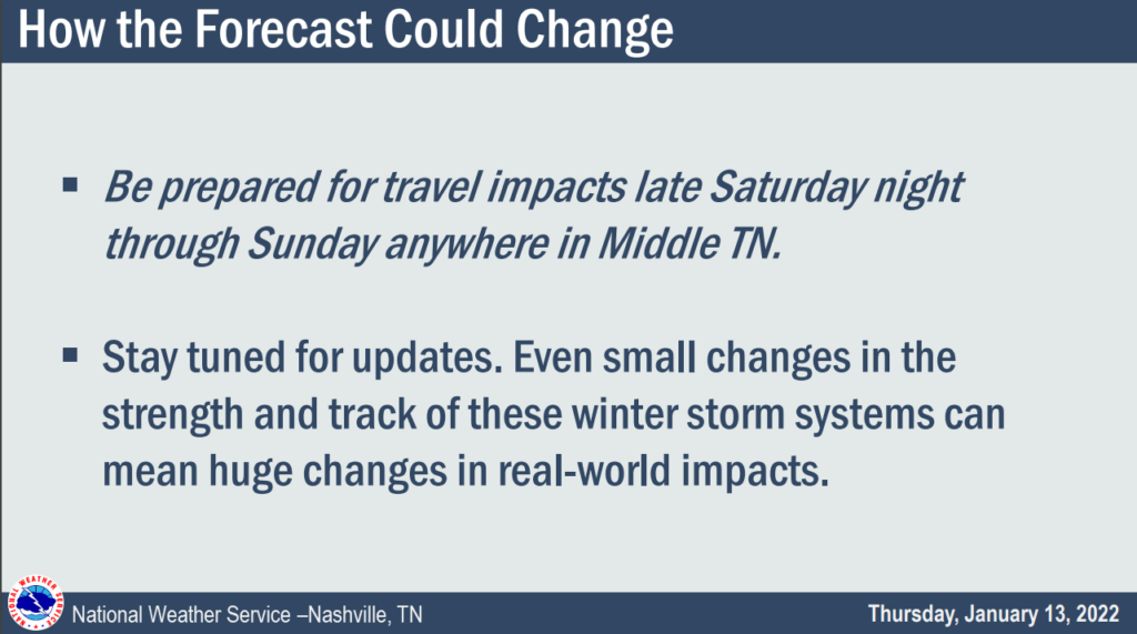
We know you want details. Those will come with time as the high resolution models start coming in range. Hang in there. We’re still pretty early in the forecasting stage.
The system should be out of the area Sunday evening, an the process of melting will begin on Monday.
Quick References:
Weather changes constantly.
Follow @NashSevereWx on Twitter for any changes to this forecast.
Live coverage during tornado and severe thunderstorm warnings:
Look good.
Support the mission.
We are 100% community supported. No ads. No subscription fees. Keep it free for everyone.
Categories: Forecast Blogs (Legacy)
You must be logged in to post a comment.