
A bit warmer today than yesterday… highs generally 5-10 degrees higher. Staying dry until at least tomorrow.
Overcast skies and maybe rain for some folks tomorrow. Likely just sprinkles; nothing to write home about. A slight cool off starting tomorrow ahead of a possible winter weather event this weekend.
The meat of the forecast is the snow/mixed precip chance. Models agree on the general pattern. Still a good bit of uncertainty concerning timing and track. All eyes on the low pressure creeping down through the Plains. A more westward track could mean more snow for us. The reverse is just as likely. Current GFS runs have the system tracking like this:
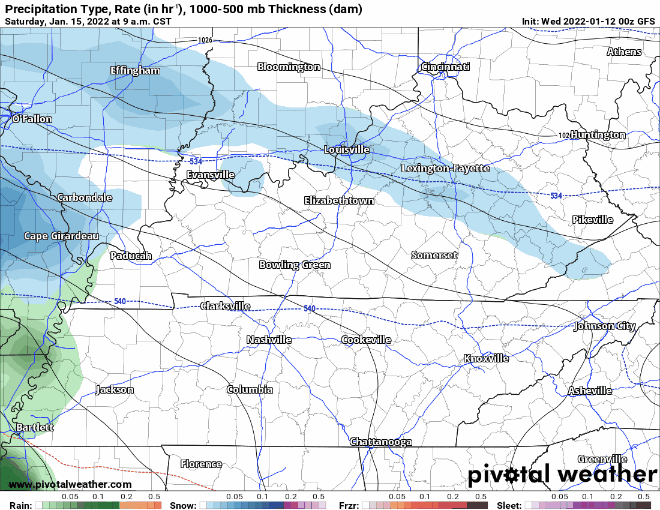
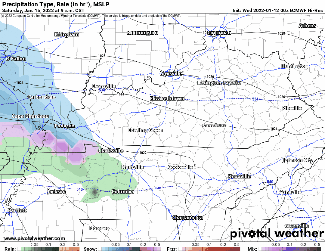
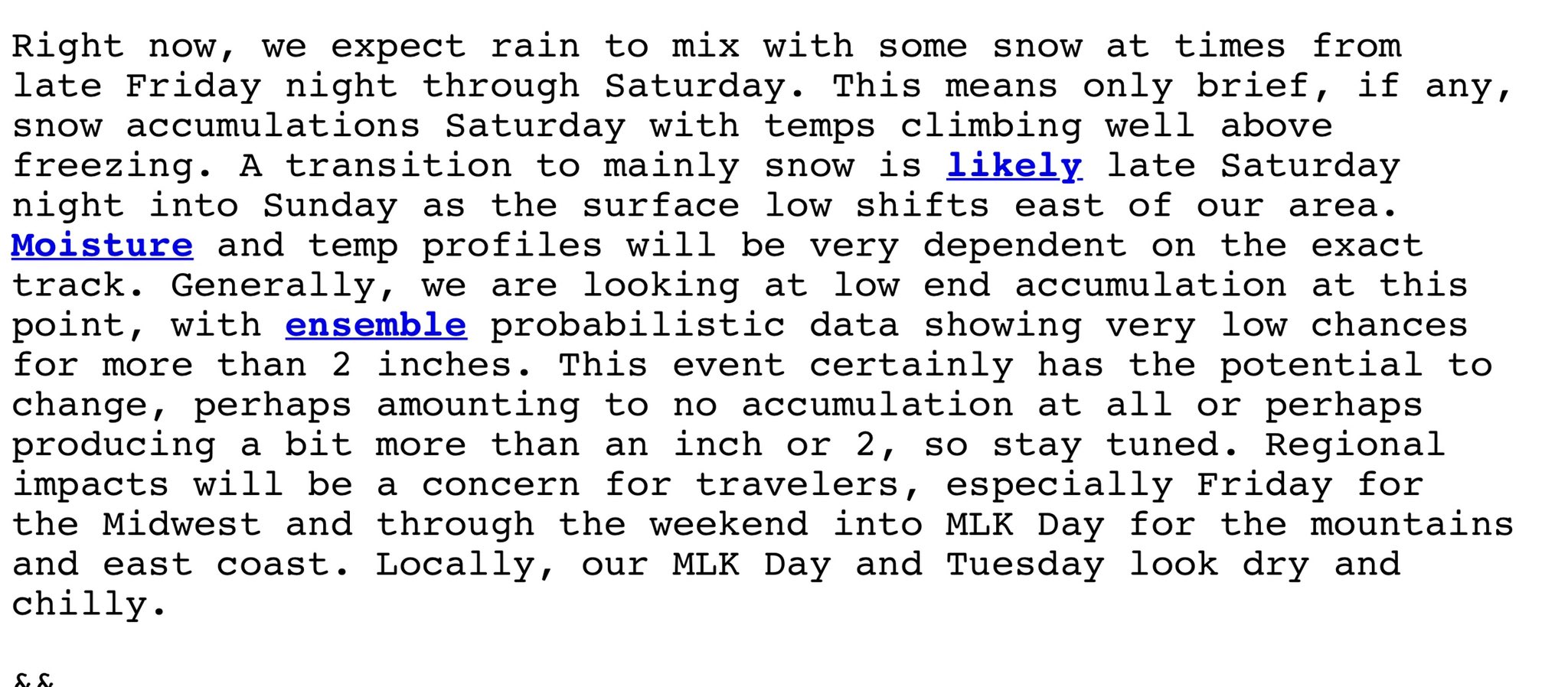
Here are the NWS comments:
To boil it down, we need more time and more data. That will arrive over the next couple of days. There may be more conclusions at that time. There may not be. As we’ve seen with our recent snow events, the line between accumulation/travel problems and nada can be very small and ever changing. Stay tuned.
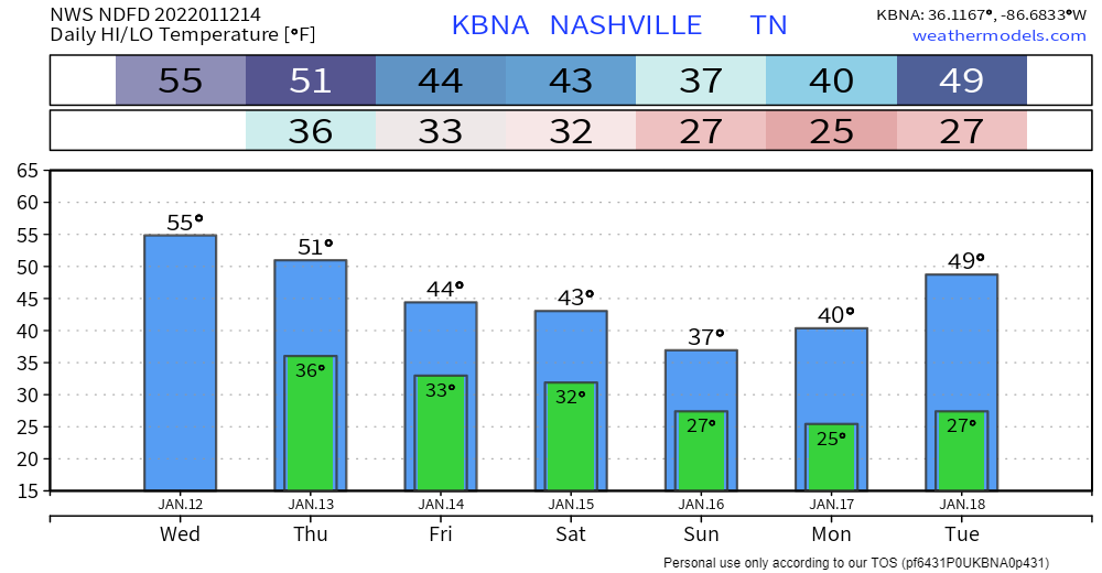
Quick References:
Weather changes constantly.
Follow @NashSevereWx on Twitter for any changes to this forecast.
Live coverage during tornado and severe thunderstorm warnings:
Look good.
Support the mission.
We are 100% community supported. No ads. No subscription fees. Keep it free for everyone.
Categories: Forecast Blogs (Legacy)
You must be logged in to post a comment.