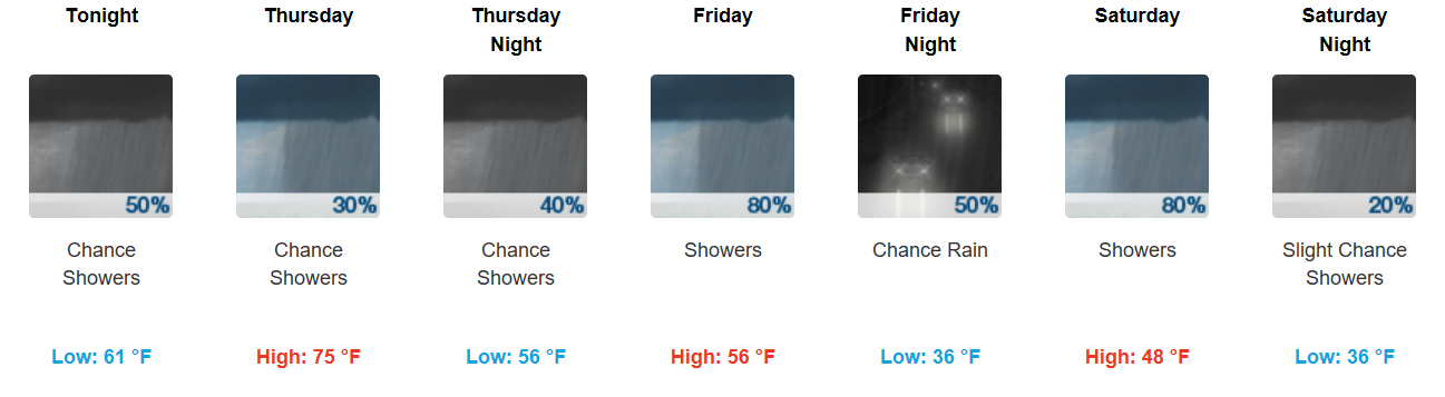
A Soggy and Dreary Couple of Days
Showers currently drift along to our southeast. Those in the southern portions of Williamson Counties may see a few of these showers this morning. Those in Davidson County may get a slight break through the AM.

Showers currently drift along to our southeast. Those in the southern portions of Williamson Counties may see a few of these showers this morning. Those in Davidson County may get a slight break through the AM.
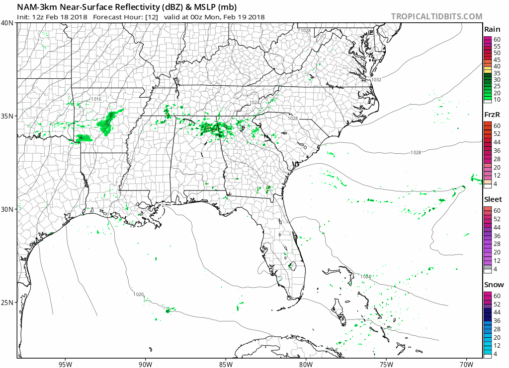
Rain showers are moving from southwest to northeast through the Mid-State this morning. A surface cold front is slowly meandering through north-central Tennessee, too. Temperatures will be several degrees cooler today, thanks to that and the addition of rainfall. A few thunderstorms are possible through the remainder of the day, but severe weather is not expected.
Sunny skies and highs into the 80s today (yes 80s!). The current record high temp of 78° in 2014 is in jeopardy with the forecast high being 81°.
https://giphy.com/gifs/editingandlayout-anchorman-that-escalated-quickly-ToMjGpjpXMFPshSYGLm
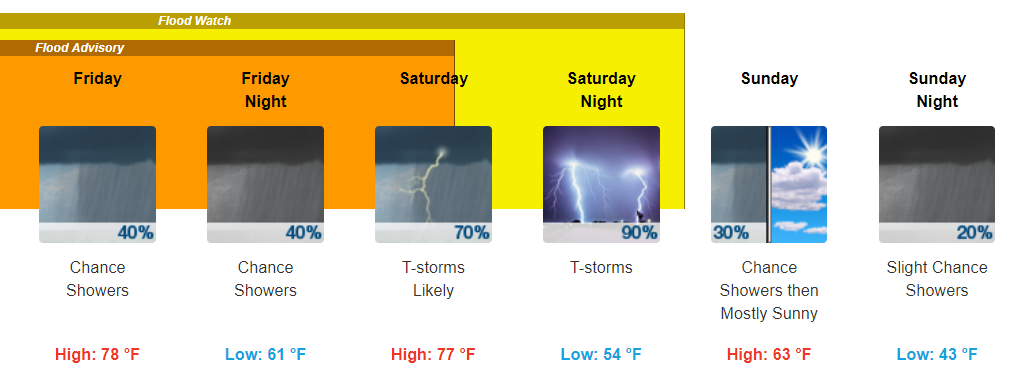
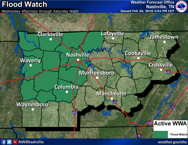
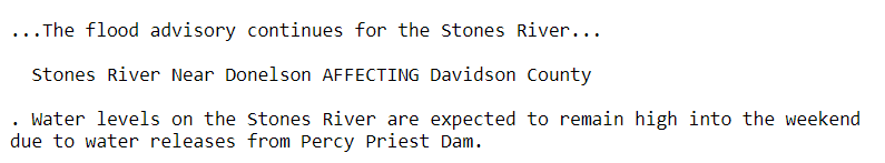
Flood Advisory for the Stones River continues…
Partly cloudy skies will be the dominant weather type today, and with extra breaks in the clouds, temperatures will skyrocket into the middle and upper 70s. Winds are also kicking up into the 30mph range already, and this will continue for the remainder of your Monday.
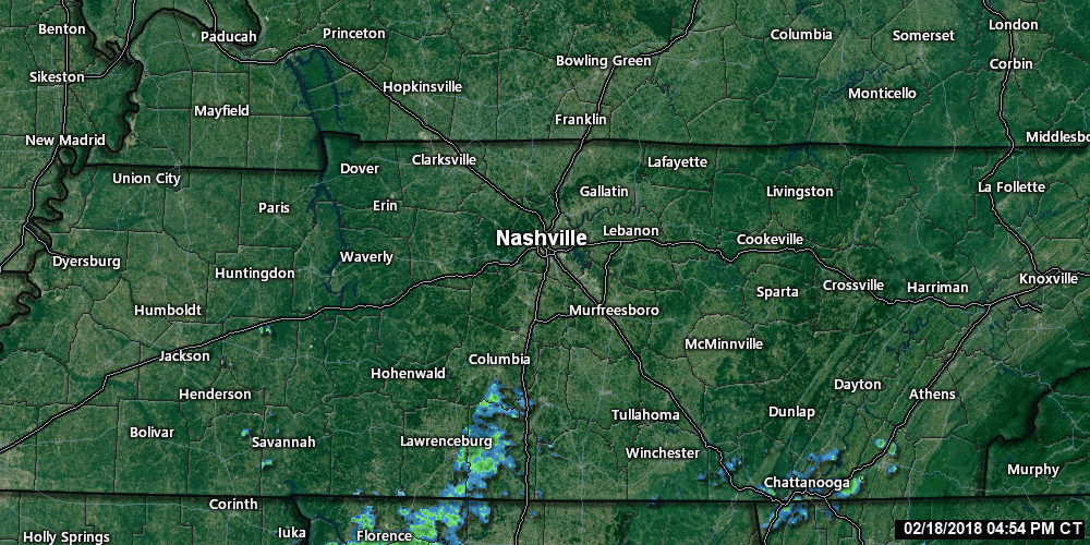
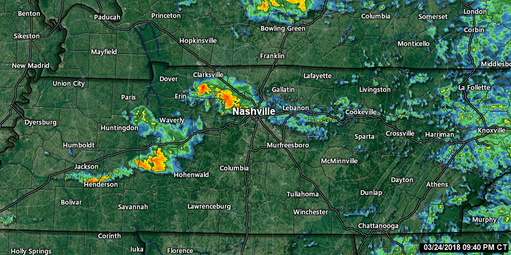
A few raindrops are trying to roll in from the southwest tonight and overnight, but mostly we’re dodging it, and I think it’ll mostly be a non-event for us. As of 5:32 PM, the radar looked like this:
60° this afternoon, a bit higher under direct sunshine.
Clouds will roll in this afternoon, staging a few brief drizzlers Monday morning.
Off and on rain, amounting to under 0.10″, mostly (and probably exclusively) happening before lunch. It’s possible some of us won’t see any.
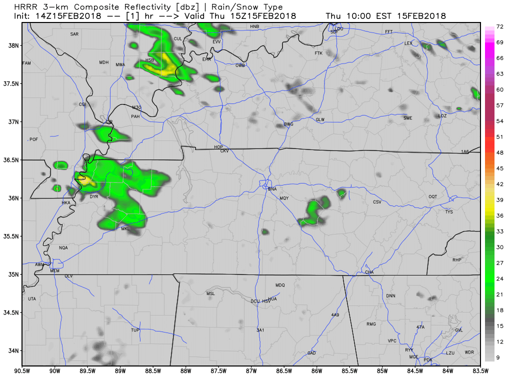
Bands of showers continue to move across much of Middle Tennessee. If you have any plans today, grab the umbrella before you head out the door.
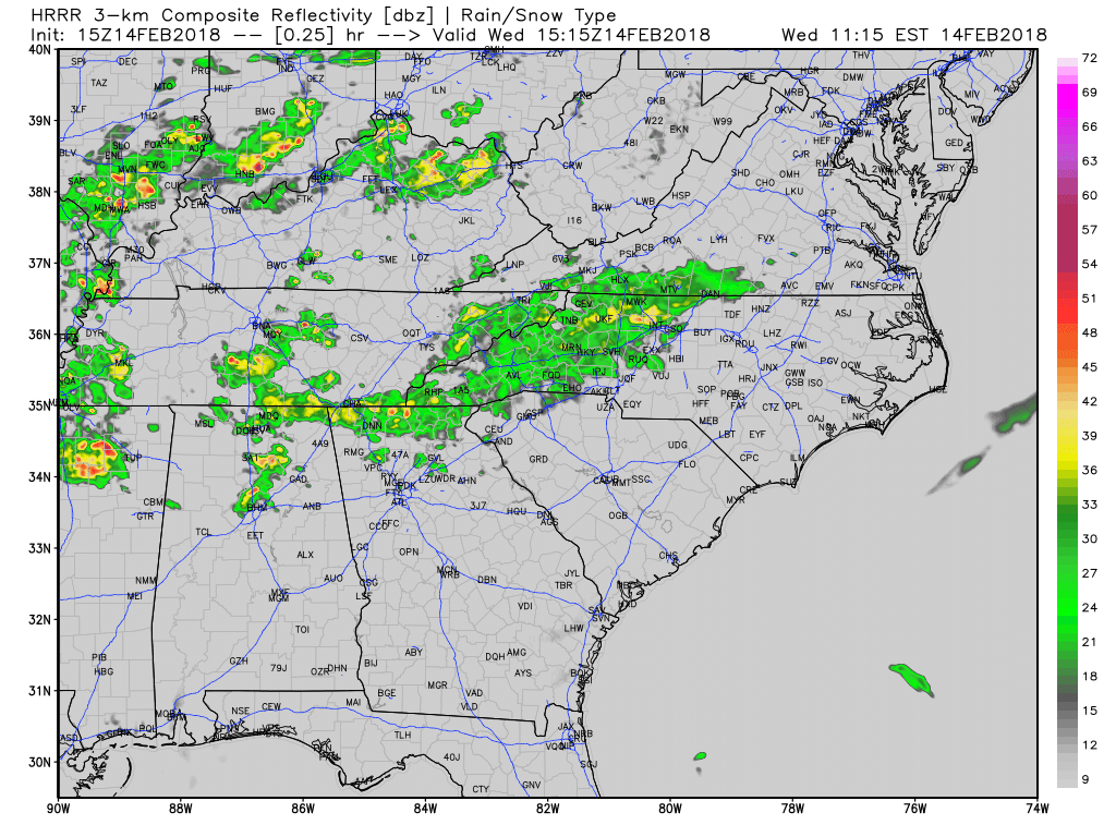
Current Radar as of 11 AM
While we may see periods of heavier downpours, which could lead to some ponding of water in low-lying areas, we are not expecting any flooding issues with these showers.
The Friday cold front has passed and we are quickly seeing its effects! Temperatures are already down into the middle 40s at 11:00AM, and we are expected to bottom out in the mid to upper 30s overnight tonight. A northwest wind will keep things gusty…20-25mph winds are possible, so keep those loose outdoor items tied down.
First things first, it is going to feel kinda gross outside today. Highs expected to reach the mid-70s (the record for Nashville is 77°) with dew point temps into the low-60s. Today will feel more like a spring to early summer day than the middle of February.
Off and on showers will continue through the evening, and even a rumble of thunder cannot be discounted. Temperatures will be relatively mild, hovering in the middle 60s.
HRRR Model Loop
Additionally, we still have a Flood Advisory out in Davidson County:
You must be logged in to post a comment.