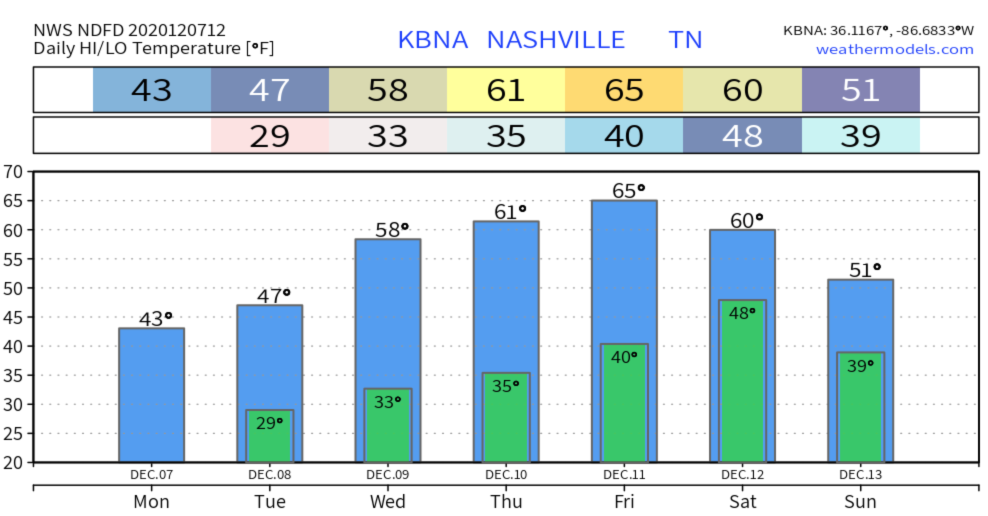
It’s quite chilly this morning with temps in the low 30’s, and we are only going to warm up to 43.
Skies are partly cloudy and will stay that way all day. A few flurries were caught in a north wind mid-morning, blowing into Middle Tennessee from Kentucky. These are of no consequence and will melt upon arrival.read more
Freezing fogs are not unusual. Light winds, clear skies, and dewpoints close to air temps provide perfect conditions for fog. Add subfreezing temps and a layer of ice can form. Probably too many clouds Monday morning for another round, but fogs and freezing fogs will be possible again Tuesday and Wednesday mornings.
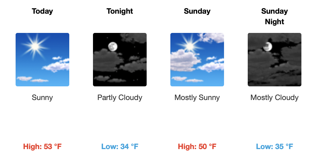
Rest of Sunday
Partly cloudy skies in the early afternoon will give way to mostly cloudy skies in the evening.
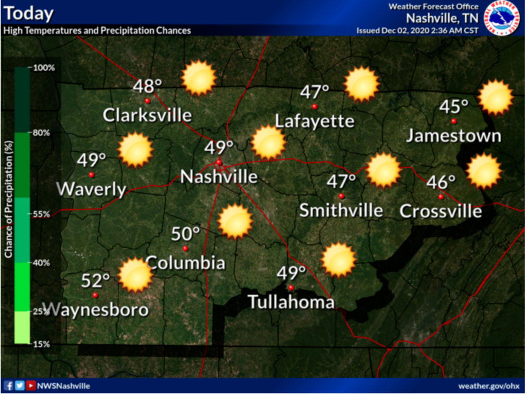
Temperatures will be near seasonal averages with a high of 54.read more
Not just any fog… Freezing Fog. Fog that forms when temperatures are at or below freezing.
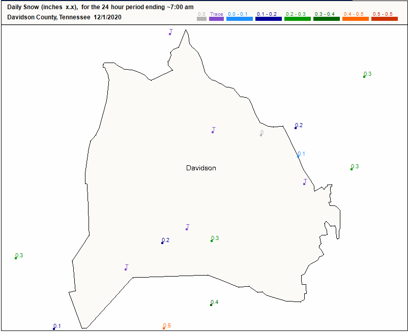
Most of it has dissipated by the time of this posting.
Through the Rest of the Weekend
Pretty quiet morning for most of Middle Tennessee. Lingering clouds moving off to the east will make way for some sunshine for the rest of the day.read more
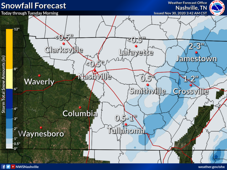
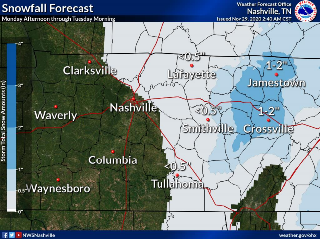
Don’t expect this to be you today. Looks like maybe a dusting today. No major travel impacts expected here, but as always this will be watched. A few degrees here or there will make the difference between splat:melt and a dusting.read more
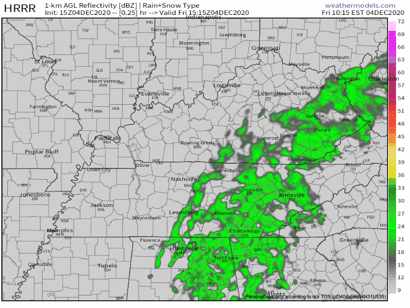
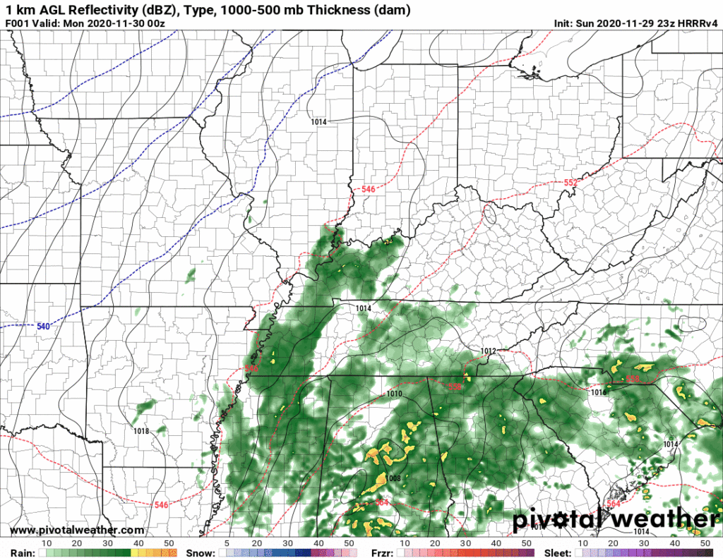
Snowflakes mixing with rain possible while we sleep overnight. No accumulation.
More snowflakes possible again Monday mid-morning into the afternoon. Accumulation unlikely.
Wind chills will drop Monday into the 20°s.
Temps should drop below freezing Monday night around dark. Snow should have departed by then, but black ice may form on wet roads late Monday night/early Tuesday morning.
Check back in the morning and through the day for updated information.
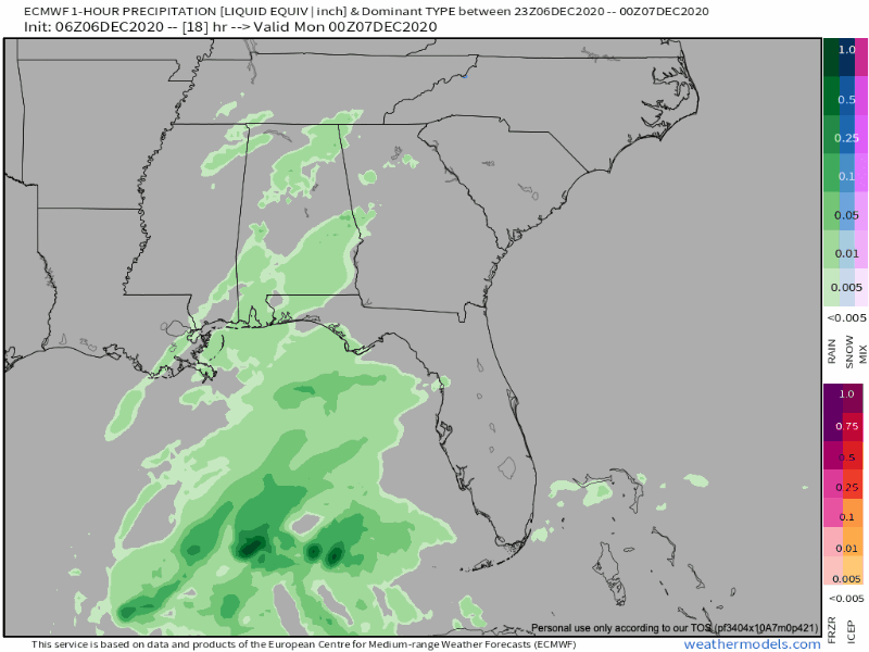
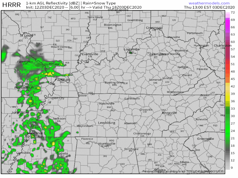
Rain will continue off and on tonight and overnight.
Forecast rain totals increased slightly from this morning. 1.00″ on average, but local rain gauges will vary. More rain is likely southeast (Nolensville, Antioch, College Grove, Franklin). Less rain is likely northwest (Bellevue, Bordeaux, Joelton, Fairview). read more
Daylight hours Sunday should be dry. Rain expected around sunset or shortly thereafter.
Euro Model shows a 6PM start time.
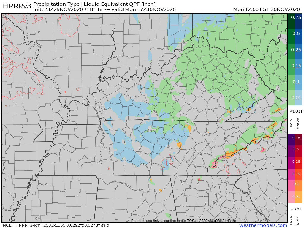
This is a soaker. NWS-Nashville lists 0.75″ but that’s an average. Data suggests more rain southeast (Nolensville, Antioch, College Grove, Franklin) and less rain northwest (Bellevue, Bordeaux, Joelton, Fairview), but that line could shift a bit here or there and give everyone 1.0″ or 0.5″ or less. Some may see more than 1″. We’d rather see less rain to limit the potential for black ice Monday night into Tuesday morning. Here’s the HRRR model total rainfall:read more
Subscribe to Blog via Email
Privacy & Cookies: This site uses cookies. By continuing to use this website, you agree to their use.
To find out more, including how to control cookies, see here:
Privacy Policy


You must be logged in to post a comment.