Category: Featured Blog

A Few More Showers Tonight, Warm & Sunny into the Weekend

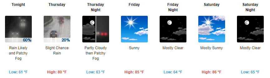
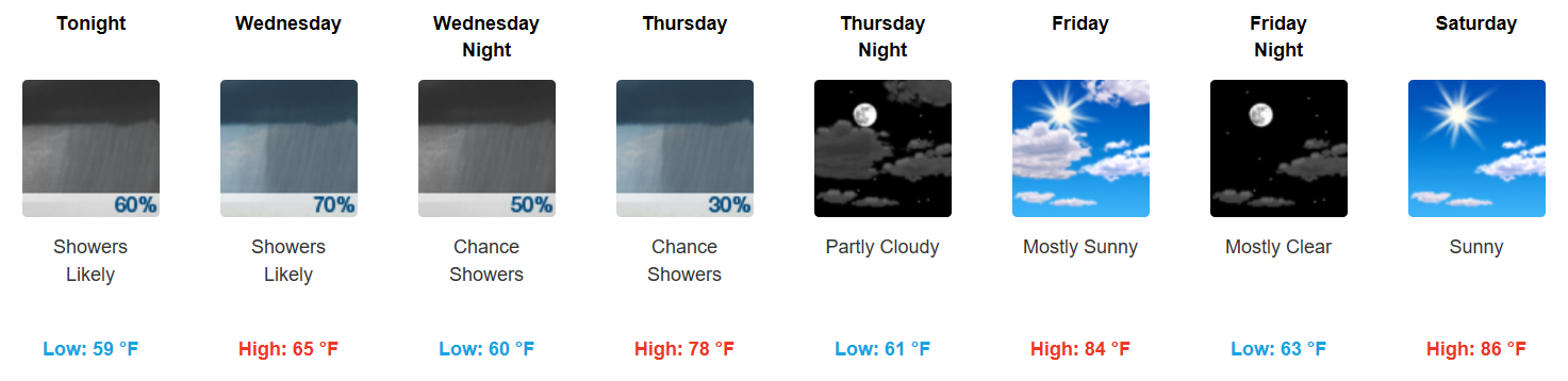
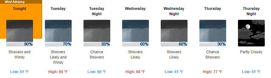
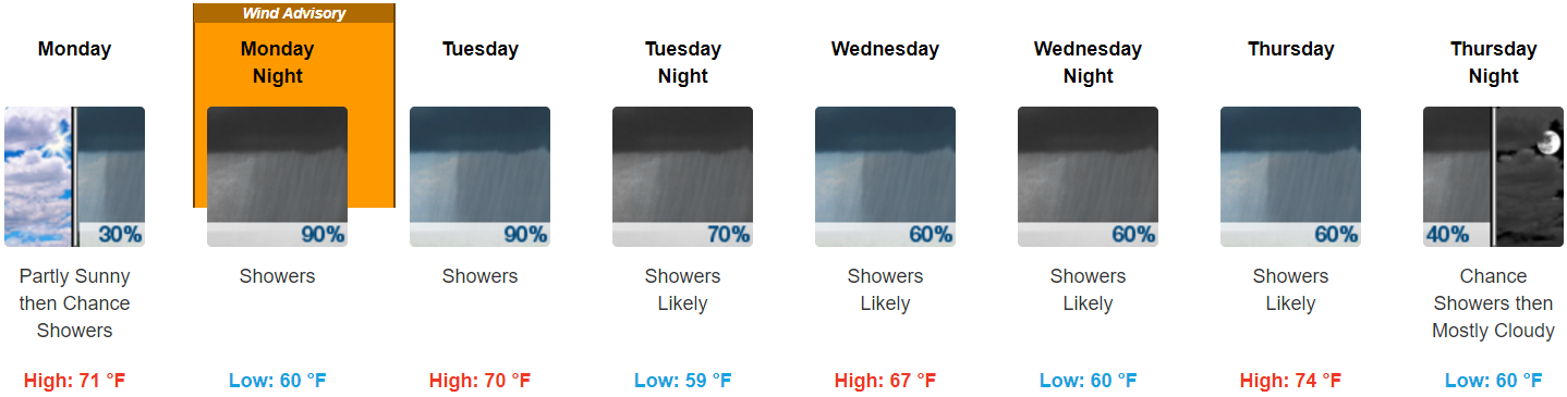
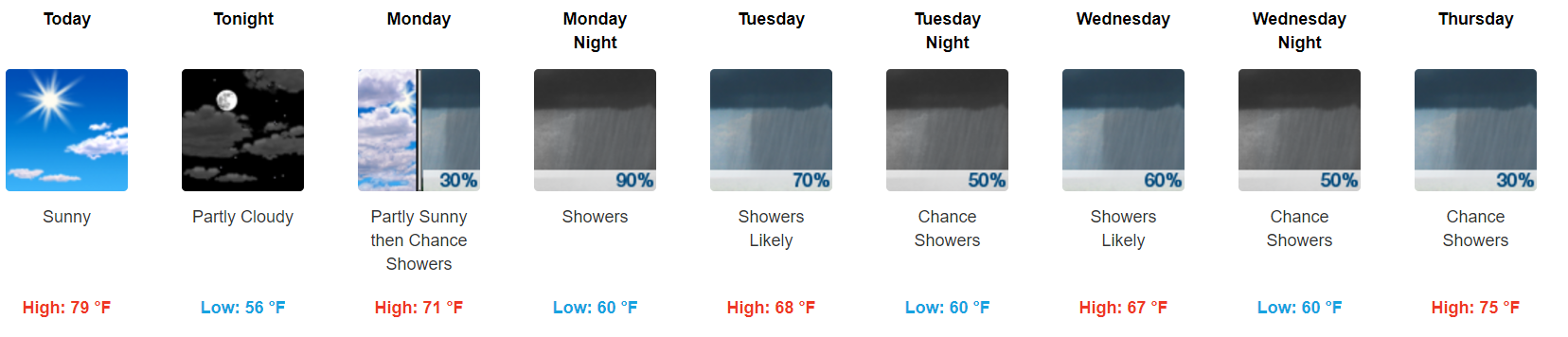
Scattered Showers Continue Tonight, Diminish into Tomorrow

Special shoutout to one of our readers, Sarah Szpak-Miller. Thank you to everyone who reads and loves our posts! We have eyes and ears everywhere.

https://giphy.com/gifs/gift-W80Y9y1XwiL84

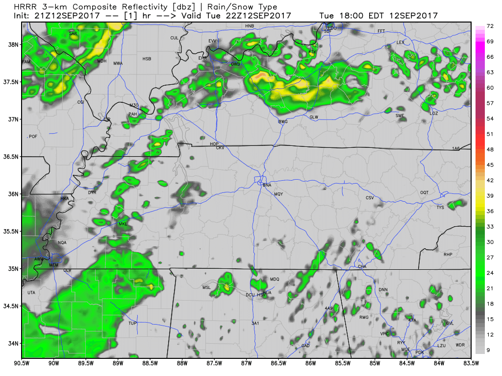
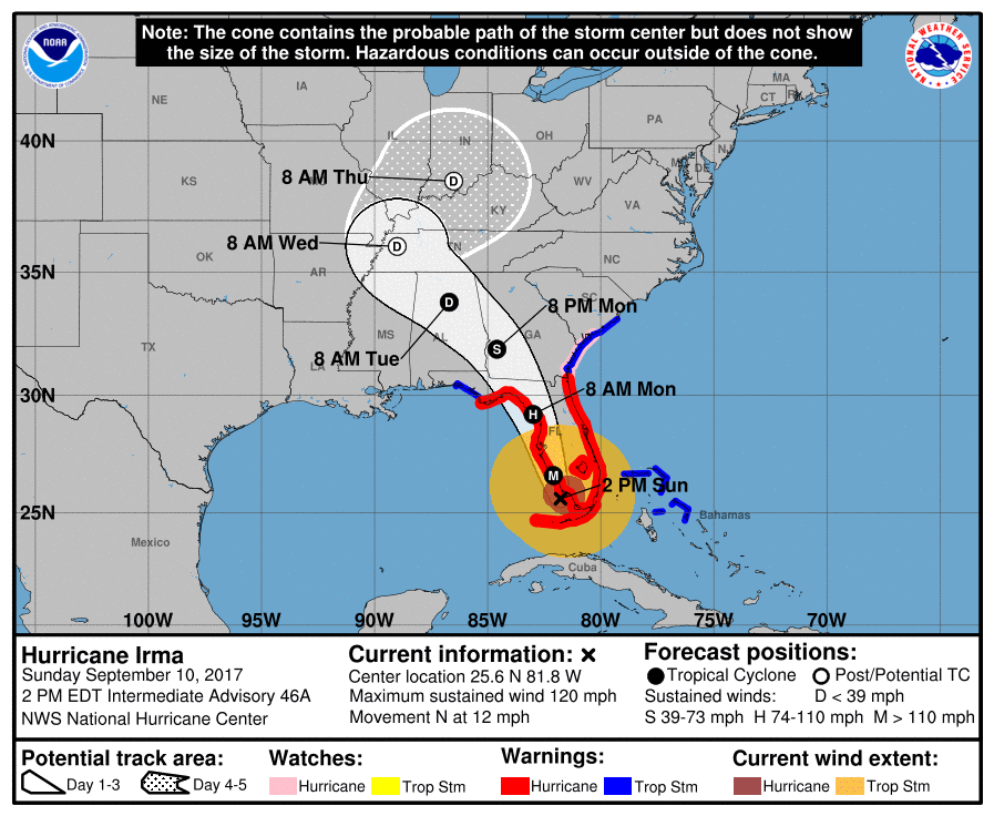
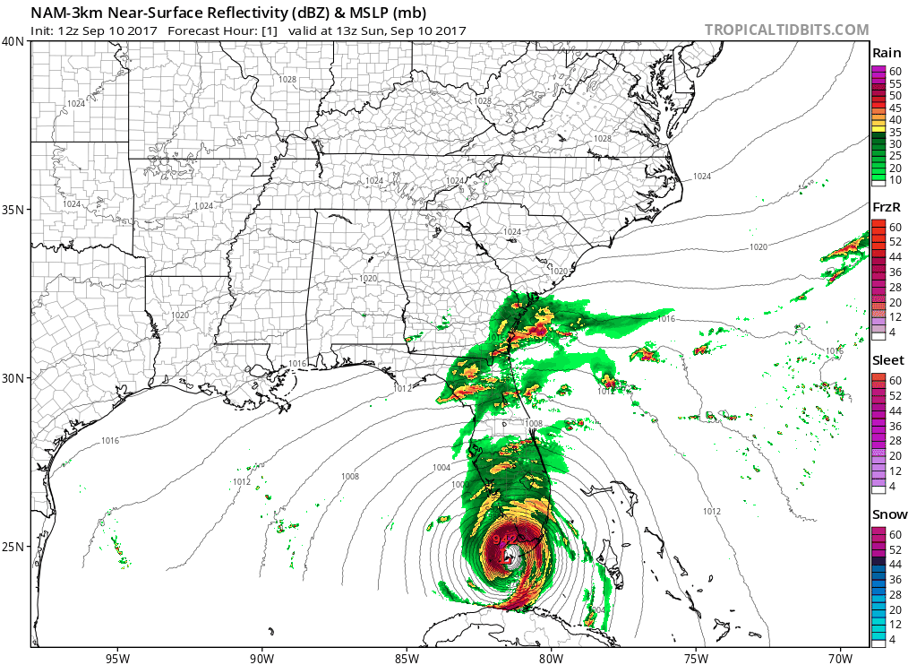
Our dreary day will continue into tonight with on and off showers. Luckily, showers from the remnants of Irma will clear out during the overnight hours into tomorrow morning. read more

Showers Through Wednesday PM, Clearing and Warming By Friday

Scattered Showers Continue, Dreary Through Wednesday Night

Latest HRRR Loop – Updated 6:30 PM CDT

…by the way, where are we today temperature-wise in comparison to seasonal averages? Almost 20 degrees below average!


Irma’s remnant center of low pressure is expected to kick northeastward tomorrow, but bring in another swath of moisture and likely rainfall. Again, not a complete washout but definitely another dreary day on tap. read more

Irma’s Rain & Wind: What To Expect

Summary

  • 1.5″ to 2″ Monday afternoon through Thursday afternoon is most likely; most of it falling Monday night into Tuesday morning. Flash flooding cannot be ruled out, but it is not expected.
  • A Wind Advisory goes into effect Monday at 7 PM until Tuesday at 7 AM for winds 15 to 25 mph with gusts to 45 mph. Expect a few trees down, isolated power outages possible, and hazardous driving conditions.
  • Severe thunderstorms and tornadoes are not currently a concern.
  • This does not look like a repeat of Harvey, but stay connected to reliable weather information as this storm approaches.

Irma’s Rain

Late Monday night, Irma’s center will pass to our south.  See the red “L” below.

Irma is a large storm.  Before Irma’s center crosses I-65 in Alabama, rain will approach from our southeast. read more

First Hint of Fall Weather, Cooler Temps and Sunny Skies

Sunshine and Below Average Temps

Let’s start with the NWS Nashville’s AM discussion, there really isn’t a better way to put how the next few days will be:

With yesterday`s showers and scattered thunderstorms just a distant memory, there really isn`t a whole lot to talk about in this morning`s forecast package. We continue to monitor the behemoth Irma and her monster winds in the Atlantic and what she could bring to Middle TN, but the bulk of this morning`s discussion is going to revolve around unseasonably cool temperatures and a mostly dry forecast. read more

Clearing and Below-Normal Temps Ahead

Feeling Like Fall!

GFS 250mb Winds through Sunday (Jet Stream)

The beginning of this loop is today’s storm energy moving through, with a cold front behind it.

High temperatures the rest of the week will remain in the 70s, gradually warming by the weekend. Northerly flow will keep our daytime temperatures nearly 10-15 degrees below normal for this time of year. Additionally, with mostly clear skies each night, our overnight lows will be exceptionally chilly…somewhere in the low to mid 50s through next Sunday! read more