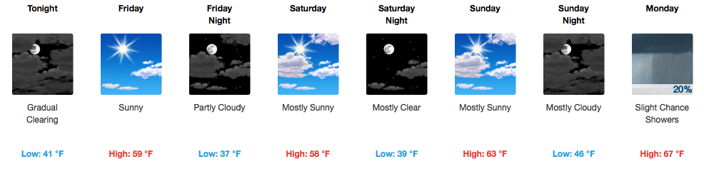
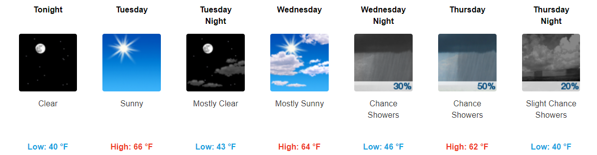
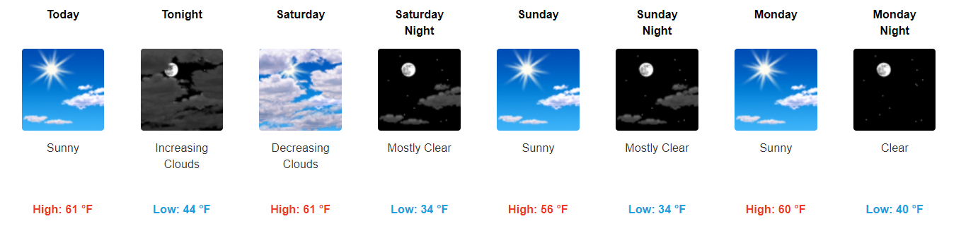
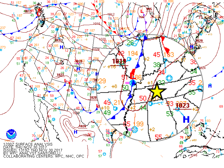
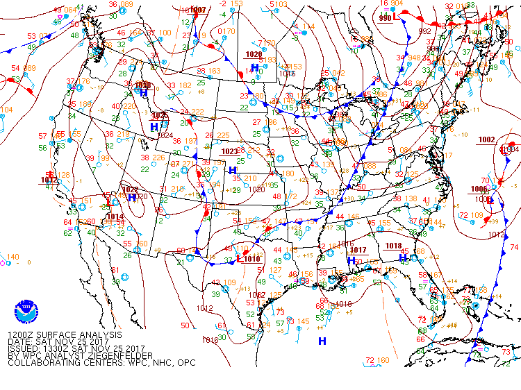
The cold front showed up around 3:30 PM. You could see the cooler northwest wind arrive on radar:

It has come with a breeze.
About 20 mins ago on Old Hickory Lake Wilson Cty pic.twitter.com/tuDXZPTwdW
The cold front showed up around 3:30 PM. You could see the cooler northwest wind arrive on radar:

It has come with a breeze.
About 20 mins ago on Old Hickory Lake Wilson Cty pic.twitter.com/tuDXZPTwdW
Before 8 AM, warm, humid air was streaming in from the south, with a cold front pushing rain toward us.

Winds will pick up (13 MPH or so), then that rain will be here this afternoon.
The HRRR model thinks a main “line” of rain, briefly heavy, will show up between noon and 1:30 PM or so, followed by maybe another light passing shower before dark.

GOES 16 Sunrise Loop

Fog is visible from space this morning over Middle Tennessee, but it isn’t widespread. By 11AM, it should all be mixed out.
HRRR Model Dew Points Through Sunday 1AM


Into tonight, you may want a light jacket for any outdoor sporting events as temps will fall into the upper-60s by 7 PM and the mid-60s by 9 PM.
Like this morning, patchy fog is possible overnight tonight into early tomorrow morning.

NOTE: Barring a partly/mostly clear nighttime, fog could develop and be around for tomorrow’s morning commute.
GFS Model Loop through Sunday Morning

We will remain dry through Saturday as high pressure continues to hold in place through then. Flow will become southerly on Saturday, so expect temperatures about 10-12 degrees warmer than they are today (middle 80s).

Temperatures will remain near normal into tomorrow. Unfortunately, these cooler temps won’t last that long.
https://giphy.com/gifs/diorandi-the-orchard-dior-and-i-3o6ZtifZvaatBm2hMI
Just like that, temps will jump back into the 80s on Friday and stay in the 80s through the weekend. Sunny skies look to hang around through at least the first half of the weekend, with no measurable rainfall in the forecast through Saturday.

Regional Radar 11:30AM CDT

Rain has encompassed much of Middle Tennessee this morning and another heavier batch is moving in from the west for the lunch hour. Plus or minus a few more showers after this next rain swath, we will be largely done with measurable precipitation by late afternoon/evening. The HRRR is in good agreement with this scenario.

Scattered showers look to start sometime late tonight and last throughout the day tomorrow.
NAM3 Loop 10PM Tonight Through 7 AM Wednesday

You may want to keep the umbrella handy throughout the day.
As sunset sped west (the sunset is the white stuff coming in from the right), what’s left of tropical depression Nate was speeding just southeast of us.

Nate’s hurrying toward Pennsylvania tonight and tomorrow morning, taking its rain with it. The HRRR model illustrates:
Hurricane Nate made landfall on the northern Gulf Coast.
Nate’s now a tropical storm, speeding northeast into Middle and Eastern Tennessee. The center of Nate should pass east of us.


Off and on all day.
You must be logged in to post a comment.