This afternoon we tied the record high temp for November 5, 82 set in 1975.
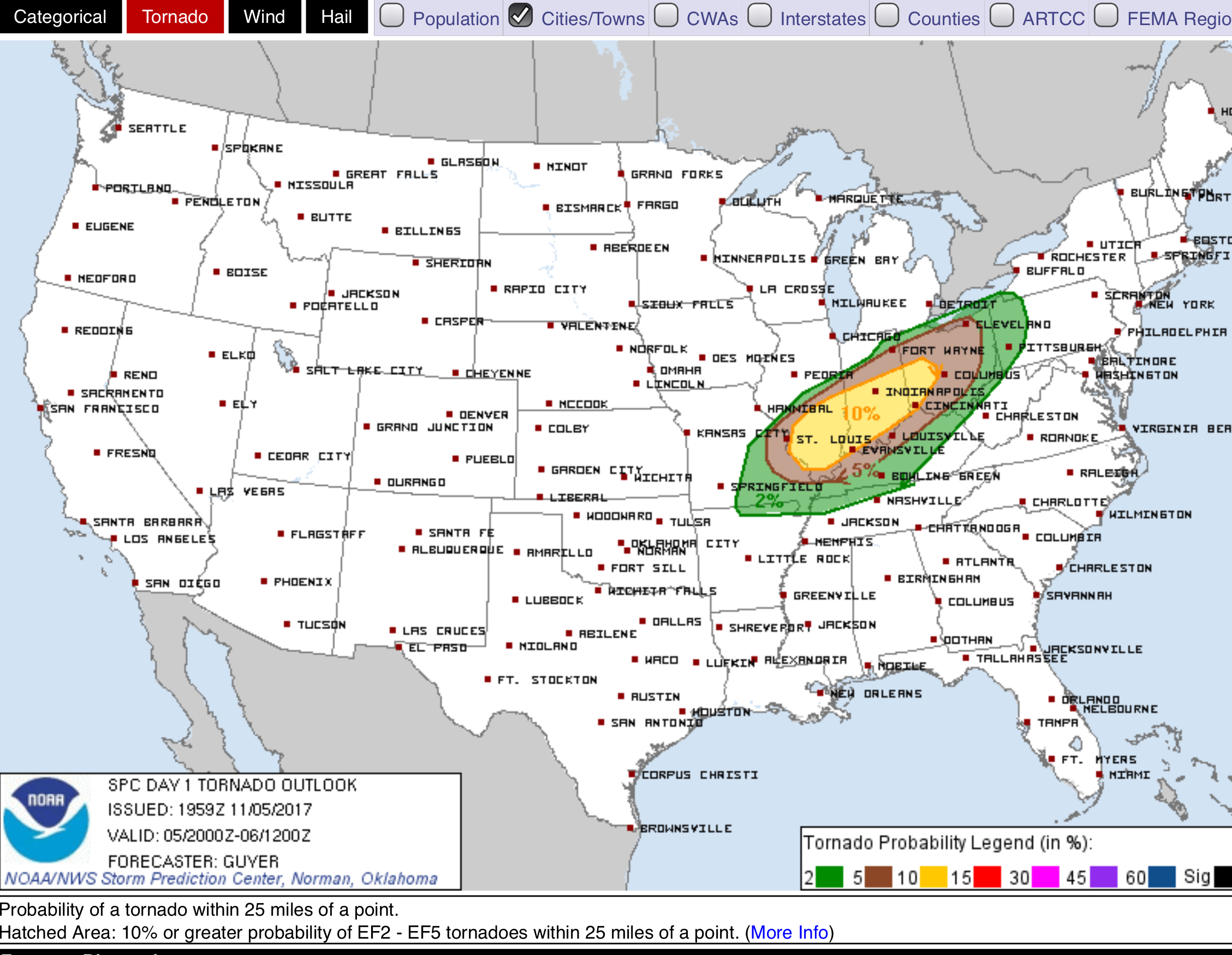
Meanwhile, severe weather has been ongoing in Missouri, Illinois, and Indiana this afternoon, fueled there by a cold front.
That cold front will approach tonight.

This afternoon we tied the record high temp for November 5, 82 set in 1975.
Meanwhile, severe weather has been ongoing in Missouri, Illinois, and Indiana this afternoon, fueled there by a cold front.
That cold front will approach tonight.

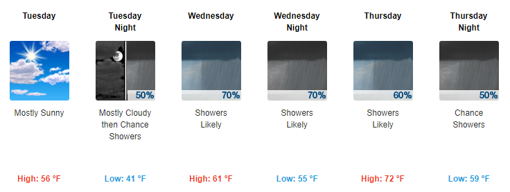
One week ago we faced a Frost Advisory. Today, this.
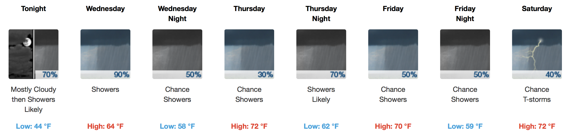
Today clouds and sun, high 81°, very humid (especially for November, dewpoint 65°!), and very windy this afternoon, south wind sustained ~ 16 MPH gusting to 28 MPH. Rain likely to start around midnight.
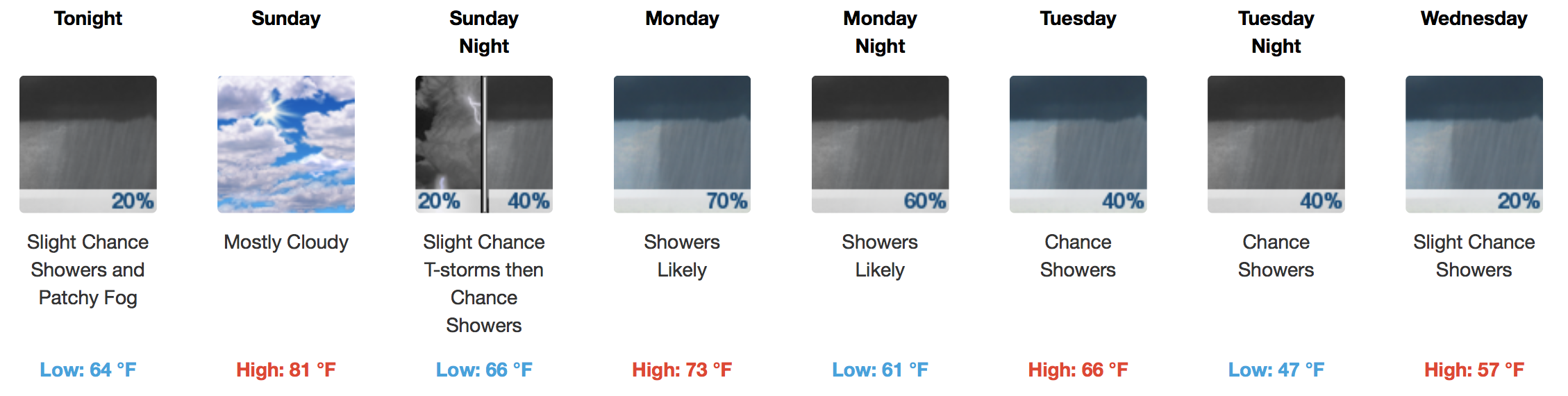
Temperatures this morning are quite warm for the beginning of November in Nashville. A renewed surge of even warmer air is expected to start today, thanks to southerly surface winds. It may feel like a distant memory after our couple of recent cold spells, but a muggy “Gulf of Mexico airmass” will move north, back into Tennessee, for the weekend and part of next week.
So far, nothing has developed this afternoon to sound off any rain alarms. That said, there is still a chance of showers developing through the afternoon into the early evening thanks to the abundance of moisture and a weak front moving towards us. Models aren’t showing anything along this front, but if we do end up seeing rain this afternoon/evening it would be because of this.
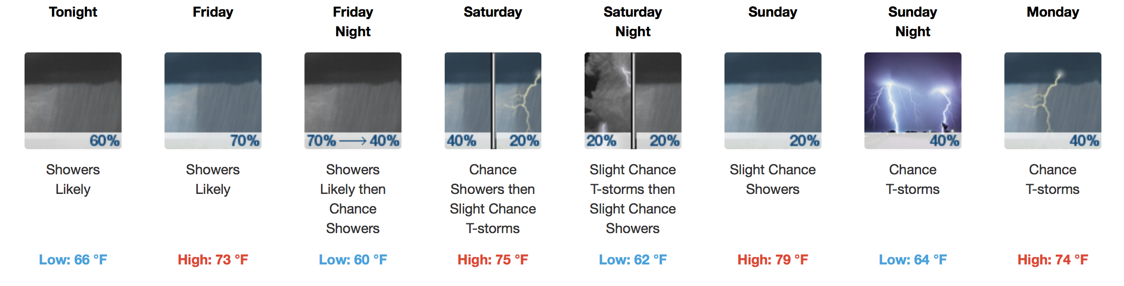
Rain during the daylight hours today is unlikely but more will encroach on the area late tonight/overnight. Latest observations at the airport have us near a balmy 69ºF at 11AM under mostly cloudy skies. The dew point is only ~9ºF lower at 60ºF, meaning moisture return from the south is definitely in play. You will feel the southerly breeze today, too, gusting as high as 20-25 mph, based on latest HRRR model data.
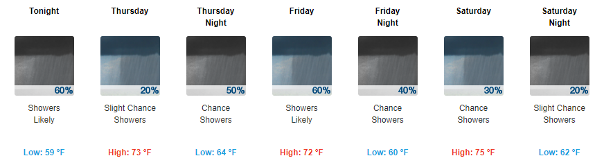
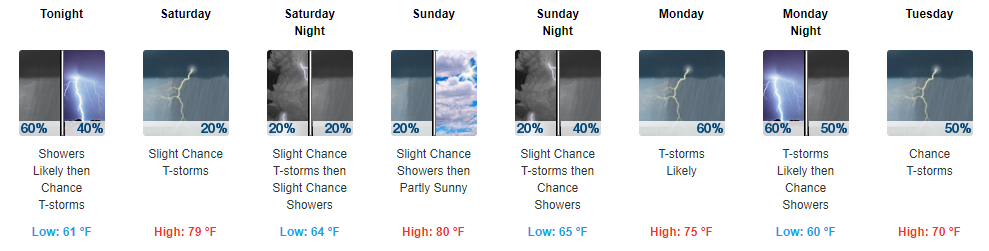
The rain, rain is not going away anytime soon. Our local NWS best described the rest of this week by stating there will be the potential for numerous periods of rainfall.
We will see our next batch of these scattered showers this afternoon into this evening.
Temperatures Today/Tomorrow
[av_textblock av_uid=’av-2egmvw’]
[cjtoolbox name=’Treg DONT DELETE’]
[/av_textblock]
As the sun sets tonight and costumed kiddos head out to trick-or-treat, temps will slide from the lower 50s into the upper 40s. Make sure to bundle up!
Mostly sunny skies have settled in for the day. We will actually warm up a bit more today than we have in recent days with highs expected to reach into the mid-60s. All in all, it’ll feel nice and comfortable today.
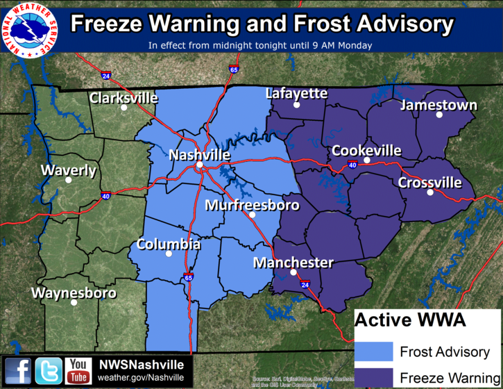
Officially the forecast low overnight is 35° in Nashville and 34° in Franklin. Those with less pavement around you should dip to or close to freezing. Our Frost Advisory is effective at Midnight and runs through 9 AM, technically the coldest temps are expected just before sunrise.

Wood expands and contracts in the summer and winter. With these overnight cold temps, boards in your house “pop” pretty loud, especially in the middle of the night when it’s coldest. It can be so loud you may think someone sinister is inside your house burgling your meat and cheese foodstocks. Do not worry, it’s not a “robber” as is the phrasing at my house, also it’s probably not this guy:
You must be logged in to post a comment.