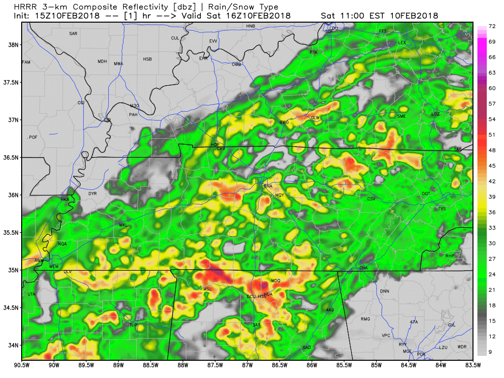
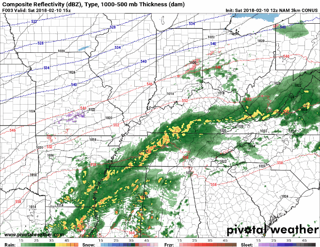
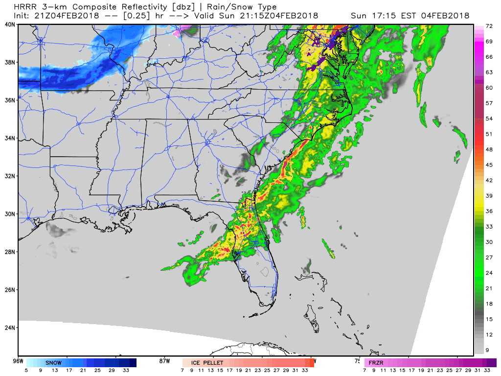
The overnight low is 2°.

2° is expected shortly before dawn. Before then, 10° at 9 PM, 7° at midnight, 6° at 3 AM.
Note that’s the official forecast temp; locations around Davidson and Williamson Counties are often a few degrees colder.
The overnight low is 2°.

2° is expected shortly before dawn. Before then, 10° at 9 PM, 7° at midnight, 6° at 3 AM.
Note that’s the official forecast temp; locations around Davidson and Williamson Counties are often a few degrees colder.
Temps in Middle Tennessee overnight ranged from 4º in Dickson to 14º in Gallatin. In a few places a few flurries broke out, but nothing of consequence.
As I write this morning, officially at BNA it’s 7º, and the wind chill is -7º. Minus seven. Many backyards in Nashville and Will Co are a few degrees colder.
The first is effective begins at 10 PM and ends at 9 AM Monday morning. A second Wind Chill Advisory goes into effect Monday night at midnight, running until noon Tuesday.
No snow, just cold the rest of the week. Below freezing at least through Wednesday, maybe longer. Winds turn south Wednesday, so we may make the mid-30º. If we do, it will break a below-freezing streak that started Saturday night. If not, the streak should end Saturday when we should poke above freezing (but only briefly) in the afternoon. 7 consecutive days completely below freezing would be two days shy of the record of 9 set in 1876 and 1899.

As it turns out, we can go pretty low. Believe it or not, today’s official forecast high of 36ºF will be the highest temperature of the entire forecast period. Yikes!
European Model – 850mb Temperature Pattern Through Next Sunday

This is going to be a bundle up forecast for the next week. Pull out the extra blankets!
https://giphy.com/gifs/cold-Msh88oWPvHCMg
Overall Forecast Now Through The Beginning of Next Week
Here’s what you can expect for the week to come from our local NWS:

Most thermometers were reading in the teens this morning, but thanks to dry air, we will warm up into the middle 30s this afternoon. A few passing clouds are expected throughout the day, with a steady increase in cloud cover by Friday afternoon and evening. Saturday, temps will begin their nose dive in the mid-30°s, too cold for paintball or any other reasonable outdoor activity, then Saturday night we’ll plunge below freezing and stay there for the next four days.

Today is going to be a cold one folks. Highs likely will not reach above freezing with temps dropping into the teens overnight tonight. Be sure to bundle up before you head out!
https://giphy.com/gifs/gutearbeitoriginals-snow-winter-d3mlmtNPoxNrt4Bi

GFS Model Loop – General Jet Stream Pattern

Temperatures will fall tonight as more dry, cold air digs into Middle Tennessee. Highs on Wednesday will struggle to reach the freezing mark, so make sure to bundle up!
To all of you reading this run-on sentence, wherever you are, whatever you’re doing, whether delighted or content or hurting or tired or trying to figure out how something you unwrapped works or new to the area or just merely cruising by to read about the weatherweek ahead, thanks for following, thanks for reading, thanks for being part of this weather community and for landing on this website. Thanks for giving us your time, your trust, your confidence, for telling others about us, and for your financial support. We really appreciate it.
You must be logged in to post a comment.