

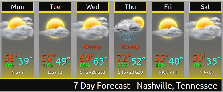
Last night’s forecast was “no rain until Thursday!”
Uhhhh. Then this morning happened.
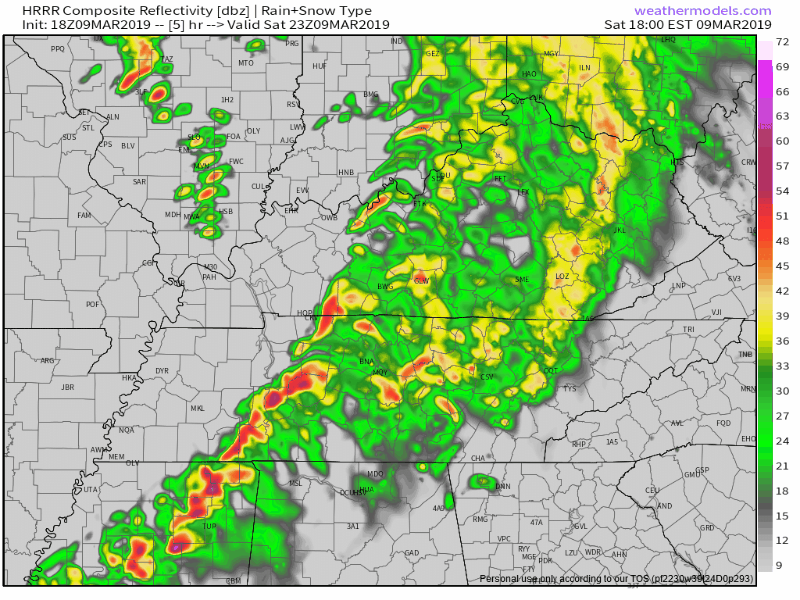
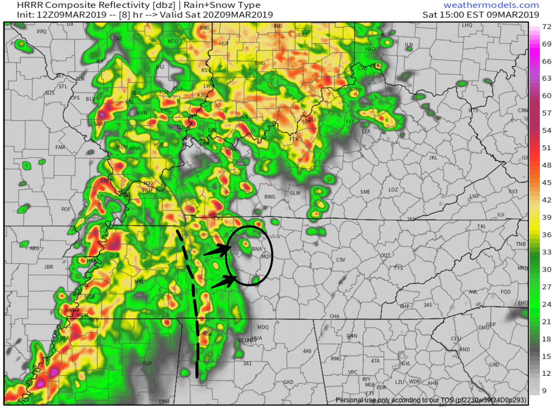
Light rain this morning surprised me. Rain was supposed to pass completely south of us. Most of it did. But we still got some this morning. At 5:56 AM NWS-Nashville noted approaching rain in West Tennessee was not reaching the ground thanks to a low level Dry Air Monster.


You must be logged in to post a comment.