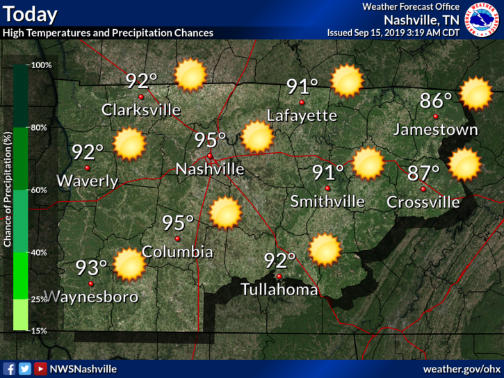
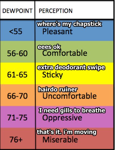
Possible Evening No Worries Flurries; COLD Friday Morning; Chilly Weekend; And Those Tuesday Snow Chances

At 6PM we’re sitting at 38° and looking dry. Clouds cleared out early but they’ll soon return as a cold front approaches. There was mention of very light snow flurries earlier, but now models don’t seem to be picking them up. We might be lacking the moisture needed to get snowflakes to form. read more

No Snow Tonight. Wee Hour Ice, Though?

No snow tonight.

The precip moved east, faster than all models thought.

Foiled again by cold air chasing the precip.

Will Wet Roads Freeze Overnight?

At 7:25 PM, BNA reported 43°. At 8:05 PM, it’s 39°. And falling.

Rainwater continues running off the roads. Runoff means less water to freeze. read more

Wind Advisory, Rain, sNOw: It Must Be January

Wind Advisory

TIMING: Until 3 PM CST today

WINDS: Breezy south winds 20 to 25 mph with gusts around 40 mph.

IMPACTS: Gusty winds can cause tree and branch damage. Loose outdoor objects may be blown around. High profile vehicles, especially those traveling on east-west roadways, may experience travel difficulties. read more

Wednesday: Rain? Yes. Transitioning To Snow? Mehbe. Frozen Temps Thursday AM Tho. Also: Rant.

Clouds are arriving. Rain is coming Wednesday, and it may turn to snow Wednesday night.

Alert! Editor’s Rant. This isn’t about you most of you. Warning: what you’re about to skip over read is indulgent and arguably therapeutic (for me). If you came here for No Rants, Just Weather, I respect that, skip the blue words. read more

Warmup Coming, sNOw Wednesday Night

Today:

Today things will be warming up and quite mild overnight tonight. Breezy, but really pleasant for mid January, or early November for that matter. Rain will begin late Tuesday night as a precursor to a change coming through the day Wednesday. read more

Windy Tomorrow; Washout Wednesday; Then 3 Uninspiring Snow Chances

26° is our pre-dawn low Tuesday morning.

A Wind Advisory is effective beginning noon Tuesday through 9 AM Wednesday.

Strong south winds, 15-25 MPH, gusting around 40 MPH, may topple lightweight elderly and tip mostly empty garbage cans. read more

About Last Night, Clipper System & Eclipse Viewing, Warm Up, Rain, More Meh Snow Chances

Winds dried wet roads last night. Throughout last night’s dusting, winds blew between 13-17 MPH, gusts 25 to 35 MPH.

Some Middle Tennesseans saw snow. Clarksville’s emergency manager reported 1.2″. Sumner County CoCoRahs observer near Portland logged 1.0″. Same for Greenbrier in Robertson County. read more

More Rain, then Wintry Mix, then a Dusting of Light Snow Tonight/Overnight; Icy Roads/Travel Problems Possible Sunday AM

Here’s the low end / high end snowfall probability on either side of NWS-Nashville’s snowfall forecast:

Meanwhile, wind speeds pick up significantly. Sustained winds of 12 mph in the afternoon will quickly jump close to 21 mph after 8 PMgusting upwards of 35 mph at times in the night. read more

Saturday’s Heavy Rain, Then Rain>Mix>Snow. Travel Impacts Expected Late Saturday Night Into Sunday.

(Editor’s comments in blue).

Get out and enjoy today. If you need to do anything outside, or put gas in your car, that kind of stuff, do it today or, if you love risk and adventure, Saturday afternoon.
read more

Saturday’s Heavy Rain, Saturday Night’s Snow & Ice Potential

In 48 hours a heavy rain event may turn to snow, possibly cause a flash freeze, and I can’t stop myself from doing this special forecast.

There was inspiration.

I went to the gym tonight. Got home – TMI Alert!!! – got in the shower, water was warm, then suddenly all the hot water ran out but I was still sudsy and had to suffer shivering through the cold water, which I flipped off then on, then got out of there. Fast. read more