Fog between midnight and 6 AM in the “usual spots” near bodies of water and low lying areas. Low 37° with a dewpoint 35°, so freezing fog isn’t expected right now, but it’s close. Fog should mix out by sunrise.read more
We’re going to stay dry for the remainder of the morning, before showers from the Southwest move into Middle Tennessee. We’ll see scattered to numerous showers begin to move in between 2PM-4PM, and lasting through the evening. The best rain chances are for those mainly along and just East of I-65. read more
Beautiful skies and lots of sunshine. Temps in the low 50’s this afternoon. 39 tonight.
Downright nice day all around. Get outside and enjoy it. Brittney is excited about it too.
Chance for showers?
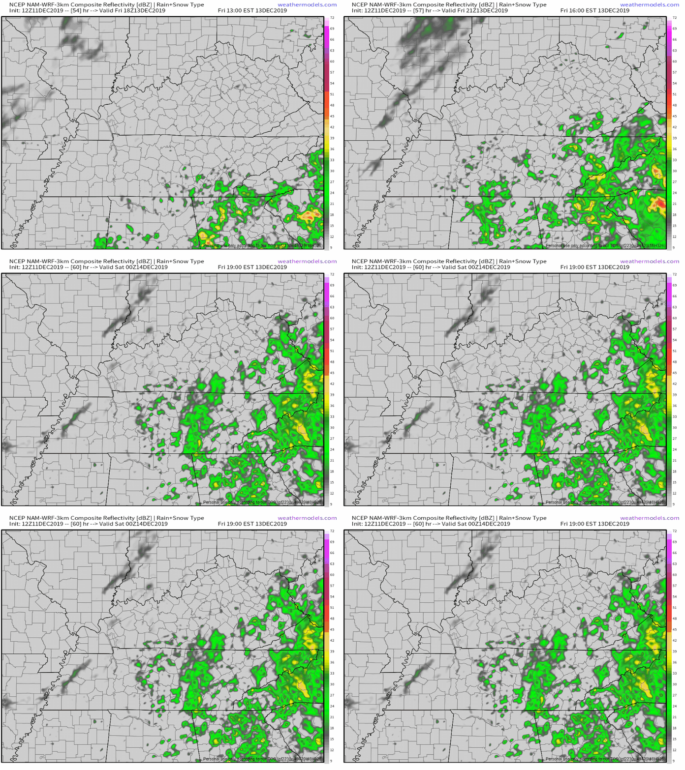
There’s a slight chance of showers late tonight and through tomorrow. That chance will be much more than slight as we head toward afternoon Friday. This will set the stage for a wet weekend for all of us.
Digging a little deeper
NWS-Nashville had this to say about precipitation this weekend.
As evening hours progress tonight, the dry weather pattern since
the late evening hours on Tue night will commence to ending. It
will be replaced with an overall wet weather pattern established
across mid state region through at least next Monday night.read more
45 today, 27 Thursday morning, up to 53 Thursday afternoon, all clear/sunny.
We’re 15.41″ above normal for rain this year. Superwet February 2019 is the main reason for that.
More rain coming.
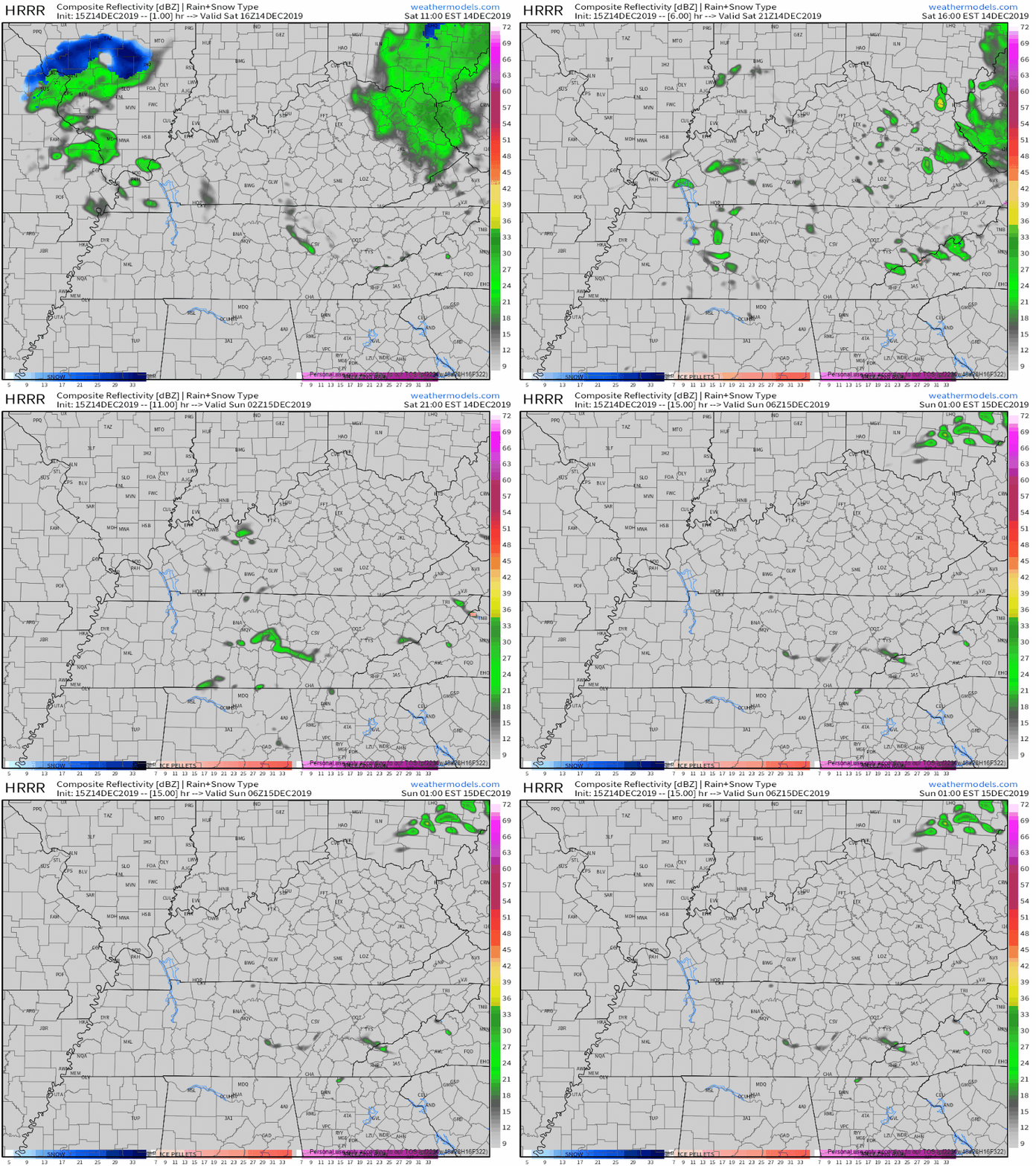
Rain window opens Thursday night and closes Saturday afternoon. Off and on mostly. Cold too, lows mid/upper 30s, highs around 50. Rain is most likely Friday afternoon and Saturday morning, but it could fall at any time during that window.read more
Today snow fell at 10,000 feet and 5,000 feet and even at 2,000 feet but before it could reach us on earth along came the Dry Air Monster. He ate it all up.
By taking a cross section of precip, we can see what's really going on. Snowing like crazy from 9K to 10K feet up. Still snowing at 5K, 4K, 3K, and 2K feet. But when snow falls under 2K feet, the Dry Air Monster is eating it up. pic.twitter.com/llmC0TT9X4
Suppose you’re standing at a sink holding a hand towel and a shot glass of water. Put the hand towel between the shot glass and the sink. Then pour the water onto the towel. The water is absorbed into the towel. The water never makes it into the sink.read more
Temperatures may fluctuate some today. However, according to our nearest road sensor at the Kentucky border, road surfaces are running about 8° higher than the air temp for now. That’s good news, but may change later tonight. More on that below.read more
It’s not a “minor” travel impact to you if you slide into an overpass wall, so be smart out there. Fortunately we have a traffic problem and no one goes more than 25 MPH anymore.
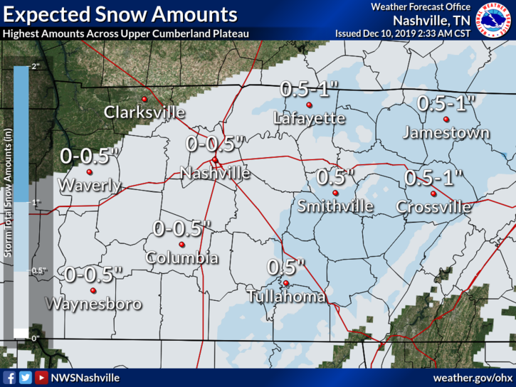
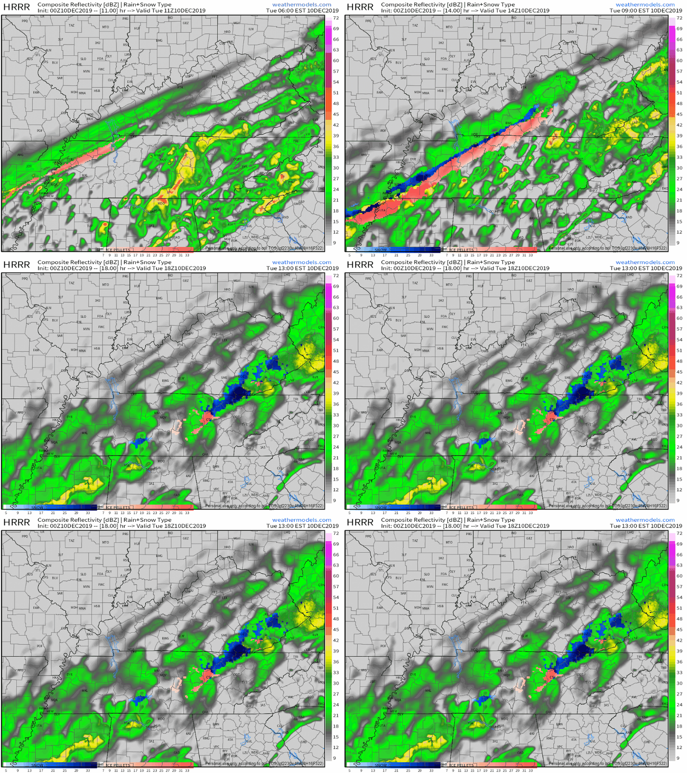
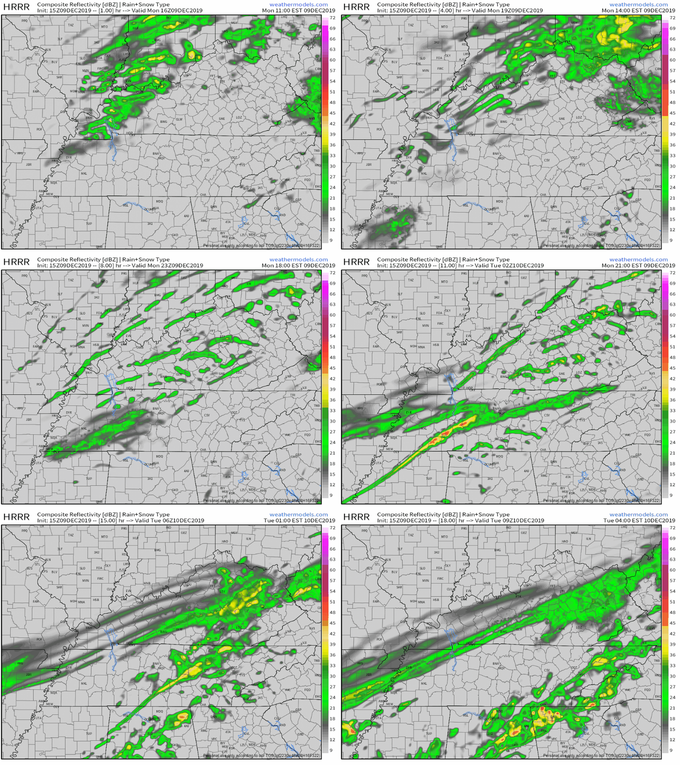
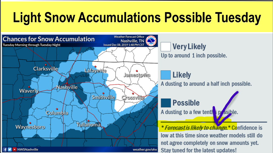
New model data arrived. NWS-Nashville made maps you need to see for Tuesday. Forecast is evolving. Snow forecast is trending upwards but forecast confidence remains low.
Showers possible very late Sunday night, light and brief, probably while most sleep, maybe lingering into the AM rush hour. So thinks the NAM3 model:read more
Subscribe to Blog via Email
Privacy & Cookies: This site uses cookies. By continuing to use this website, you agree to their use.
To find out more, including how to control cookies, see here:
Privacy Policy






You must be logged in to post a comment.