
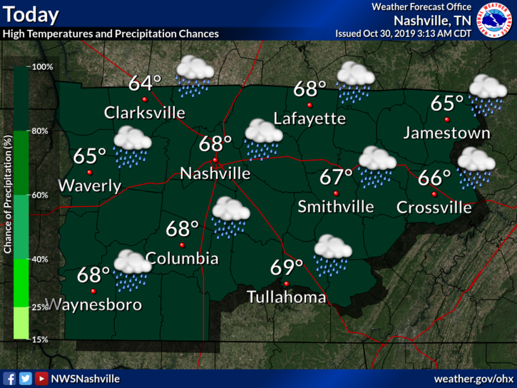
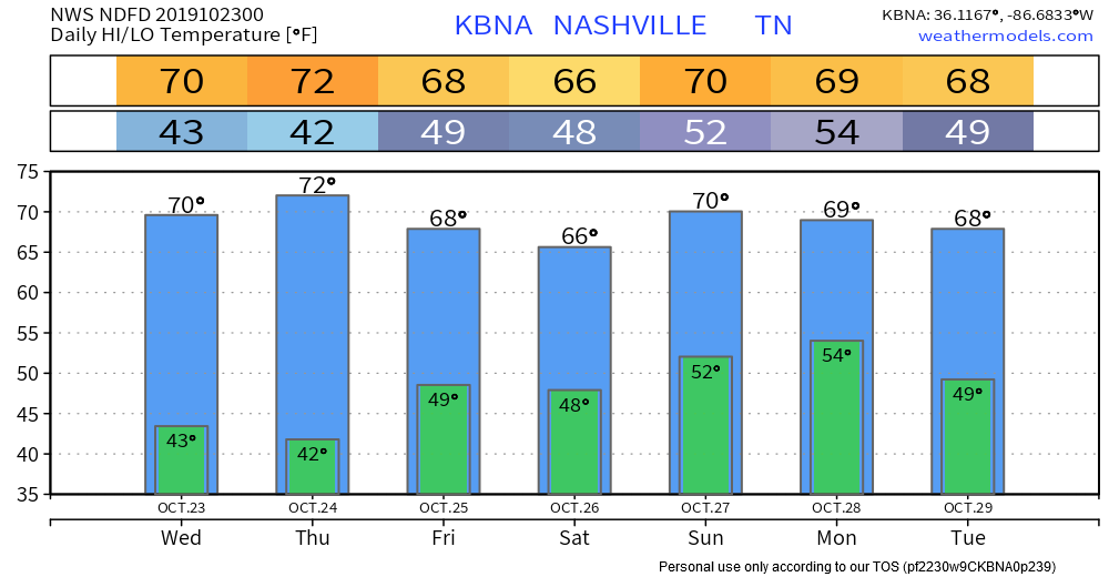
Cold Trick or Treating; Freeze Warning Tonight-Overnight
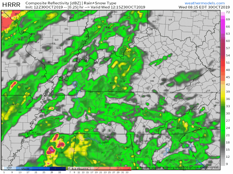
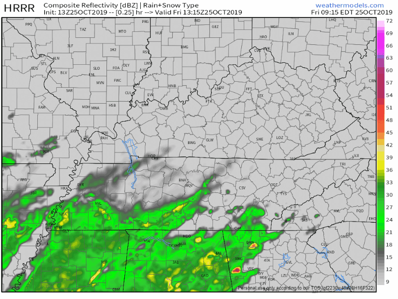
Those cool showers have finally moved out of Middle Tennessee, bringing behind it plenty of cooler temperatures for all of us to “enjoy.” Here’s the HRRR, showing this line of showers along the cold front leaving us :


You must be logged in to post a comment.