
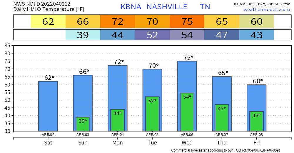
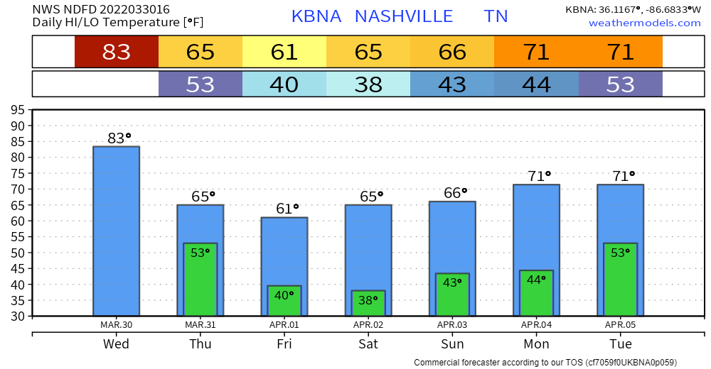
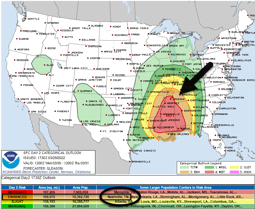
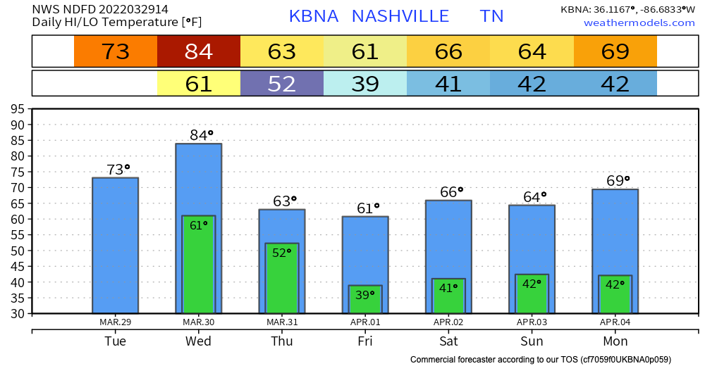
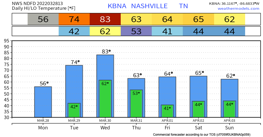
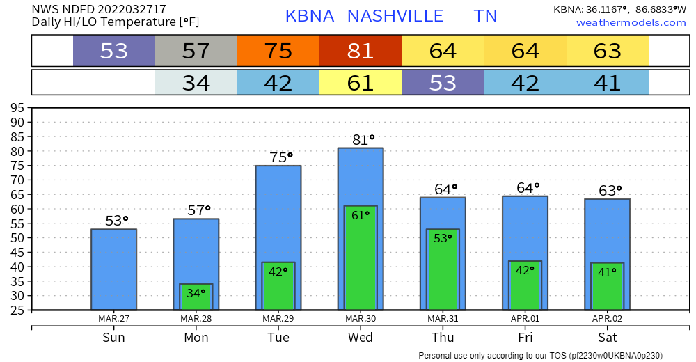
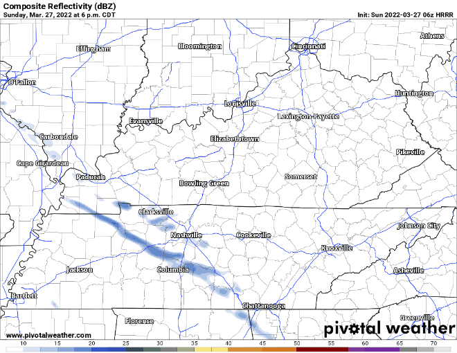
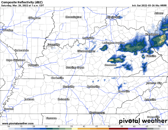
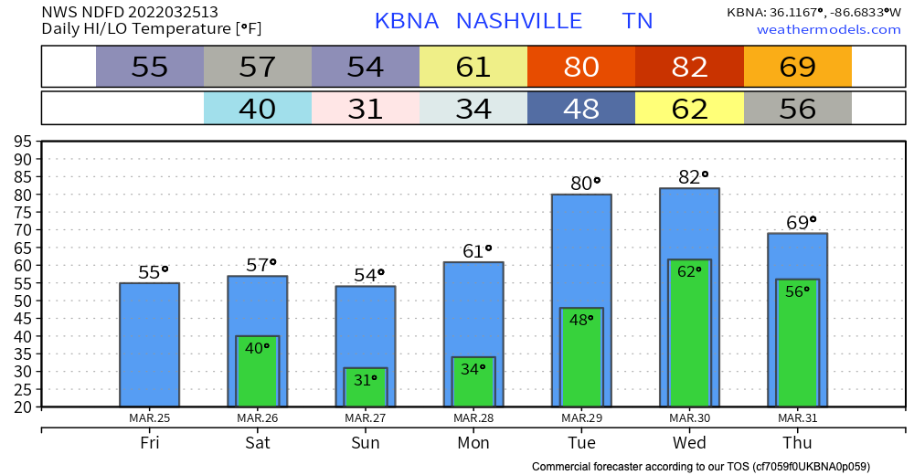
Currently some showers in West TN, slowly making their way towards us.
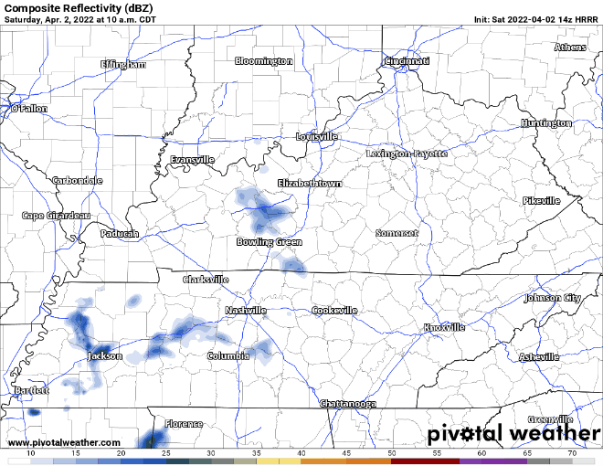
The Dry Air Monster is feasting on these showers. I doubt any rain this rain will make it to the ground. If it does, amount would be just enough rain to cause a nuisance, not “oh no rainout, cancel all outdoor plans” kinda rain.

You must be logged in to post a comment.