
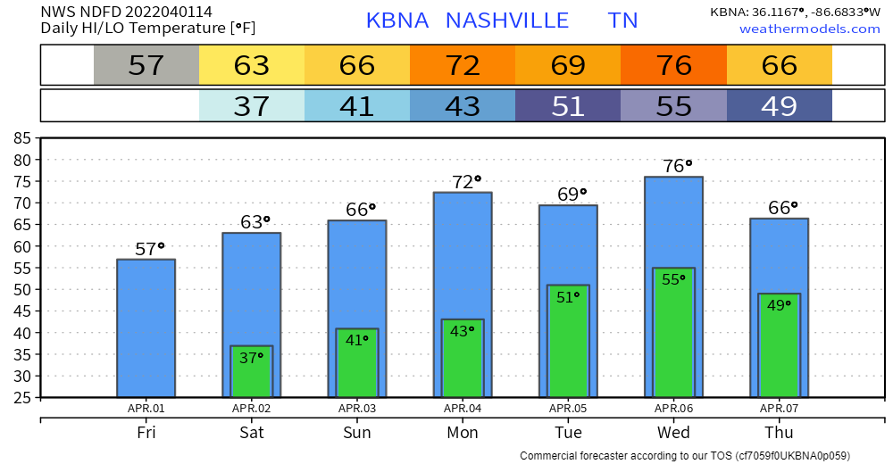
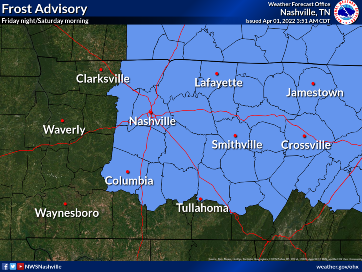
Pesky spring back-and-forth temps are in full effect. We’ve gone from near-record highs to a frost advisory in just a couple days. Tomorrow morning before sunrise. Build-up of frost on plants is never good… make sure to cover yours up!
Warming trend wastes no time after tomorrow morning. Back up into the 70s next week. Plenty of sun to be had and no rain for a few days. The kind of weather that’s desktop background worthy.
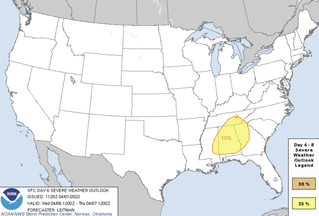
The warmer temps come at a price. For every action, there’s an equal and opposite reaction. The atmosphere is no exception (more of a “bigger picture” analogy than a purely scientific one), which leads us to our next rainmaker. Too far out to speculate on severity. However, SPC has already included areas juuuust to our SE in a 15% probability of seeing severe weather on Wednesday. Lots could change before then. We’ll keep following it.
Quick References:
Weather changes constantly.
Follow @NashSevereWx on Twitter for any changes to this forecast.
Live coverage during tornado and severe thunderstorm warnings:
Look good.
Support the mission.
We are 100% community supported. No ads. No subscription fees. Keep it free for everyone.
Categories: Forecast Blogs (Legacy)
You must be logged in to post a comment.