
Currently some showers in West TN, slowly making their way towards us.
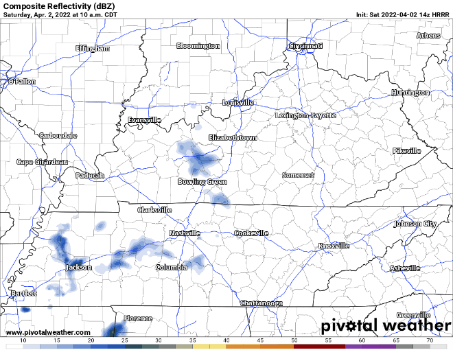
The Dry Air Monster is feasting on these showers. I doubt any rain this rain will make it to the ground. If it does, amount would be just enough rain to cause a nuisance, not “oh no rainout, cancel all outdoor plans” kinda rain.
If you hear a tornado siren today, no need to panic.
Models also hinting at some maybe quick showers around midnight tonight, if you’re out that late.
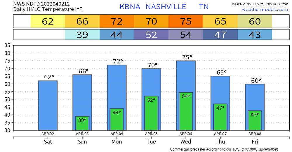
Sunday looks lovely, seasonal temps, clouds clearing out.
Monday morning, models think a band of showers will be set up just to our north. Occasional shower might swing south and make the ground wet.
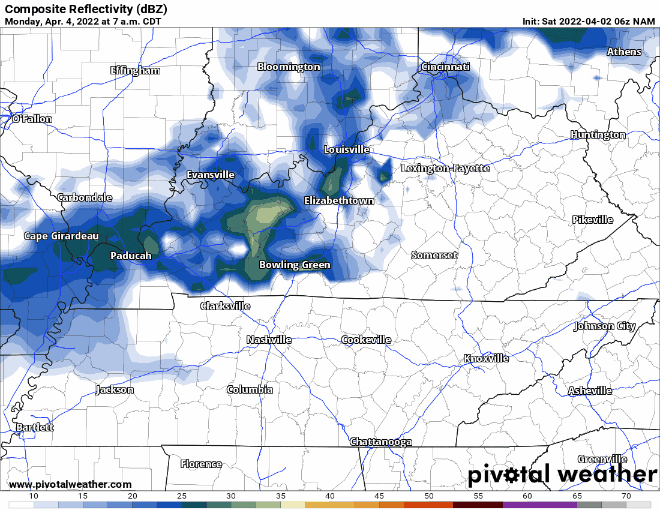
Beefier showers arrive sometime Tuesday morning. No severe weather expected with this round, that stays to our south.
WEDNESDAY
A line of showers/storms is expected to push through our area sometime during the day.
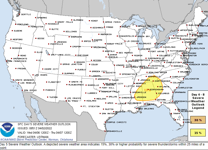
Currently, neither of our two counties are outlooked for severe weather. SPC thinks the ingredients come together to our SE. A lot could (will) change. High-res models aren’t in range for this yet, that’ll come in the next couple days. No reason to worry or panic. Stay connected and informed. We’ll keep you posted.
Quick References:
Weather changes constantly.
Follow @NashSevereWx on Twitter for any changes to this forecast.
Live coverage during tornado and severe thunderstorm warnings:
Look good.
Support the mission.
We are 100% community supported. No ads. No subscription fees. Keep it free for everyone.
Categories: Forecast Blogs (Legacy)
You must be logged in to post a comment.