
The HRRR shows a tiny shower may effect us this evening, but I wouldn’t count on it.
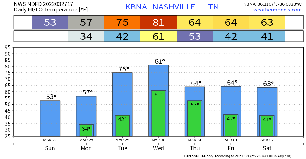
Tomorrow looks the same as today, just no frost in the morning. Similar temps in the mid 50’s. Sunshine during the day.
We warm up Tuesday. Temps in the 70’s.
The main story this week will be Wednesday a line of storms, potentially strong or severe.
During the day, temps will reach the 80’s. A cold front will push into the warmer air ahead and storms will fire up. Right now we are on the edge just outside the severe area on the SPC’s day 4 convective outlook. See below:
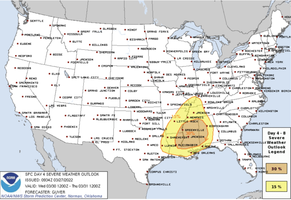
This outlook is 4 days out. A lot can change and we could find ourselves in the severe threat zone. This is not time to panic or be anxious, but just be prepared in case we find ourselves dealing with strong storms.
Timing on this line of storms looks to be the evening Wednesday. See GFS model, below:
Right now this looks like a QLCS (line of storms), not discrete supercells ahead of the line. The line itself will pack heavy rain, and lightning is possible. Models insist CAPE and other storm ingredients fall off in Davidson and Williamson Counties, but these models are the lower res global models from which the specific answers to questions we are looking for are not available. Tonight better, higher res models will slowly begin to get in range of this event. That’ll give us much more information.
Quick References:
Weather changes constantly.
Follow @NashSevereWx on Twitter for any changes to this forecast.
Live coverage during tornado and severe thunderstorm warnings:
Look good.
Support the mission.
We are 100% community supported. No ads. No subscription fees. Keep it free for everyone.
Categories: Forecast Blogs (Legacy)
You must be logged in to post a comment.