
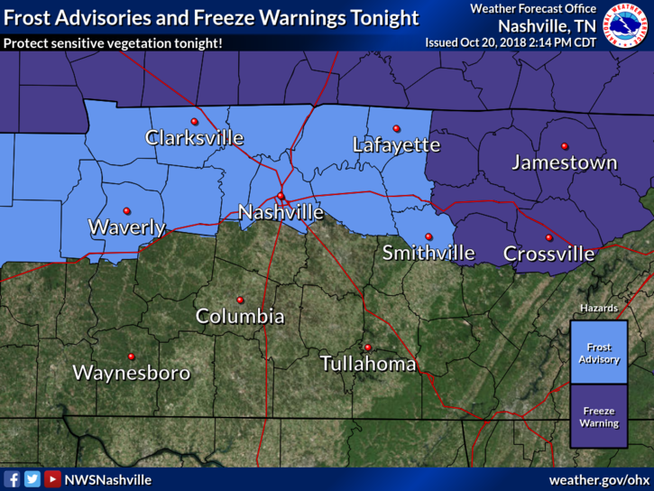
Frost Advisory has been issued for Nashville Tonight
Frost Advisory for Nashville. 33° to 36°. Sheltered and low-lying areas may see frost producing temperatures for at least a few hours prior to sunrise Sunday. A Frost Advisory means that widespread frost is expected. Sensitive outdoor plants may be killed if left uncovered.
Cold & Clear Overnight
Clouds have moved out and temps are beginning to drop. Overnight we’ll cool into the mid/upper 30s. Winds could gust upwards of 20 mph.
Rain chances for the remainder of today and this evening are gone for Williamson and Davidson counties.
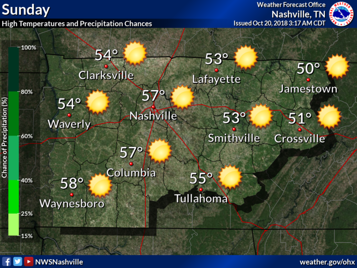
Sunday
Cold air will be here in full force on Sunday. High’s only in the upper 50s for us. Overnight lows will bottom out in the low 30s, but they’ll have a hard time dipping below 32°.
Monday Will Warm a Bit
Briefly on Monday winds will turn to the south, making our high temps warm into the 60s. A weak, dry frontal system will drop through the Midstate Monday evening, turning our winds back to the north by Tuesday morning. No increased rain chances.
Daily high temps for the remainder of the week will hover in the 60s. With our overnight lows gradually warming into the low 40s.
Small Chance of Showers Later in the Week
Next chance of rain falls later in the week – Thursday and Friday. A small inverted trough will develop over us, causing a few short lived showers to go up overhead.

We’ve a chilly week ahead! Click back here or @NashSevereWx on Twitter for further updates this week!

Categories: Forecast Blogs (Legacy)
You must be logged in to post a comment.