Beautiful Today, Chance Of Rain Tomorrow, Stronger Storms By Monday

Beautiful And Sunny Today

A high pressure is going to keep us dry throughout the day today. Temperatures climb from that cool brisk air we felt this morning to around 70 ° for the high.

Mostly sunny for this afternoon and perfect weather for some Friday afternoon/evening plans! Be sure to get out and enjoy the sunshine before tomorrow’s increased cloud and rain chances! read more

Beautiful Today, Rain Tuesday Night, Cooler Mid-Week

It Might Be A Perfect Day

We’ve got a great one on tap for us for Columbus Day. Lots of sunshine with temperatures climbing to near 75 ° for the high.

That’s pretty much all there is for today.

dance halloween GIF

Rain then a Cold Front Moves Through Tuesday Evening

Another kinda chilly morning (51°), then afternoon high 77°, with clouds building as the day progresses. read more

Showers This Evening, Cooler and Pleasant This Weekend

Showers Moved In This Afternoon

You’re probably going to need that rain jacket if you have any evening plans.

Rain Ending Today, Nice Through Friday, Another Cold Front This Weekend

It’s going to be a gloomy, but much needed, rainy afternoon and early evening.

Rain will remain scattered and continue with us along this cold front into this evening.

Here’s the latest HRRR model:

Recording Setting Heat Through Midweek, Cooling Off For The Weekend

Record Setting Heat Through Mid Week

Highs in the mid to upper 

90s read more

Potential Record Heat Next Week As We Move Into October

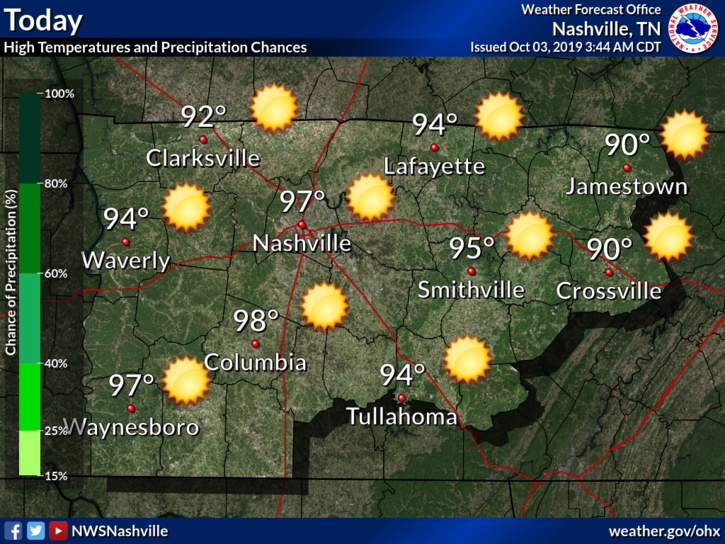
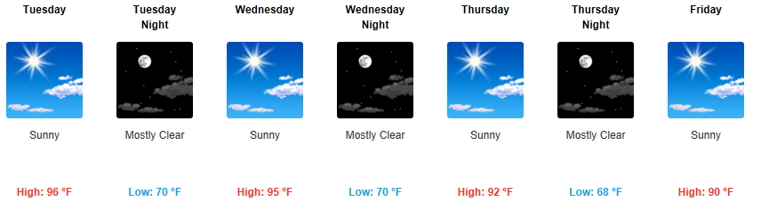
The 90s Aren’t Going Away Anytime Soon

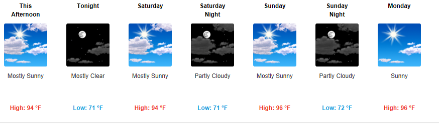
There are plenty of chances this week for some high temperature records to be broken with all forecasted highs in the mid 90s. Minimal rain chances through the week, not really any relief in sight. A strong upper level ridge boosts our temperatures mid week up to near 96°, making it feel like a July afternoon. The all-time record high for October, 94°, has a good chance of being snapped later on this week.

why GIF

The NWS-Nashville is hinting at a possible late week cold front that could bring us some relief from this madness, but we will have to wait and see, as that is still multiple days out.

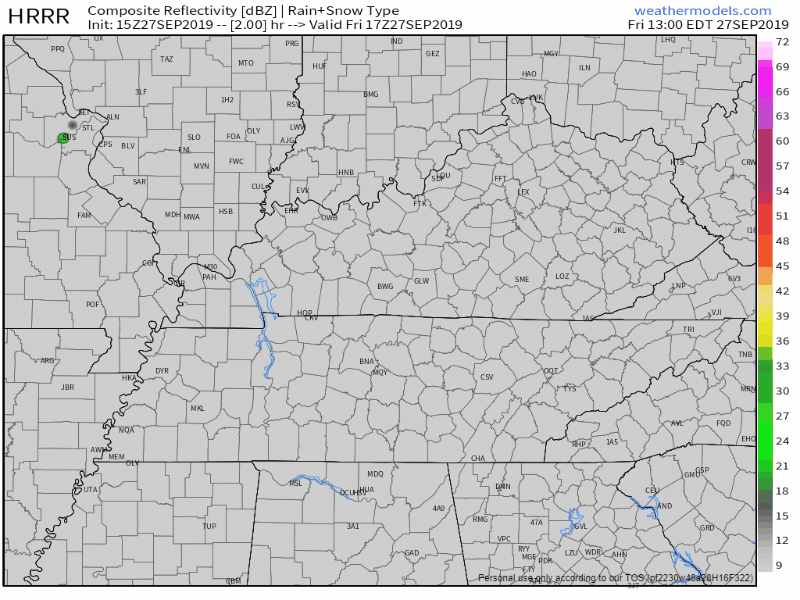
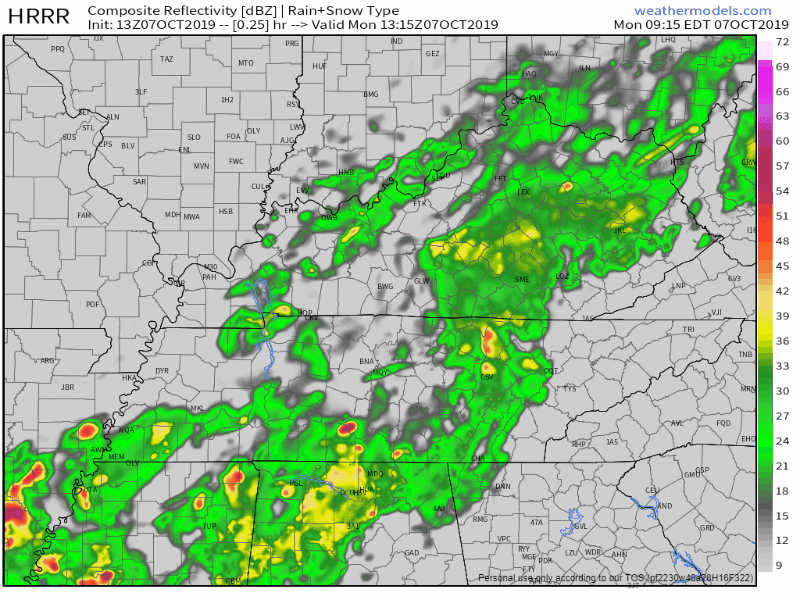
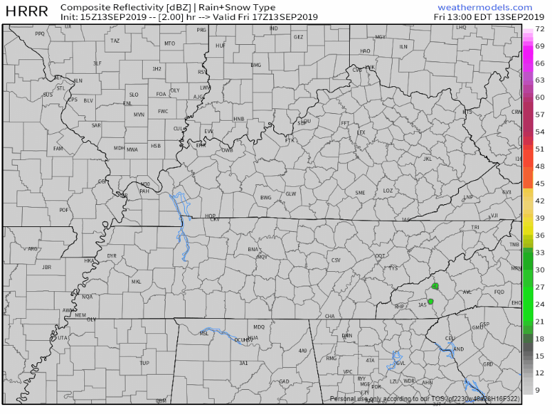
Small Chance Of Rain This Afternoon, But You’ll Probably Stay Dry

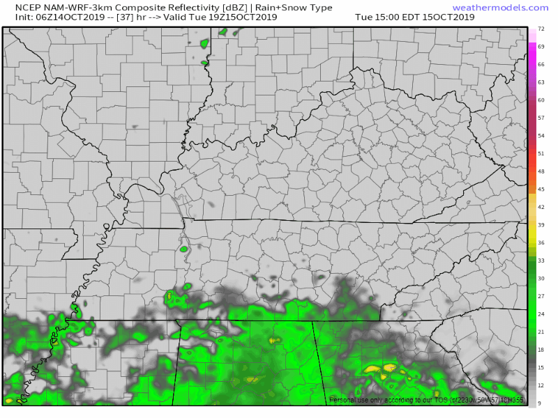
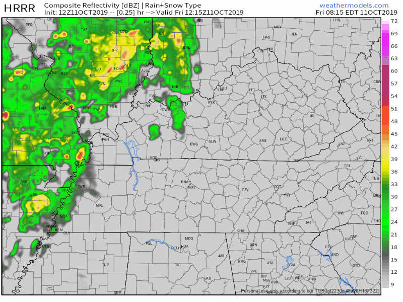
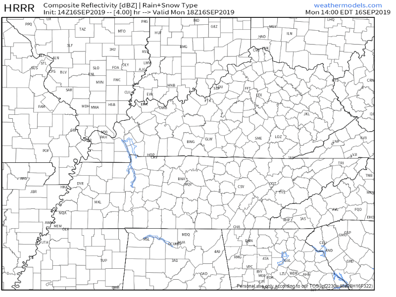
For this afternoon, we’ll be up to 94° as hot and humid air will stick with us in Middle Tennessee, possibly bringing a couple late afternoon showers. Here’s the latest HRRR, showing the majority of us staying dry:

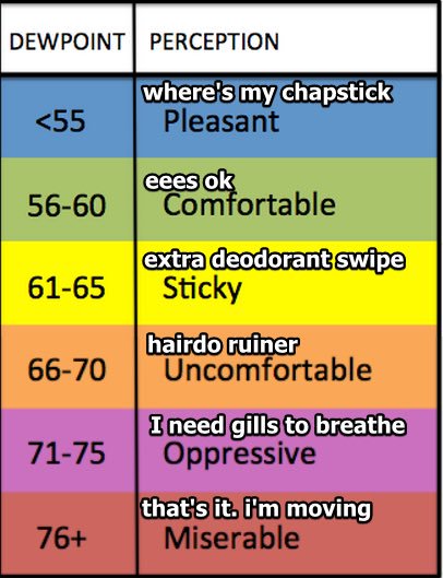
Even if some areas do see rain this afternoon, it’s not going to put much of a dent in this summer-like weather. Like I said, it’s going to be humid, making it feel even more miserable outside, with dewpoint values in the upper 60s. It’s going to be gross out there you all, no way else to put it.
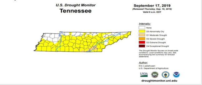
It’s…Really Dry

We’re still under a “Moderate Drought” for most of Middle Tennessee, because if you haven’t noticed, it hasn’t really rained.

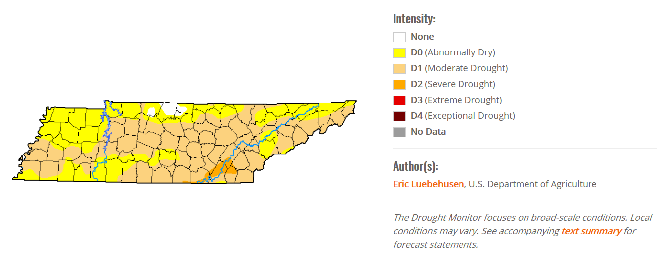
Fire danger concerns will continue through this week as this drought worsens before it gets any better.

Be on the lookout for fall…it’s out there somewhere.

looking scooby doo GIF by Boomerang Official

Check back for more updates!

It’s the First Day of Fall! (it’s ghosting us).

We won’t see a lot of rain today, sorry.

At least it’s something?

These aren’t pop up storms, instead a weak cold front is moving through today, setting off this rain.

NWS-Nashville predicts less than .25″, with most areas receiving less than .10″. Your backyard could see more, some could see less; either way it’s not a lot. This will do little to cut into our monthly deficit.

Already had some rain this morning, southeast parts of Will Co are getting wet now around lunch.

Another wave of rain is expected mid/late afternoon.

Below is the HRRR model run, showing scattered showers arriving after 4PM:

This PM round may be a little wetter.

Thanks to all this we’ll only be up to near 86° for the high this afternoon.

Temps not so bad today, Tuesday, and Wednesday.

Still above normal for highs this time of year, but mid to upper 80s for Tuesday and Wednesday is a break from the 90° days. Dewpoints through Wednesday in the 50s mean less humidity.

aliens area 51 storm area 51 GIF

A front brings a small chance for showers Wednesday night into Thursday, then Fall ghosts us.

Those rain chances aren’t very high.

Then temps rebound back into the mid 90s by the end of the week, bringing the nasty dewpoints in the mid/upper 60s along with it.

the office GIF

The Euro model has 90°s lasting all the way through the first week of October. read more

Lower Heat And Humidity, Still No Rain

Beautiful Friday

Happy Eddie Murphy GIF

We’ve got great weather to end the workweek today for Middle Tennessee.

Cooler than the past few days, but more importantly, lower dewpoints! We’ll be up to 89° today, but the dewpoints are actually going to be our friend today and stay in the 50s!

Low Dewpoints Continue Through The Weekend

Copy and paste today onto Saturday and Sunday and you’ve got your forecast!

Lots of sun ahead for us this weekend, highs in the upper 80s and continued dewpoints in the 50s. Perfect weather for those of you heading out to the Pilgrimage Festival this weekend, just bring some sunscreen.

You might even feel a little coolness overnight as lows drop down into the mid 60s.

What About Rain?

Unfortunately, we’re not looking to see much of a chance for rain in sight.

Best chance would be Monday, but very widespread with only a few hundredths of an inch North of I-40.

We’re still “Abnormally Dry” here and this looks to continue without relief in sight. Lower dewpoints and dry conditions will increase fire danger. Tennessee Division of Forestry will require burn permits staring on Monday September 23rd.

Adam Devine Workaholics GIF

Check back for continued updates!

We’ve been at or above 90° for 8 consecutive days (…and counting).

https://platform.twitter.com/widgets.js

We’ve been at or above 90° for 8 consecutive days. Not 17.

Editor’s Note: this is on me. I was perusing other data sets and saw that when I said 17 before I had misread something, I’m not exactly sure what. I messed up. Below is the confirmed data. The streak is 8 days in a row:

We were at 89° on Sept 8 and 88° on Sept 7.

The 8 day streak includes today. We’ve already passed 90° en route to a high of 97°, with sticky dewpoints in the mid 60s. 

The HRRR model is hinting at a weak frontal boundary moving southward, that could bring a couple pop-up showers that develop along this boundary into the early evening, especially for counties just off to our North:

But probably nothing for us.

The Week Ahead

The upper ridge over the Southeast will keep the sun and heat around – and the rain far away – for the remainder of the workweek.

If this verifies through Friday it’ll be 21 consecutive days at/above 90°.

NWS-Nashville points out that with projected temperatures in the 90s again this week,

we are approaching a record of the most days with temperature in the 90s+ read more

Hot Weather Continues, Not Much Relief This Week

Friday

Happy Friday the 13th everyone!

Friday The 13Th GIF by Digg

We’re heating all the way up to 98° this afternoon. You’re definitely going to feel it too when you step outside thanks to the dewpoint near 70. 

With the combination of the air temperature and the dewpoint, our heat index is going to be near 105° as we reach the high this afternoon.

We could see a bit of relief today however. The HRRR shows some pop-up storms developing from the Southeast and moving through the area between 2PM-6PM:

Here’s what the NWS-Nashville has to say about these pop-ups today:

“These will be diurnally driven and
should dissipate with the daytime heating. Nashville and
surrounding areas could see these storms a little earlier than
3pm if temperatures continue to climb quickly, which will help
spark activity this afternoon.” read more