Mostly Dry Today, A Few Showers Saturday, Washout On Sunday, More Normal Temps Next Week

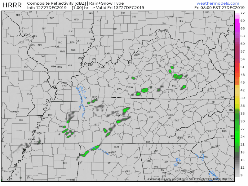
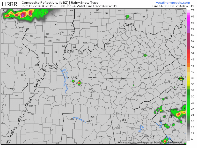
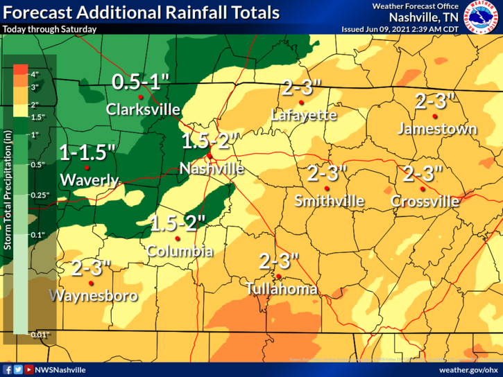
Only A Couple Sprinkles Today

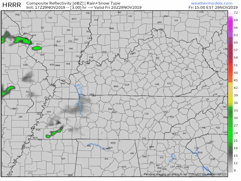
A few showers are showing up on radar this morning and on the HRRR model for this afternoon:

Clouds Moving Out, Above Average Temps Through Christmas, Weekend Rain Chance

Clouds Push Off, Temps Rise

We’ll start to see more and more of breaks in the clouds as we progress through the mid afternoon. Rain for this afternoon will stay off to our East as it pushes out of the area. Now that the sun’s out, temps have risen quickly. We’re up to a balmy 67° at BNA as of 1:00 pm! read more

Rain Today, Warming Up Through Christmas Day, Quiet Week Ahead

Gloomy & Rainy Sunday

We’re getting rain from the northern edge of a system passing south of us. High 58°.

HRRR model thinks rain will continue tonight, overnight, ending before sunrise Monday.

Flash Flooding and Damaging Winds Possible Today. Cooler And Dry Remainder of Workweek

Severe Storm Threat This Afternoon/Evening

It was a noisy night N of I-40 last night as storms developed and dropped a lot of rain. Last night’s rain will enhance the flooding threat later today. HRRR shows storms pushing E and crossing both counties again this evening. read more

Light Showers This Afternoon, Mainly Dry For The Weekend, Storm Chance Monday

Scattered Showers This Afternoon

We’re going to stay dry for the remainder of the morning, before showers from the Southwest move into Middle Tennessee. We’ll see scattered to numerous showers begin to move in between 2PM-4PM, and lasting through the evening. The best rain chances are for those mainly along and just East of I-65. read more

Plan for Minor Travel Impacts Tuesday & Tuesday Night as Rain Transitions to Snow

It’s not a “minor” travel impact to you if you slide into an overpass wall, so be smart out there. Fortunately we have a traffic problem and no one goes more than 25 MPH anymore.

But first: read more

Rain Tapers Off Later This Afternoon, Dry Through Sunday, Cold Front Brings More Rain Monday And Tuesday

Rain To Move Out By Late Afternoon

We’ve dealt with scattered showers throughout the morning, but those will quickly be on their way out. The latest HRRR model has these showers fizzling out for much of us no later than 5PM-6PM:

Cooler Today And Tomorrow, Dry Through Thursday, Potential Rain On Friday

Snow For The Cumberland Plateau

Our friends off to our East are seeing some snow accumulation this morning. Some areas will get a measly dusting while others in the Plateau could get up to 2″.

For us though, we’re not going to see any of that. We’ll have to wait a little longer. read more

Drizzly End to Black Friday, Heavy Rain, Low-End Severe Threat Tomorrow, Clearing Out Sunday - Next Week

PREPARE FOR A LITTLE BIT OF DRIZZLE TODAY AND TONIGHT

Layered clouds will keep us near 51° for the high this afternoon.

Drizzle is moving through this afternoon mostly south of I-40, unlikely to create measurable rainfall. Drizzle or a brief light rain shower is possible anywhere in Nashville or Will Co tonight. read more

Chilly Today, Next Rain System (Fri. Night, Mostly Sat.), Dispelling Snow Rumors.

Windy, Chilly Wednesday

PREPARE FOR WIND

Sustained wind 15 – 25 mph with gusts up to 40 mph this morning.

Should last until noon or so, with gusts relaxing this afternoon and tonight.

Worst of the wind is gone, so confidence you’ll get a strong wind gust is low. Kite flying is a good idea this afternoon, you still may squeeze out a decent amount of wind. read more