
Beautiful Weather Today!
Dry air has taken over Middle Tennessee, bringing with it welcomed relief! High temps will make a run at 90° today, but dewpoints continue to drop. By this evening, dewpoints will sit just below 60°.

Dry air has taken over Middle Tennessee, bringing with it welcomed relief! High temps will make a run at 90° today, but dewpoints continue to drop. By this evening, dewpoints will sit just below 60°.

The cold front that came through last night dropped the temperatures slightly and the dew points noticeably. Temperatures will be a bit lower today than yesterday. Looking at a high in the upper 80º range with dew points in the mid to low 60s.
High temps will reach the low 90s for Nashville – that’s some of the warmest temps we’ve seen in a few days. We could be feeling a bit sticky, dewpoints are reading in the mid/upper 60s.

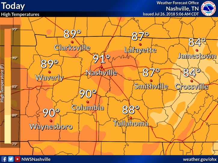
Good morning- we are still looking at a high of 89º for the day today. Nothing in the way of showers and storms.
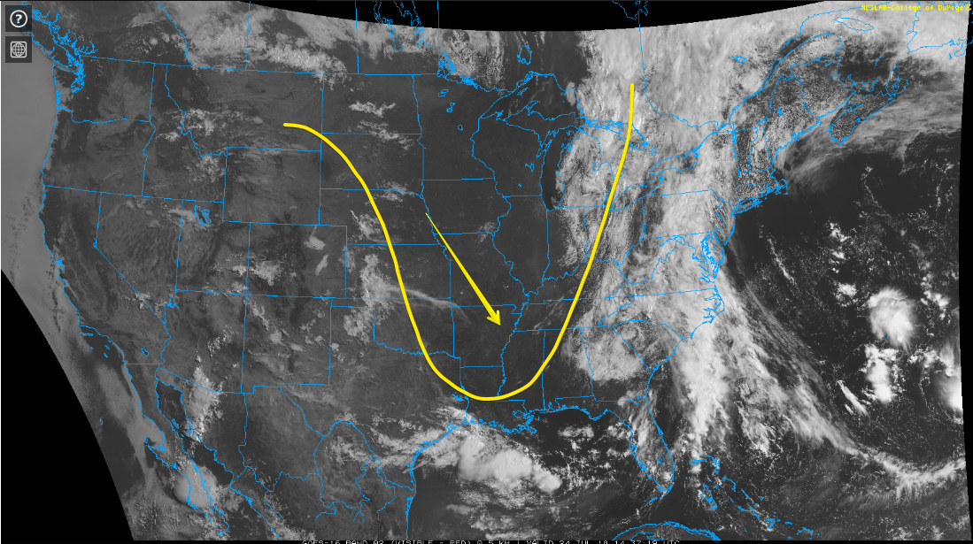
High-pressure centered over Missouri is providing sinking air over the region today. Sinking air = suppression of showers and storms.
High temps will be close to 87° today and with dewpoints remaining in the upper 60s – it’ll feel great outside!
We’ll have another day of splash-and-dash showers, but we’re expecting our Tuesday to remain mostly dry.
RELIEF!
Yesterday’s relatively cool weather will carry over to today! Only expecting a high of 83º! Woohoo!
That said, we have a chance of a passing shower during the daytime hours. No storms, just a splash, and dash here or there.

Summer breeze, out of the north, 10 MPH.
An unusual-for-July upper level low is bossing our weather and bringing much cooler temps. Highs today and tomorrow: 84°! Only 84°!
Still a bit humid, but no oppressive humidity.
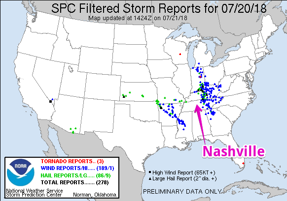
Yesterday is one of those instances where we prepared for the worst, hoped for the best, and landed on the better side of things. To give you an idea of how storms played out, we have the Storm Prediction Center Storm Reports map (pictured below). This map is created from reports the public, broadcast entities, or others sent to the local NWS office during a severe weather event.
6:30 PM UPDATE
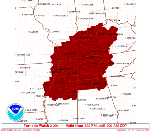
As expected, the Storm Prediction Center has issued a Tornado Watch that includes all of Middle Tennessee, in effect until 2:00am. The watch itself is HUGE, encompassing parts of eight states, and well over 100 counties:
Sticky — but not oppressive — humidity and very low afternoon rain chances; keep all your rain-afraid afternoon plans.
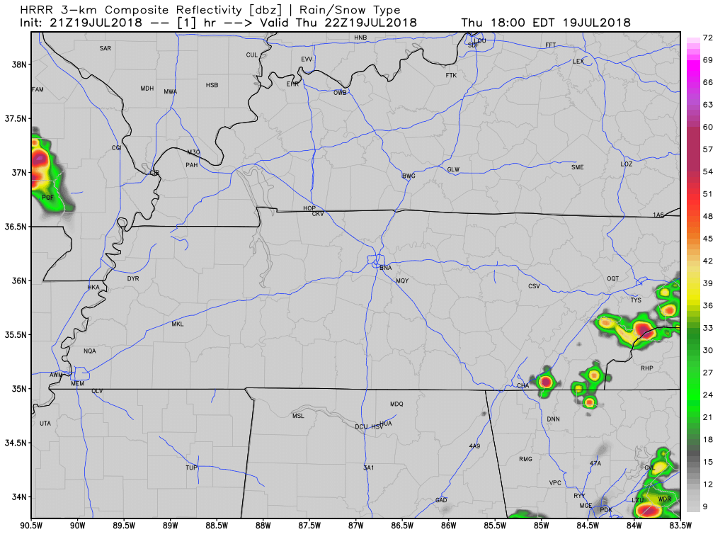
That said, a few storms could go up this afternoon, but as the HRRR model below illustrates, most of that threat will be to the south and east of Williamson and Davidson counties.
You must be logged in to post a comment.