A light, drizzly rain has worked its way into Davidson and Williamson counties this morning. By now we should just be seeing rain fall, but a flake or two could be in the mix.

A light, drizzly rain has worked its way into Davidson and Williamson counties this morning. By now we should just be seeing rain fall, but a flake or two could be in the mix.

After Will’s morning blog forecast and my Twitter review of model data, NWS-Nashville held a special briefing, the substance of which you’ll read below.
In 6 tweets, this morning I laid out all the model data on Twitter. You can read it here.
Rain will likely hold off all day today, though a stay rain or sleet shower isn’t out of the question tonight. What you will notice today and tonight is the cold. It won’t get much warmer than 40º for most of us and the wind chill will make it feel like freezing or below all night.
Clouds increasing today ahead of another cold front this evening.
Today’s high temps will easily warm in the mid/upper 40s, overnight low about 34°. Afternoon temps will feel close to freezing with the wind chill.
After some flurries this morning, our skies are clearing nicely, however, those temperatures will struggle to rebound over the 40º line.
After a mostly clear day, temperatures will nosedive into the middle 20s again. Winds will be out of the west at around 5 PM, then turning south after midnight.

A weak overhead shortwave trough has shifted our winds to the north: cold air is pouring in. Cold air and thick clouds will keep us from warming too much this afternoon; high will be upper 30s.
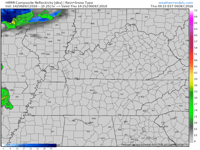
Even a few sleeters and snow showers have raced across NE Middle Tennessee. You may have seen a few wintry pellets on your windshield this morning. This may continue this afternoon with neither worries nor impacts.
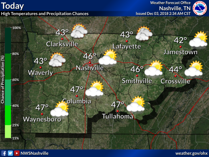
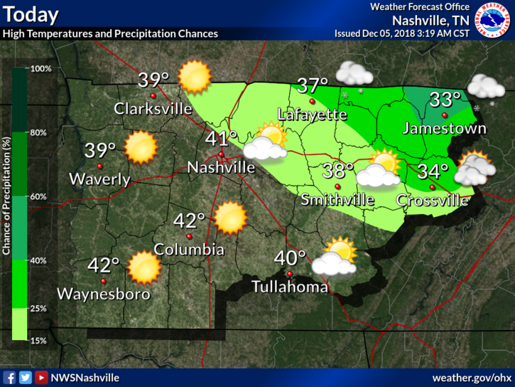
Dry air and cooler temperatures are going to be the story of the week for us here in Middle Tennessee. Expecting a high of 46º with the passage of a dry frontal system today. This front will just sweep a reinforcing shot of cold air through, no precipitation will fall.
(“Mixyerable” is a new word. Affections will vary).
Winds will relax tonight.
South winds Sunday will be west winds tonight and NW winds tomorrow morning. Therefore, waking up to temps under 40° Monday. We should not see 50° anytime this work week. Bundle up tomorrow!
From NWS-Nashville:
forecast soundings would suggest we should see plenty of wind gusts of 30-35 mph. This is just below wind advisory criteria (gusts of 40-57 mph).
Sustained winds will be strongest this afternoon.
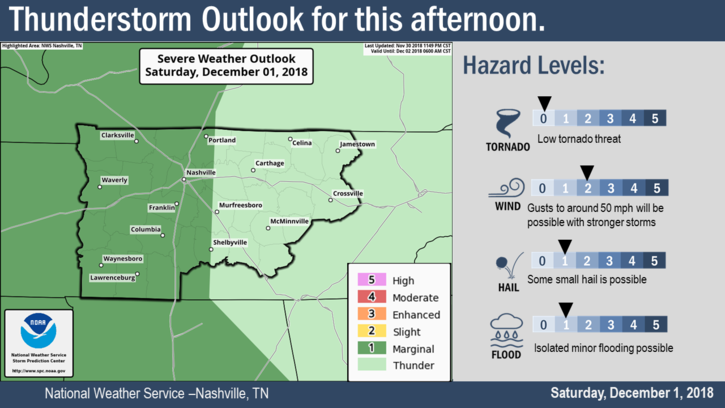
The Storm Prediction Center has us placed within a Marginal Zone (1 out of 5) of severe storm activity for this afternoon.
6:39 PM update: there’s another line of storms to our west.
The latest Mesoscale Discussion mentions these storms:
You must be logged in to post a comment.