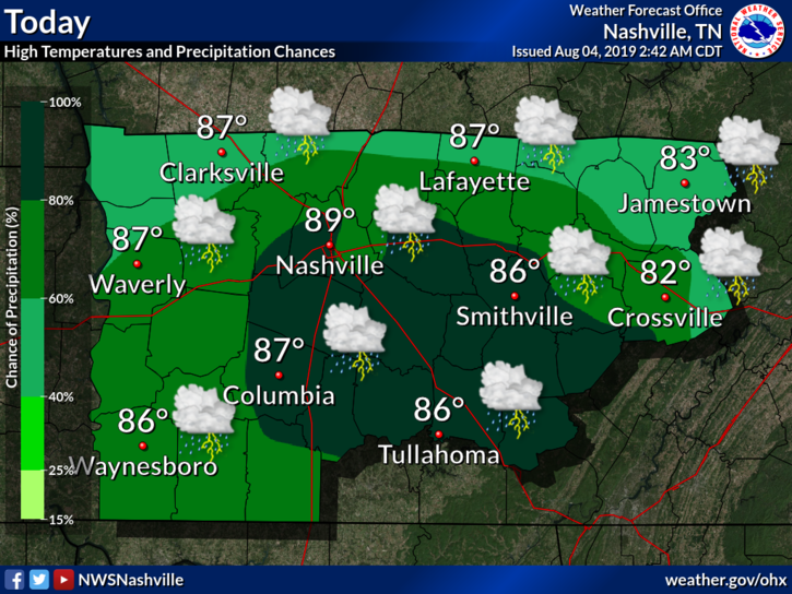
Well, if you’re sick and tired of the rain, I have some bad news for you…it isn’t over just yet. Middle Tennessee is going to see numerous waves of heavy rainfall and flooding Tuesday through Sunday.

Well, if you’re sick and tired of the rain, I have some bad news for you…it isn’t over just yet. Middle Tennessee is going to see numerous waves of heavy rainfall and flooding Tuesday through Sunday.
When will the rain end?
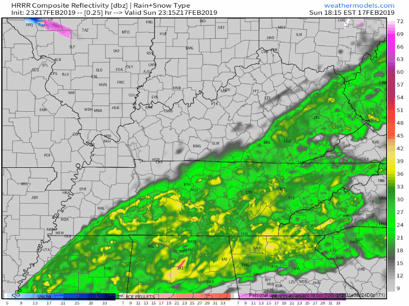
Hang in there, HRRR and NAM think the rain should come to an end about midnight. Temps will drop overnight, falling to the upper 30°s by Monday morning’s commute.
The band of rain has slowed down, allowing more rain to fall over Nashville than previously thought, we could expect 0.5″ to 0.8″ through the night. NWS Nashville does not expect flooding concerns today.
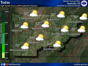
After yesterday’s cold front, we’re left with a relatively cool day. High temps will only push into the mid 40°s in the afternoon, a bit cool for what we normally see in mid February.
Dry air will try to mix in with our clouds in the afternoon, so we could see some thinning. Don’t expect to spot much of Mr. Sunshine.
The temperatures think today is opposite day. Instead of warming through the day, temps will be cooling through the day. Why? A cold front passed through during the morning hours.
Drizzle is already showing up on the radar in west Tennessee, moving closer. However, air is super dry aloft, so it’ll take time for rain to hit the ground. Therefore, for most of the afternoon Williamson and Davidson Counties will be rainless and overcast.
It is a very pleasant and mild afternoon out there today without temperatures topping out in the low 60’s. These conditions will not last however, as an approaching cold front will bring temperatures back to near normal for this time of the year, along with renewed chances for rain. I have a map below which shows the location of our cold front marked with the blue triangles as of 12 PM Central Standard time. Out ahead of this front, we are in a warm sector with a mild and breezy southwesterly flow. As this front approaches and moves through tonight we will see a drop in temperatures and even a slight chance of a shower.
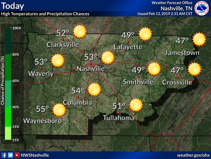
The month of February has been a wet one so far, with rainfall values well above average. The Nashville Weather Service has recorded a value of 6.18 inches of rainfall for the month already, and it’s only the 13th! This is four and a half inches above the normal for this month. The good news is we are seeing a few dry days ahead before the next round of rain returns. Today, we will see a sunny, dry day with temperatures rising into the low 50’s.
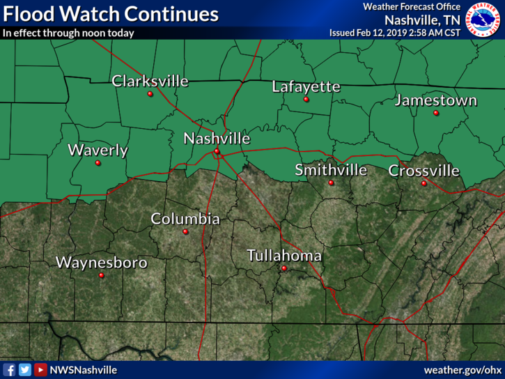
A Flood Watch continues for Davidson County until noon today. We’ve had quite a bit of heavy rainfall this morning, but not as much as the models thought. Totals should settle in around 1.25″ or so; models predicted 1.5″ to 2″. Although some area creeks, streams, and rivers rose to action stage, none are expected to rise to minor flood stage, which is a relief.
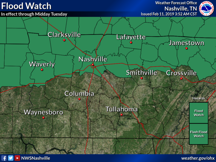
Flood Watch: A Flood Watch remains in effect for Davidson County through midday Tuesday.
Key Takeaways:
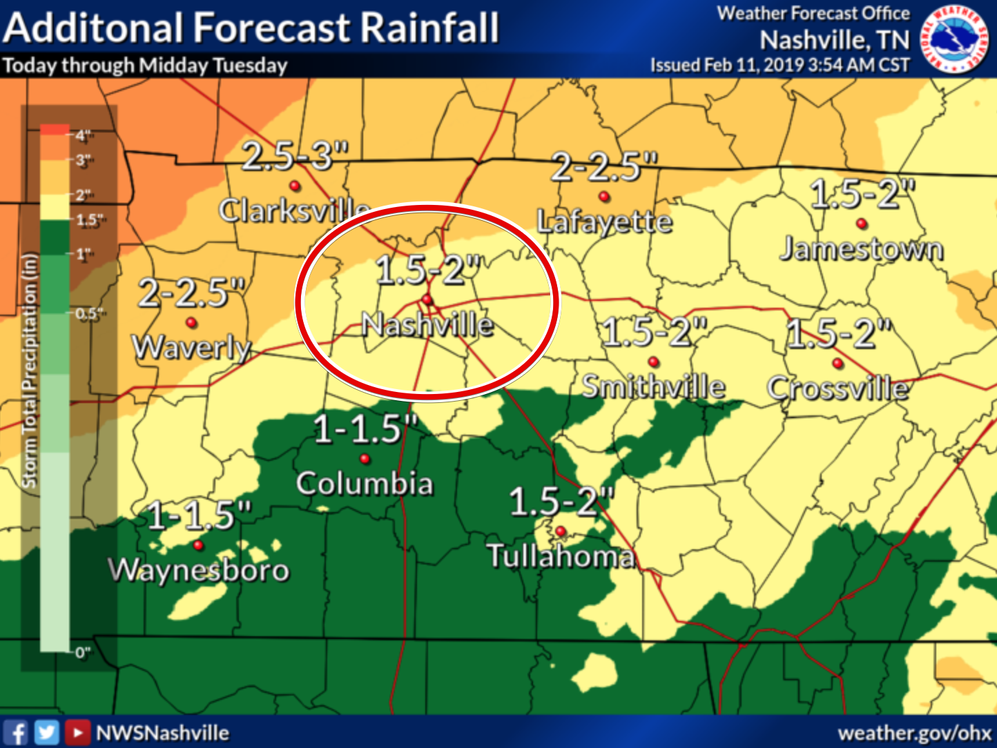
The National Weather Service in Nashville has both Williamson and Davidson Counties in the 1.5-2″ range. This is through midday tomorrow. More expected north and northwest of us.
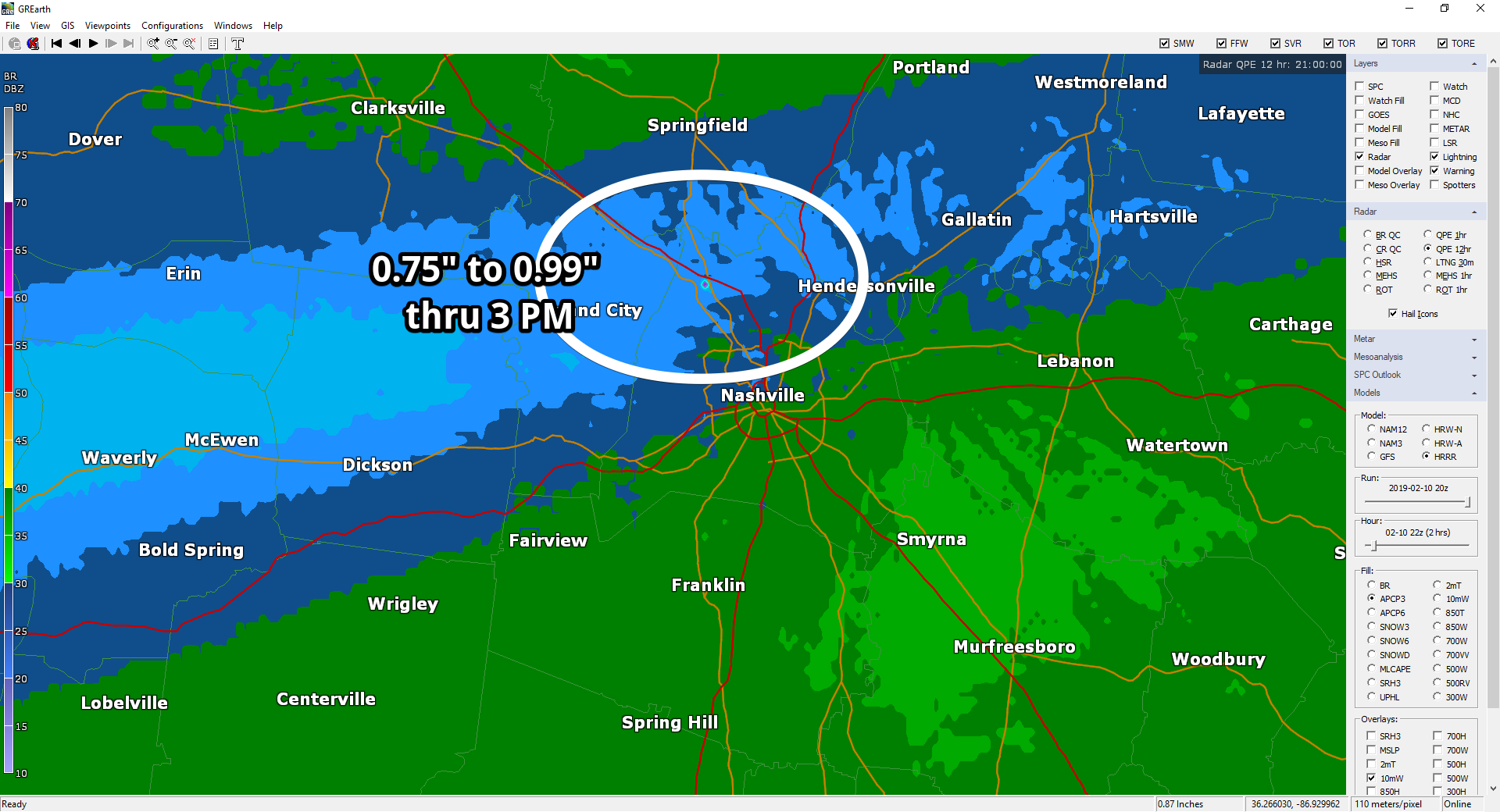
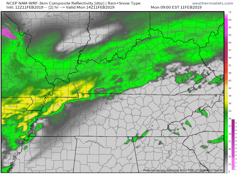
It’s been raining most of the day along and N of I-40. Rainfall through 3 PM:
More rain is on the way.
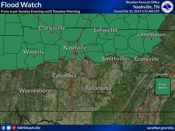
A Flood Watch goes into effect tonight through noon Tuesday for Nashville, but not Will Co.
Expect off and on rain today with temps in the 40°s.
A Flood Watch goes into effect tonight through “late Monday night” for Nashville, but not Will Co.
2″ to 4″ of rain is expected in the green-shaded areas.
You must be logged in to post a comment.