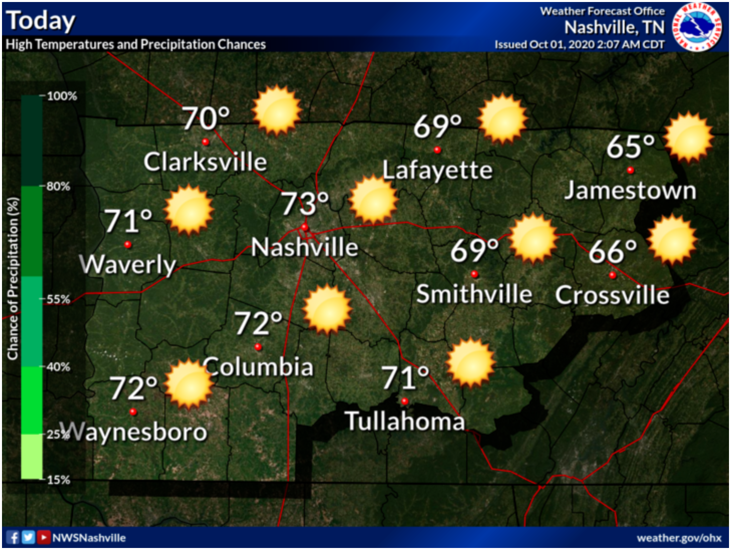
Happy Friday! This morning temps were in the low to mid 50’s along with clear, sunny skies.
This afternoon, those temperatures will increase to 73 degrees for our high today. Those sunny skies will stick around.

Happy Friday! This morning temps were in the low to mid 50’s along with clear, sunny skies.
This afternoon, those temperatures will increase to 73 degrees for our high today. Those sunny skies will stick around.
No clouds to be seen this morning!
A dry cold front will go through this morning, bringing cooler temps and drier conditions.
High temps will be about 5° lower than yesterday, at around 73°. We’ll have a west-northwest breeze throughout the afternoon.


*denotes weather only.
Let’s hit the wayback machine to September 30, 2019:
It also was not raining. From Sept 29, 2019:
Southwest winds today here in 2020 will take us to 77° this afternoon.
Winds could gust as high as 25 mph throughout the day.
Fog to start the day has since cleared. Expect a high of 69 with partly cloudy skies.
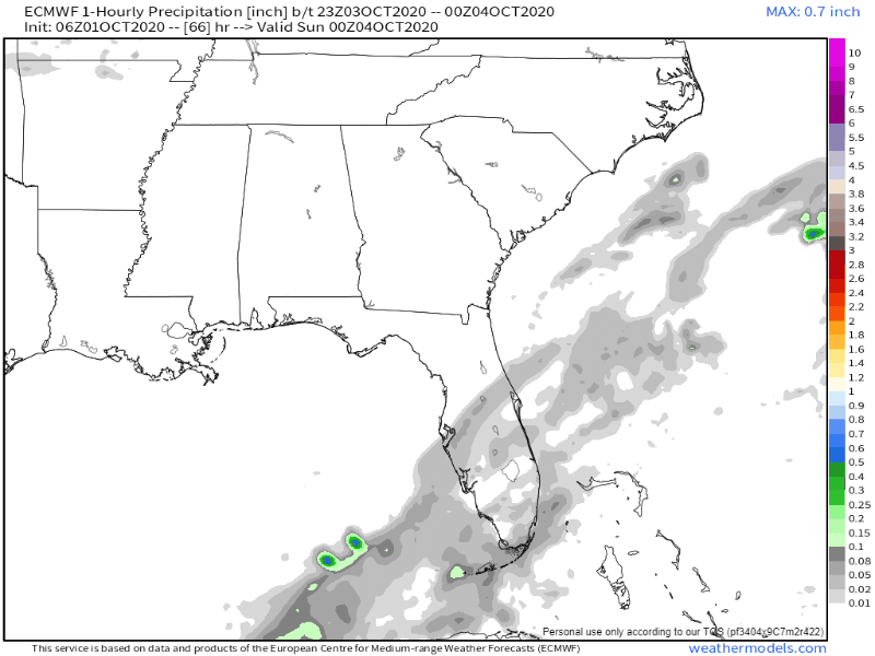
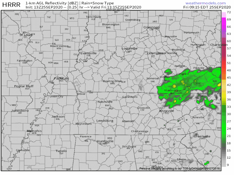
Can’t rule out some drizzle as an upper low moves into the area. HRRR Model isn’t very bullish:
These will be a nuisance more than anything. Most will stay dry.
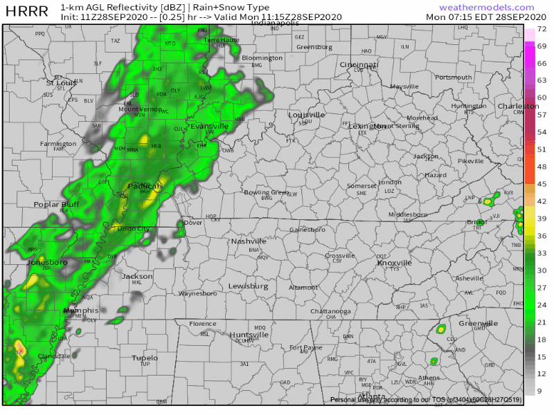
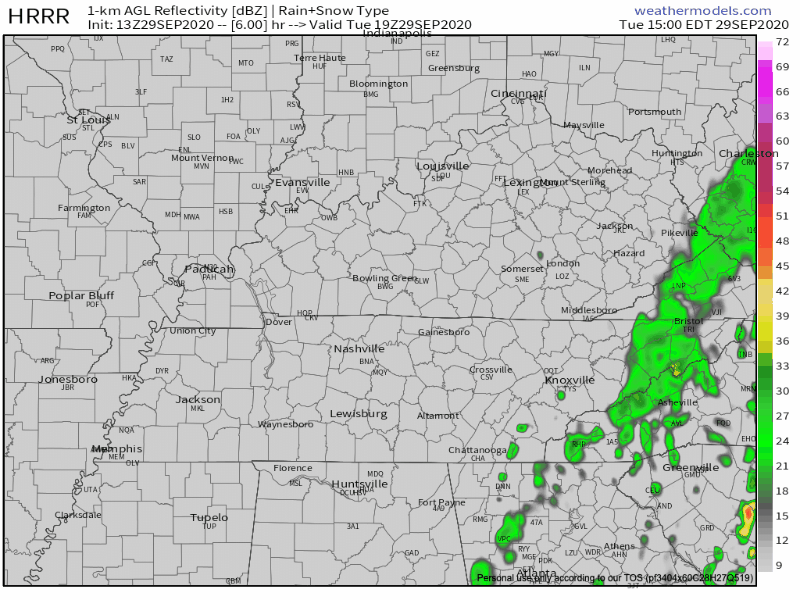
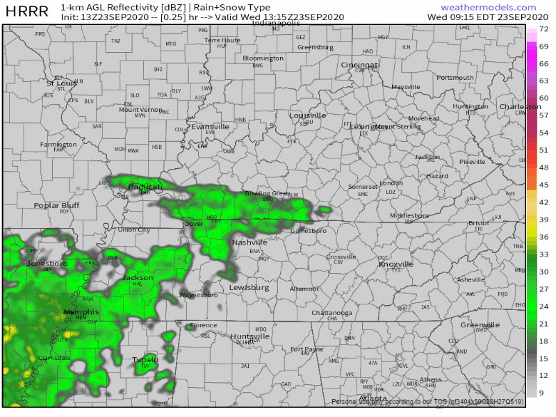
Lots of showers across Middle Tennessee today as a cold front moves our way. Washout conditions will prevail this morning. The HRRR agrees with this opinion:
The rain should clear the area by late afternoon, around 4pm.
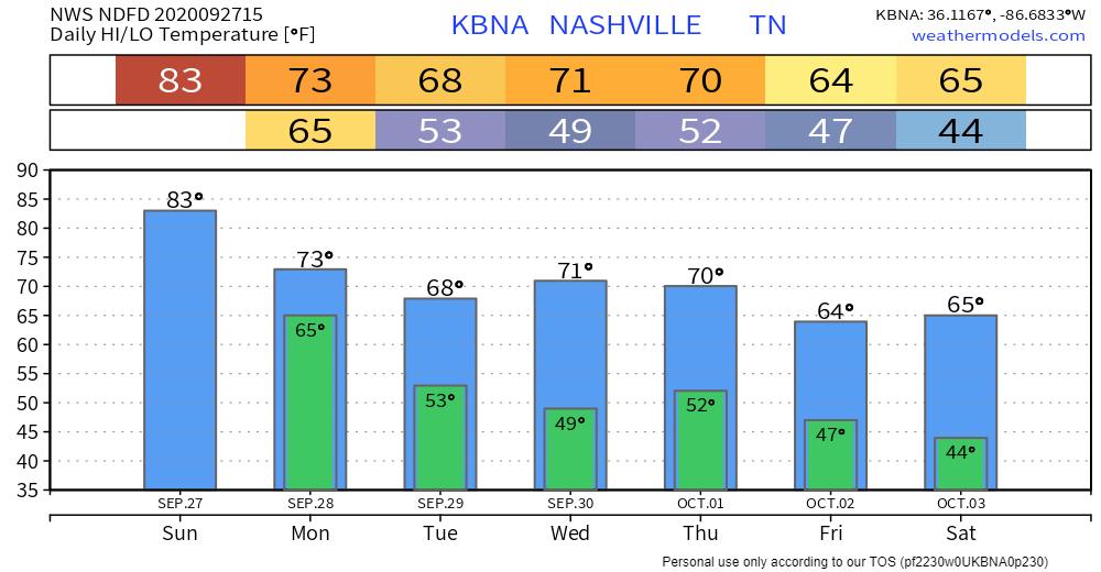
Sunday will be partly cloudy with a high of 83. Dewpoints in the mid 60s will make it feel sticky as well.
Upper-level low to our south might try and bring up a few Sunday afternoon showers. HRRR Model isn’t impressed and neither are we.
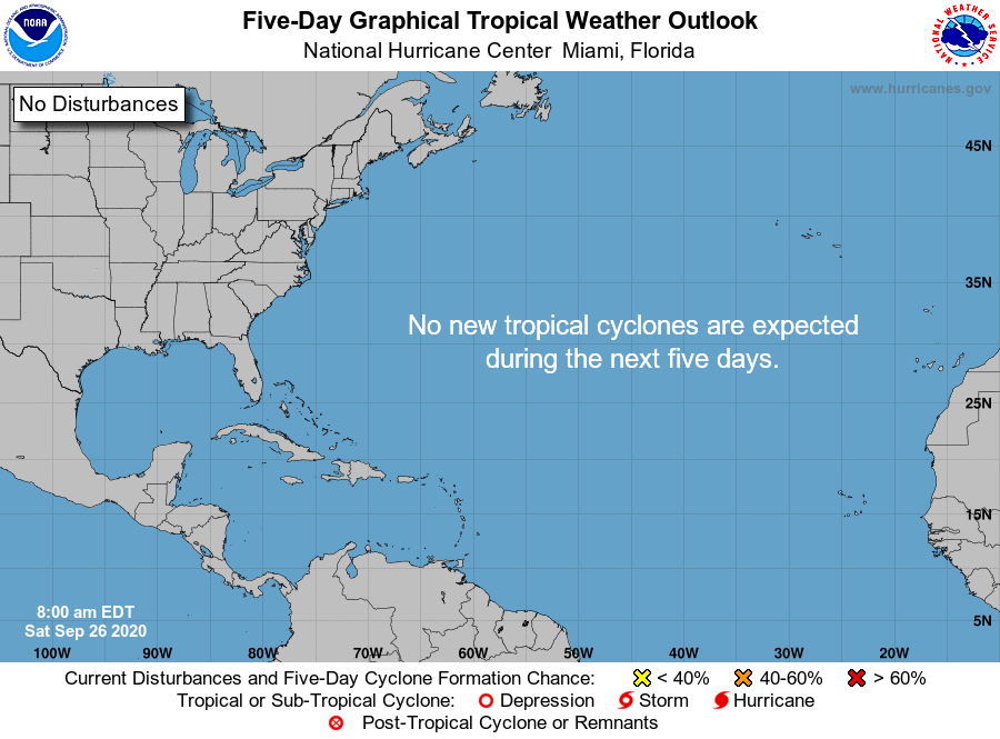
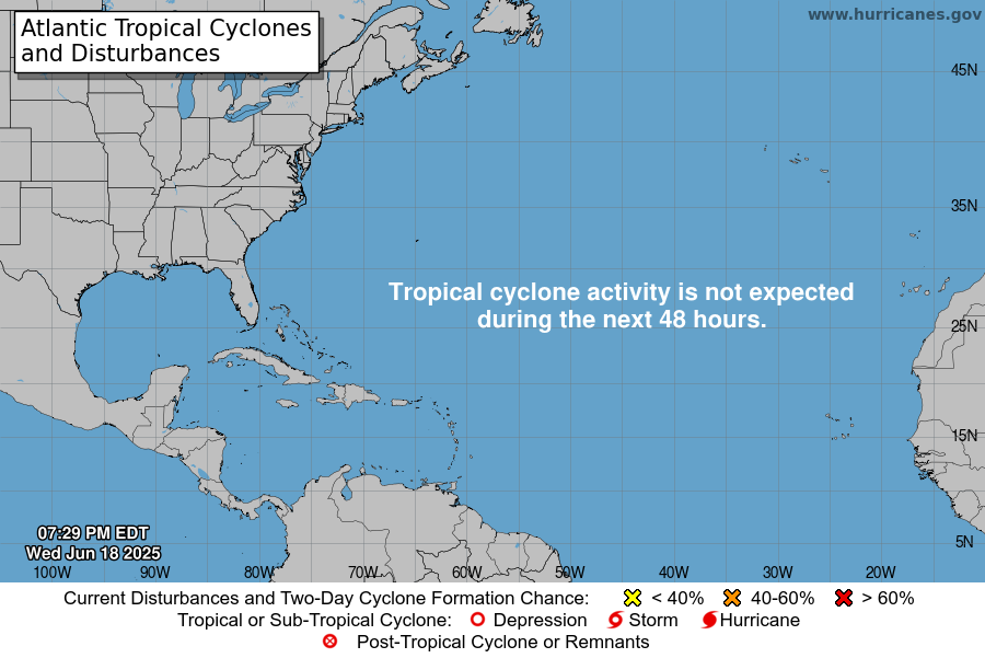
Not a single system on the map and nothing is expected to form over the next 5 days.
After a busy couple of months, we could use a break
Dense fog this morning will give way to partly cloudy skies and warm temps this afternoon. Highs should top out at 80. No rain.

The clouds will gradually clear up throughout the day today. The HRRR shows rain staying off to our east. A few popup showers may appear, but they will likely stay out of Williamson/Davidson.
Over the next day or so, the lingering moisture from Beta will also push off to the east. Make way for clearing skies and warming temperatures!
Post Tropical Depression Beta is now in central MS.
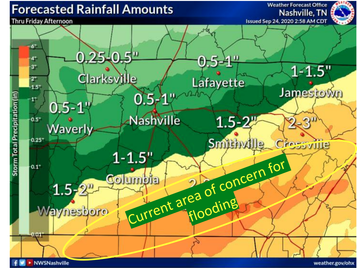
Beta’s northeast side is producing heavy rainfall in Middle Tennessee.
The north edge of that rain is cutting through our counties. More rain south, less rain to the north.
Step outside and you’ll feel a few sprinkles.
The HRRR model predicts more off and on light showers through the afternoon and evening.
Around a tenth of an inch of rain is expected. Probably not enough to rain out outdoor activities, but you may want an umbrella or rain jacket.
You must be logged in to post a comment.