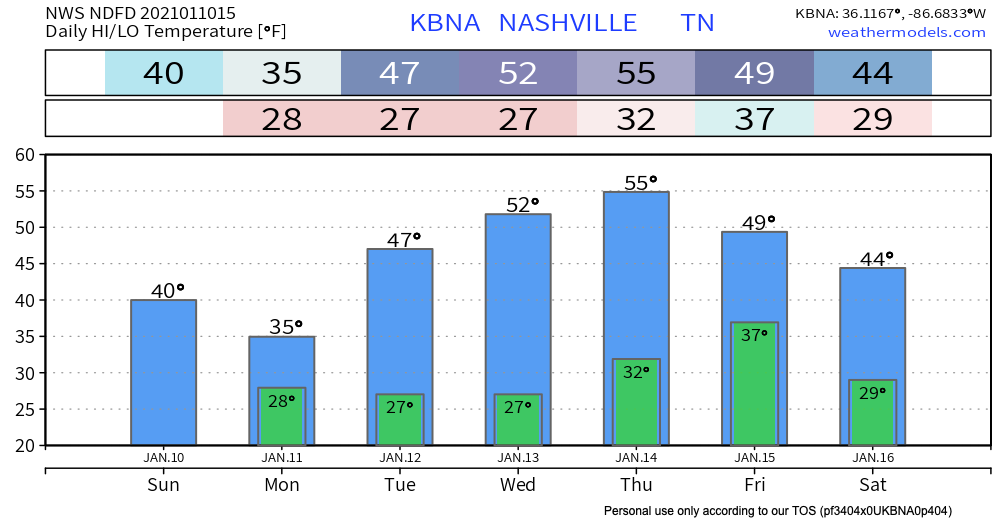
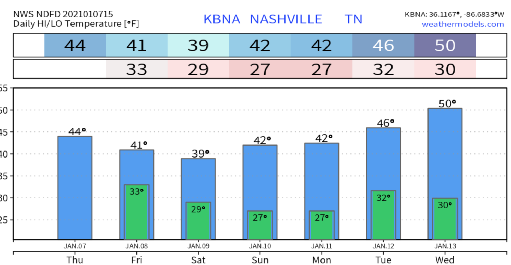
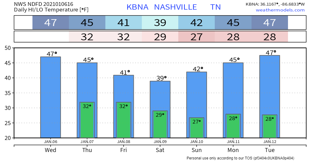
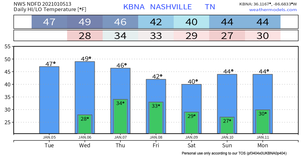
It’s noticeably warmer today…same for tomorrow with sunny skies sticking around. Light south winds today should become more gusty Thursday ahead of our next system.
An incoming front may bring a spotty shower late Thursday night into early Friday morning.read more
(Sunday’s forecast for Monday’s snow wasn’t horrible, wasn’t great. Looked like SE Will Co could get clipped and that’s what happened. The “place” forecast was good, the “amount” forecast was not. All the models “missed” this event, a reminder that weather models are not forecasts. Forecasts are not truth. Future prediction is hard. The arrogant forecast will be humbled. –David.)read more
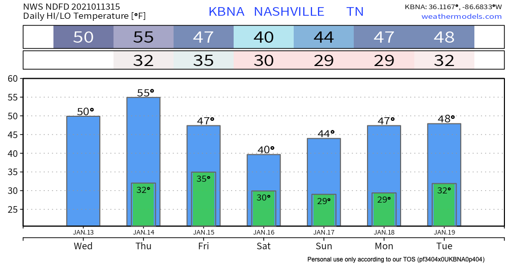
Confidence is “low to medium” (NWS-Nashville) in forecast accuracy for snow Monday.
Variables include:
Temperatures. South of us, snow is likely Monday morning. We may be too far north to get snow. Snow may not even extend into Will Co, much less Nashville, but it’ll be close. If snow gets far enough north, by mid-morning surface temps may warm into the mid-30s, causing any flakes to splat:melt. It may even get warm enough to change snow to rain. Noon temps around 35, upper 30s possible Monday afternoon.
Moisture. Most moisture will be well south of us. We will get the northern edge. If we had more moisture incoming, temps wouldn’t rise as fast. But moisture is limited, so those at elevation (hills, on bridges and overpasses) may be the only spots cold enough to collect snow. There’s just not enough “stuff” there to tap to make a good snow event.
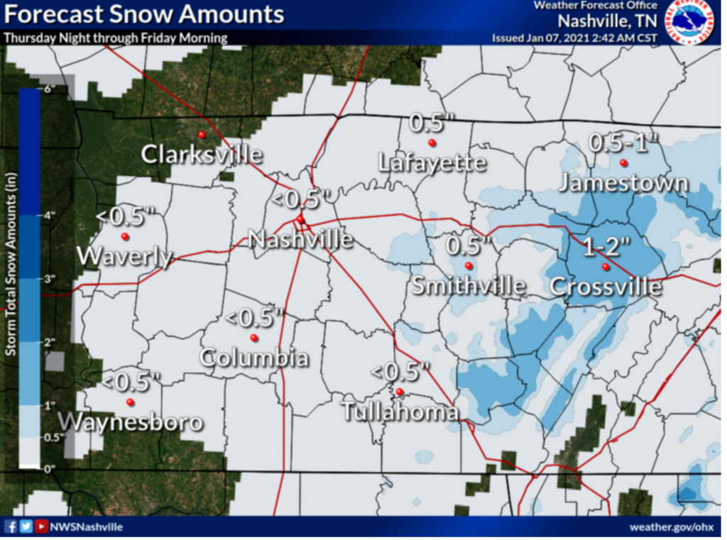
NWS-Nashville make no changes to its snow total forecast. Under a half inch, which includes us getting nothing. Most of those north of I-40 get shut out:read more
The real story here is that rain will begin pretty soon. JK the real story is that there is a non-zero chance of snow tonight and tomorrow morning. Let’s dive in…
After the afternoon rain event today (mainly after 5pm), temperatures will drop below freezing and that rain will transition into a rain/snow mix.
Nashville, although, is only expected to see less than half an inch. If anything, we will just get a dusting.
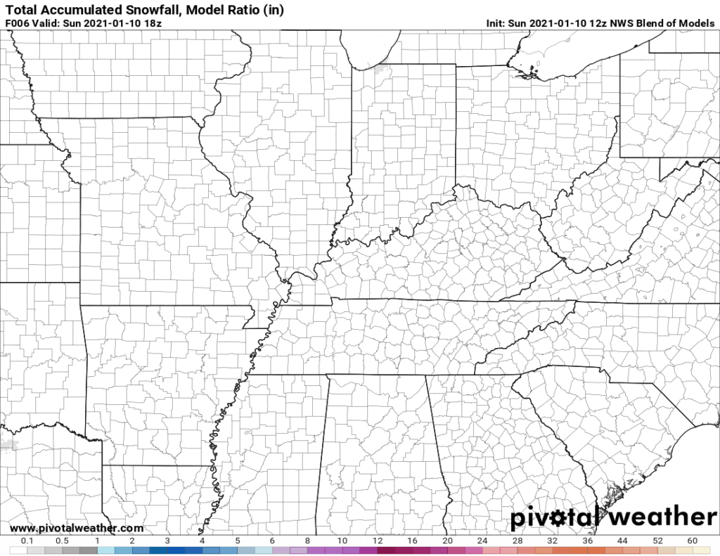
Official NWS Snowfall Accumulation Map
In general, impacts remain low. Temps should hover just a little bit above freezing at the surface in Nashville, but in the hollers, if it’s colder, bridges and overpasses could be impacted. Regardless, if you plan on traveling anywhere tonight or tomorrow morning, be cautious!
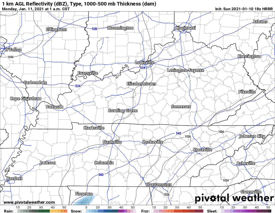
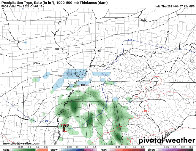
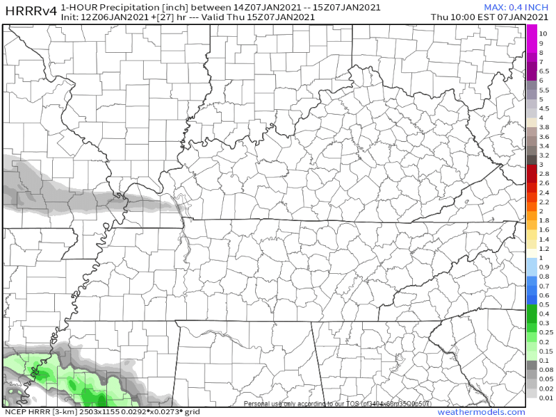
Let’s take a look at forecast models.
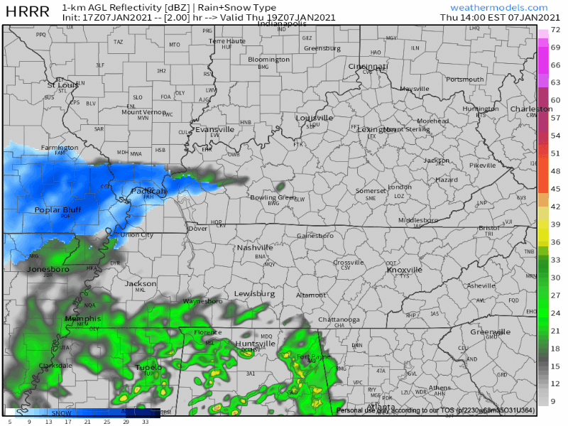
HRRR Model from 2pm Thursday – 6am FridayEuropean Model Overnight Into Friday
The Euro model (above) shows the snow Friday staying to the east. Other models show lingering moisture and weak lift which should be enough for some areas to see flurries.
Here’s what the NWS says…
IT STILL LOOKS LIKE THERE MAY BE A BRIEF PERIOD OF MIXED
PRECIP THIS MORNING ON THE LEADING EDGE OF THE PRECIP WEST OF I-65
AND LOOKS TO BE ALL RAIN THROUGH THE DAY THEREAFTER. AFTER
SUNSET, TEMPS WILL DROP TO THE MID 30S BEFORE 9 PM, AND PRECIP
WILL CHANGE FROM RAIN TO A RAIN/SNOW MIX, FOLLOWED BY ALL SNOW
JUST AFTER MIDNIGHT. HIGHER ELEVATIONS INCLUDING THE PLATEAU MAY
COOL OFF A FEW DEGREES SOONER, AND SEE ALL SNOW BEFORE MIDNIGHT.
SHOULD TEMPS COOL OFF A BIT SOONER AREA WIDE, WE MAY SEE MORE
SNOW, AND IN THE OTHER DIRECTION, SHOULD TEMPS STAY WARMER, SNOW
WILL BE DELAYED AND AMOUNTS WOULD DECREASE. read more
Thursday morning the HRRR model thinks our rain system will be near the MS/LA/AR intersection with rain on its northeast side. Notice it has a snow band in West Tennessee. That’s not expected to impact us (but yeah, we’re watching it). read more
Subscribe to Blog via Email
Privacy & Cookies: This site uses cookies. By continuing to use this website, you agree to their use.
To find out more, including how to control cookies, see here:
Privacy Policy


You must be logged in to post a comment.