
Here’s a quick rundown of how today’s gonna go:
Sunday will be a little sunnier, and a little warmer.
Snow Chances Monday
Unfortunately, they’re not looking great right now.

Here’s what the National Weather Service has to say about this system:
Temperatures will start off Monday morning supportive of at least a mix of rain and snow, warming into the afternoon just enough to change any precip over to all liquid, then cooling again in the evening as the precip pulls out of the mid-state.
NWS Area Forecast Discussion
Basically, temperatures aloft should be cold enough for frozen precipitation to form, but it will all depend on the moisture available. This will stem from the location and strength of an upper-level low passing to our south.
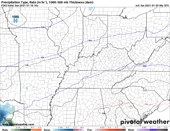
The GFS shows primarily rain with a slight chance of some frozen precip around 6 pm Monday…
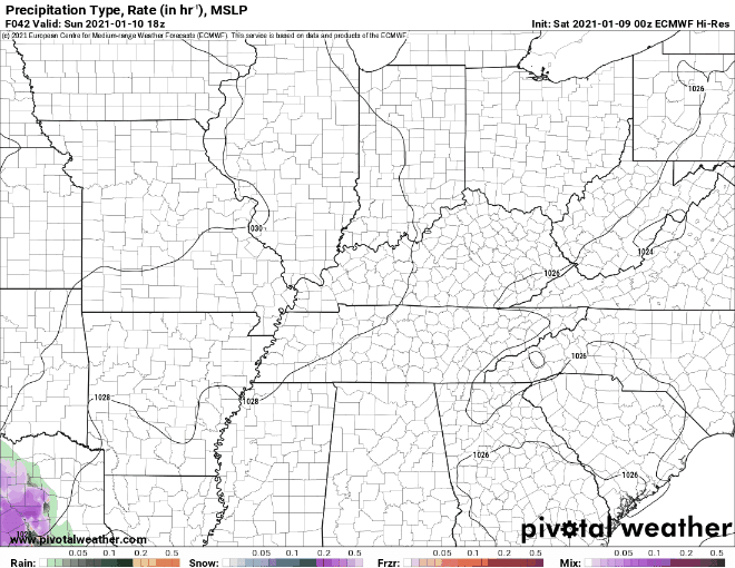
While the Euro model shows the low being too far south, eliminating much of the activity for our area.
Editor’s Note: This track (below) is good news is you like snow and live in Huntsville, Alabama.
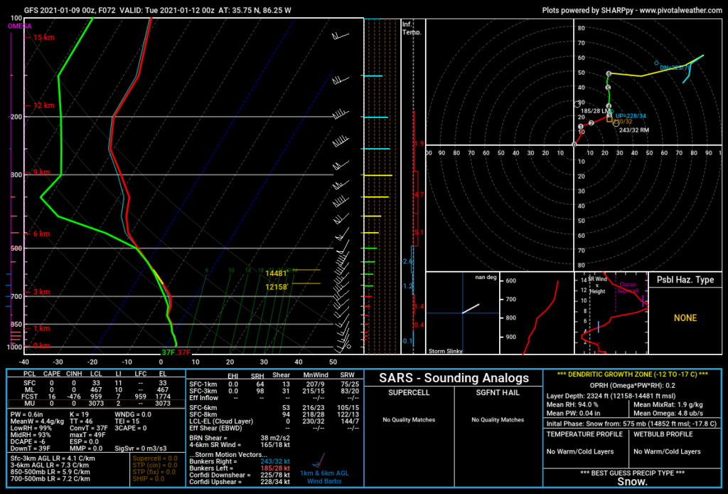
If any frozen precip does occur, the surface temps look to be too high for anything to stick. The GFS sounding for 6 pm shows surface temperatures at 37°.
With each day between now and Monday our forecast get better, but as always, things can change quickly and often.
Looking Ahead
After the system passes through Monday night, we should begin to see some sunny skies.

Temps will begin to increase through the week, possibly even making it into the 50s by Wednesday. What a treat for Mid-January!
Categories: Forecast Blogs (Legacy)
You must be logged in to post a comment.