Hot/Humid/It May Storm (what else is new?)

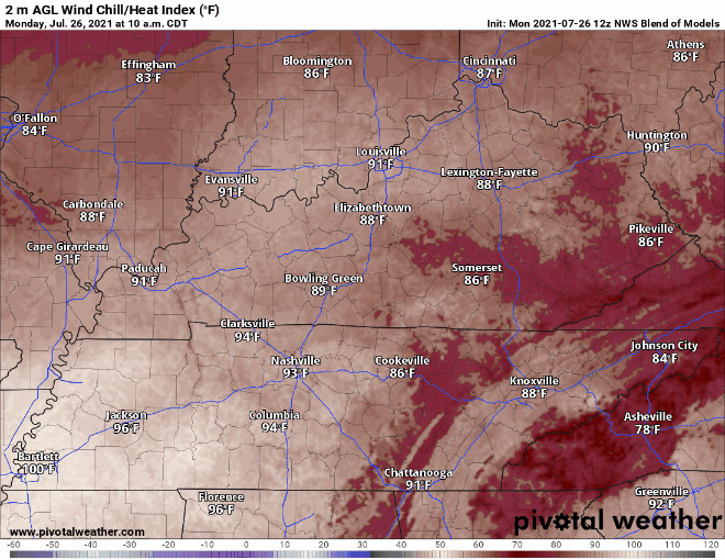
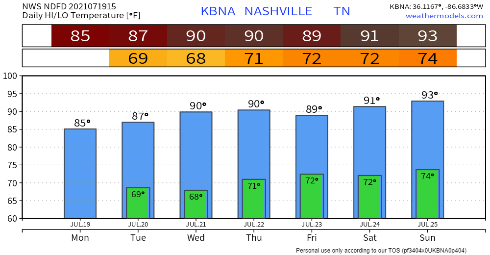
The NWS Blend of Models thinks our heat index will get to 101° this afternoon. That’s in the shade!

NWS BOM 2 m AGL Heat Index, valid Mon. 10am – Mon. 8pm

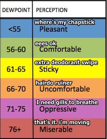
Dewpoint around 73° to 74° this afternoon.

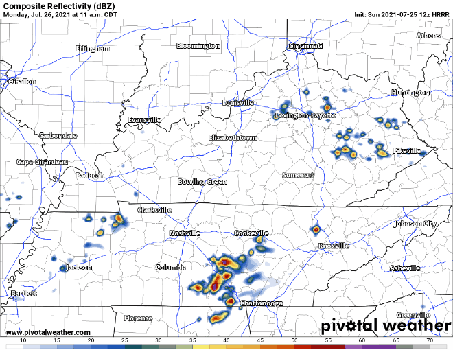
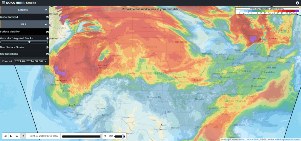
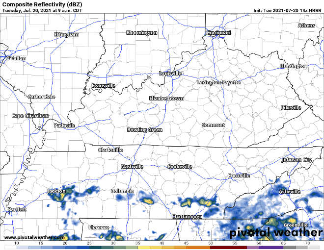
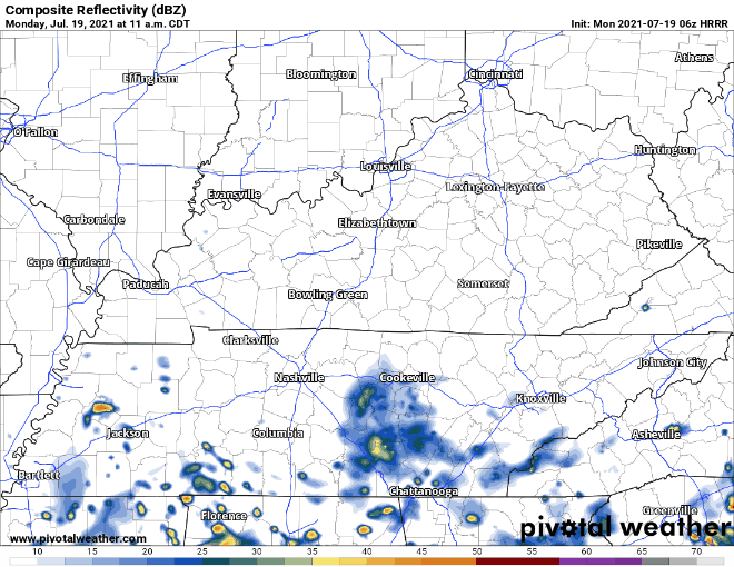
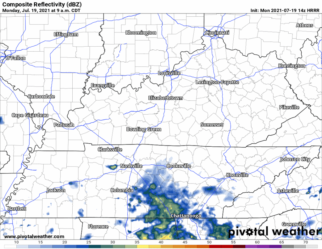
Models thought we would see a line of storms here mid afternoon. That was yesterday’s models. Today it shows that line south of us. Some of us will probably see a few showers/storms pop off this morning (we have one already in Brentwood/Nolensville) and/or this afternoon from a weak upper level boundary, but the meat of the system should be south of us if the HRRR is right. read more

:I’m Not Feeling Great: emoji

Air quality is improving. Most of the wildfire smoke cleared. It’s heavier northwest and southeast of us.

NOAA HRRR-Smoke, Sun. 9am

Today expect a miserable combination of temps and dewps. Like walking out into a tropical rainforest. NWS-Nashville issued the below Special Weather Statement for the heat. See below. Heat exhaustion is likely for those who ignore basic hydration, rest, and shade. read more

Hazy Skies Remain Today, but No Rain! Sunday and Monday Next Chance for Rain.

Early morning fog will have cleared by the time you are reading this, but only to give way to hazy skies we’ve gotten used to.

Fog GIFs - Get the best GIF on GIPHY

Wildfires are still raging in the Western US and Canada. Upper level winds are still transporting smoke all the way to our area. Today is probably the last day you can expect a Tatooine-esque sunrise or sunset. Smoke levels will start to decrease after this morning. read more