
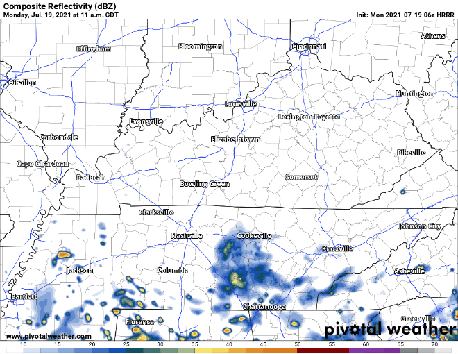
Heavy rain got many of us this weekend. Others, not so much. Today the rain is more likely in southern Middle Tennessee. Notice the HRRR model, below . . .
. . . it’s got a few downpours south of I-40 today. Those north: nothing.
Previous model runs had “crazy Ivan” showers (those move from east to west) for those along and north of I-40 later today.
And WPC just included those north of I-40 in the marginal risk of flash flooding today:
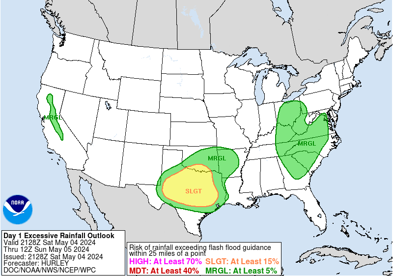
Previously, that line was drawn along I-40. So maybe there is something to this. Don’t be surprised if a Crazy Ivan shower rolls into Nashville today. But the HRRR (for now) thinks some of us will see only a little rain today, with most of us getting nothing.
No severe worries. Lightning is possible but other hazards aren’t a concern.
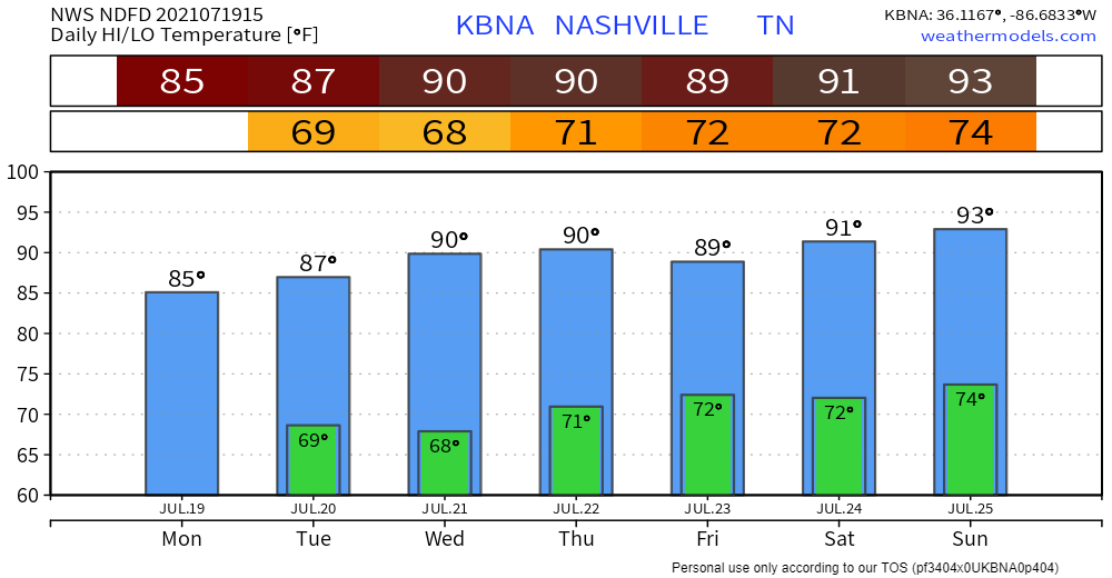
What About the Heat?
The recent rain and cloud coverage will keep temps the same tomorrow. Wednesday will be a few degrees warmer as things dry out and skies clear. Heat index, as of now, is forecasted to be in the mid 90s. Dewps will be down a smidge, too …. but still muggy.
Afternoon pop up rain chances return Thursday/Friday. Saturday looks maybe ok? Sunday, not so much. Details too fuzzy and unreliable to comment further.
Categories: Forecast Blogs (Legacy)
You must be logged in to post a comment.