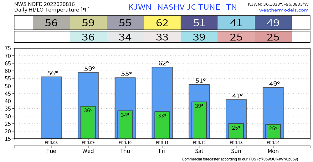
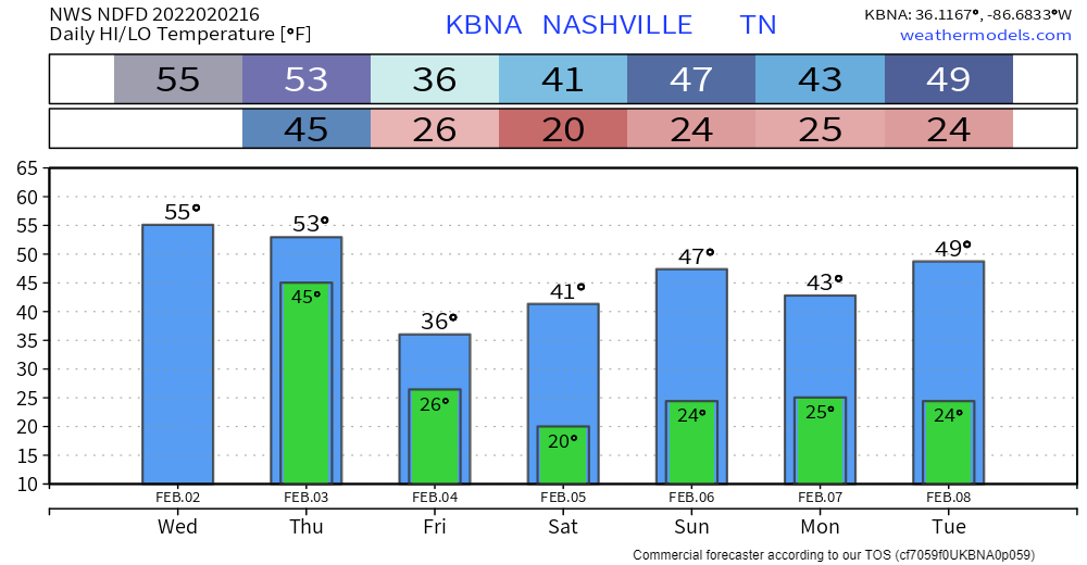
Mild, spring(ish) weather to look forward to the next couple days. High temps well above average. Mostly sunny and dry through Friday. Overnight lows in the mid 30s. Chart below can help with wardrobe decisions:

Mild, spring(ish) weather to look forward to the next couple days. High temps well above average. Mostly sunny and dry through Friday. Overnight lows in the mid 30s. Chart below can help with wardrobe decisions:
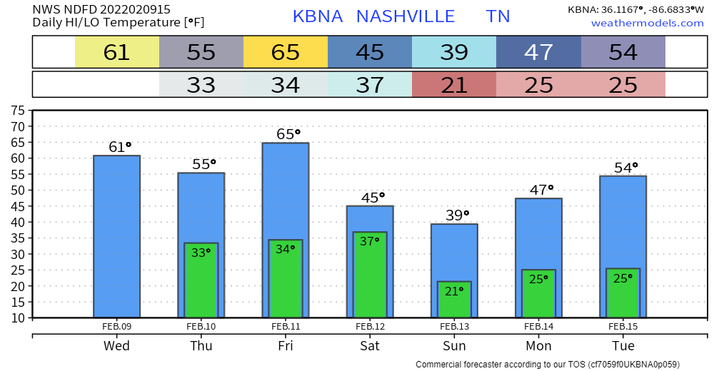
We’re sticking to the pattern of near freezing overnight low temperatures, and reasonable high temps in the high 50s. Winds from the southwest tomorrow will warm us up a little bit more, as our high temp hits right under 60.

Cool and dry this week.
A cold front sweeps through Friday. Sometimes these fronts make rain, but right now the models think the precip will miss us. Even if rain were to develop it’d be very little.
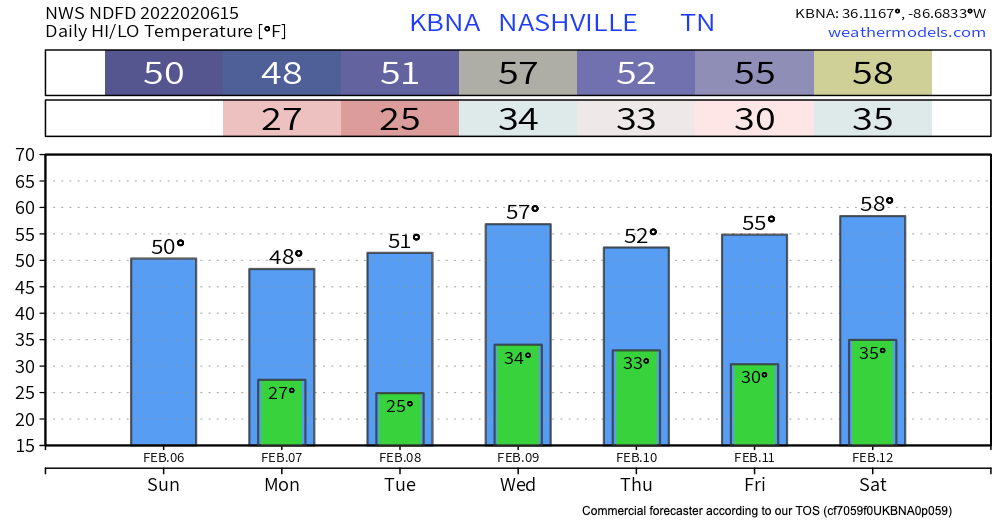
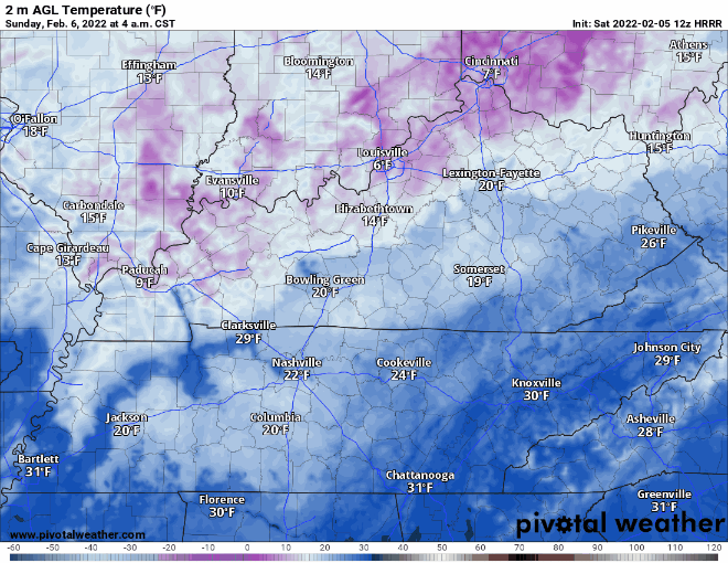
This morning was chilly. Temps in the high 20’s. That early morning chill will be a common trend this week. Maybe not in the 20’s everyday, but 30’s at least. Don’t let any Northerner friends try to convince you this isn’t cold like the guy in the gif below.
Nothing really exciting happening today weather wise but it is National Weather Person’s Day!
The high today is a whopping 35° (sarcasm).
Tommorow will be sunny and warmer than today.
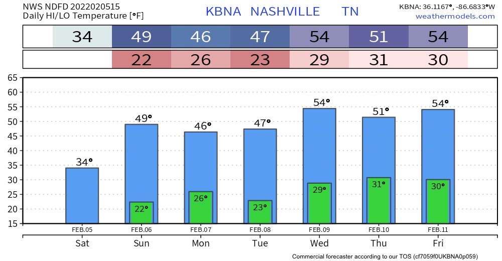
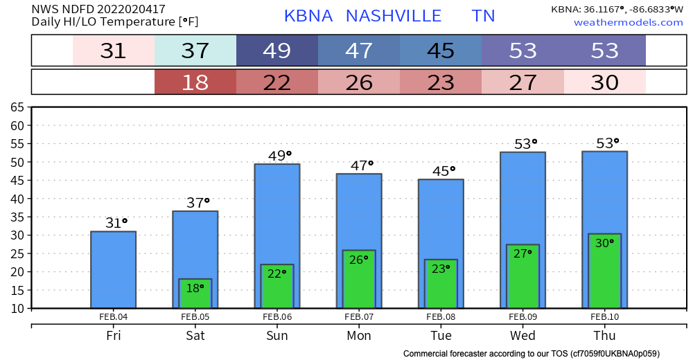
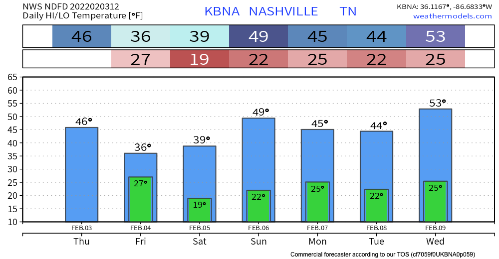
We warm up this week.
Any freezing drizzles should be ending soon. Temps aren’t expected get above freezing for too long if at all today. Because of the lack of melting, black ice still poses a threat throughout today, tonight, and tomorrow morning. Proceed with caution in areas of elevation, overpasses and secondary roads.
With the approaching heavy rain that we will see today, we are currently under a Flood Watch until tonight.
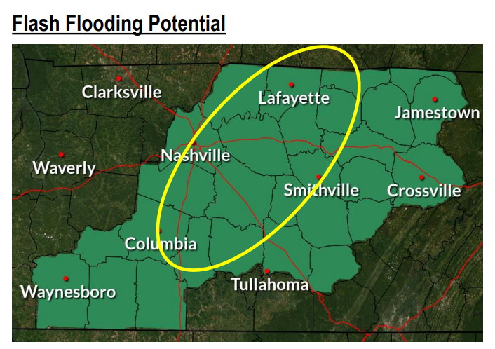
The area above highlighted in green could see 1-3 inches of rain today. The area in the yellow circle could possibly see more. This is enough rain to overflow your creeks and rivers, as well as low lying areas. Stay weather aware as well as aware of your surroundings, especially if you’ll be out driving today.
Widespread showers are already under way. On and off for the rest of the day. A (not long enough) break tonight before heavy rain Thursday. The meat of the system rolls through tomorrow morning through the afternoon.
We enjoyed some really nice temps today with a high of 67° and plenty of sun. But…
Temps stay in the mid 50’s for Wednesday and Thursday. Low pressure starts to come into our area bringing rain early Wednesday morning. Sustained winds Wednesday ramp up to 20 mph with gusts <30 mph. Showers continue but are spotty Wednesday afternoon to evening time.
Temps right around normal today will heat up to the low 60’s by tomorrow.
Rain should begin as early as Wednesday morning. but it’s more likely to start Wednesday afternoon. Rain should be heaviest after midnight Wednesday and into Thursday morning. Rainfall rates should be high, totaling 3″ to 4″ by Friday morning. It looks like rain will be spread out long enough to enable runoff and drainage, but local creeks, streams, and low lying areas should rise. Flooding concern is there, and will be watched closely, but the concern is not high right now. Those in flood prone areas should continue to monitor.
You must be logged in to post a comment.