
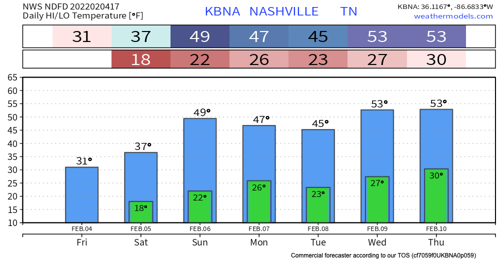
Any freezing drizzles should be ending soon. Temps aren’t expected get above freezing for too long if at all today. Because of the lack of melting, black ice still poses a threat throughout today, tonight, and tomorrow morning. Proceed with caution in areas of elevation, overpasses and secondary roads.
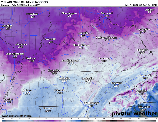
Although we’re dry for the rest of today, sustained winds can get up to 10 mph. Wind chills tomorrow morning get down to the single digits in some parts of our counties. Tomorrow morning will not be the morning for a jog.
A cool, dry pattern settles in today and will stick for a while. Temps heat up to the high 40’s by the beginning of next week. Lows don’t get above the freezing mark for the next week or so. We’re not expected to see any precipitation within the next week as well. The atmosphere is giving our counties a much needed break so enjoy it!
Quick References:
Weather changes constantly.
Follow @NashSevereWx on Twitter for any changes to this forecast.
Live coverage during tornado and severe thunderstorm warnings:
Look good.
Support the mission.
We are 100% community supported. No ads. No subscription fees. Keep it free for everyone.
Categories: Forecast Blogs (Legacy)
You must be logged in to post a comment.