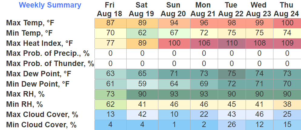
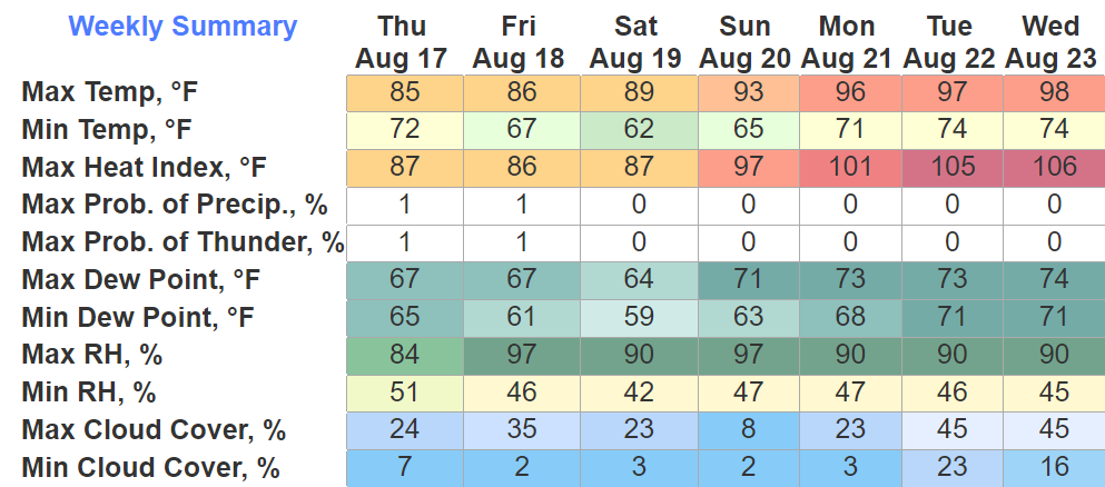
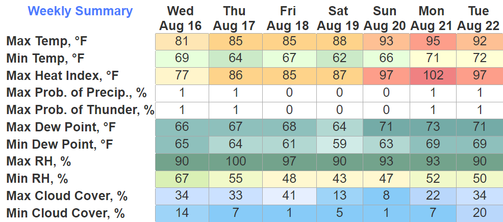
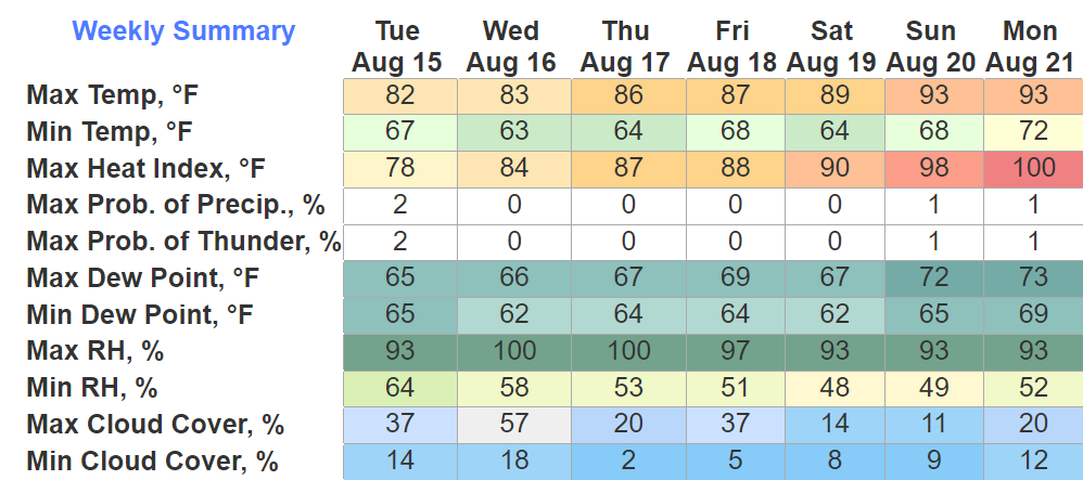
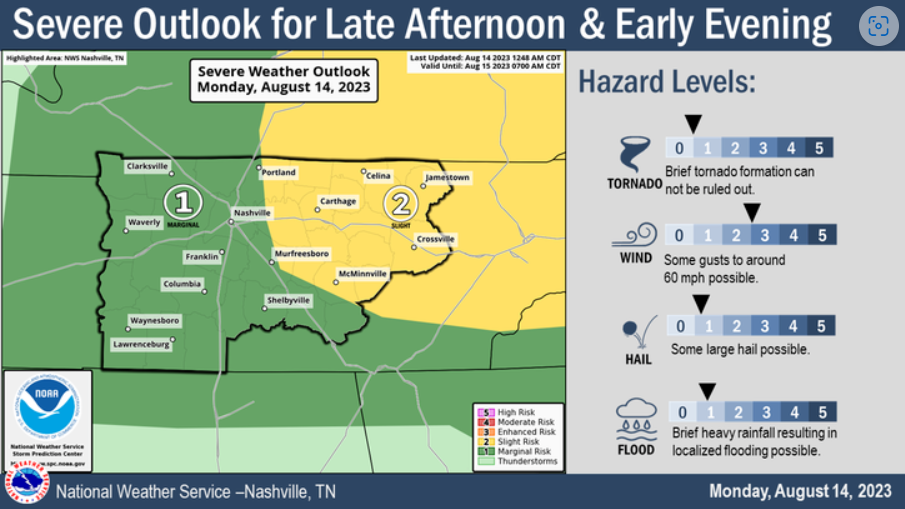
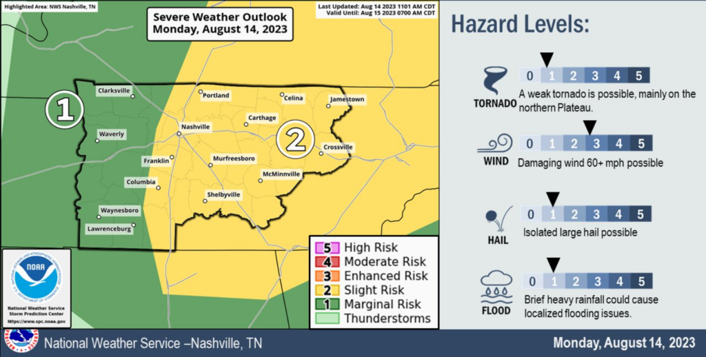
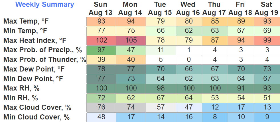
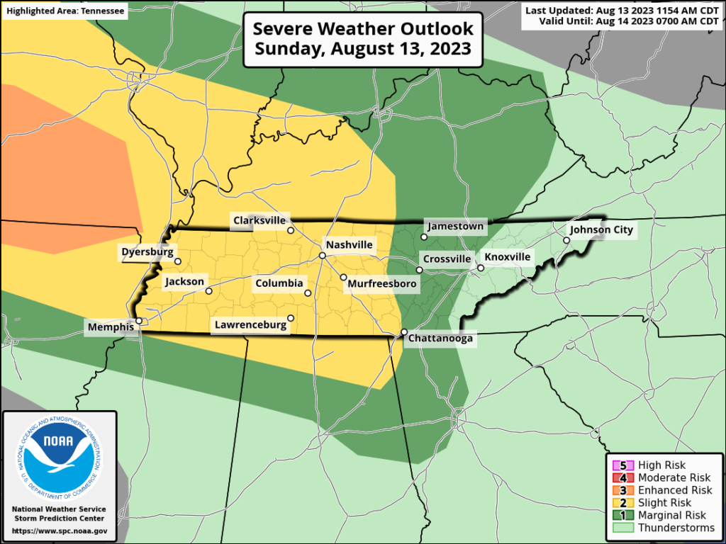
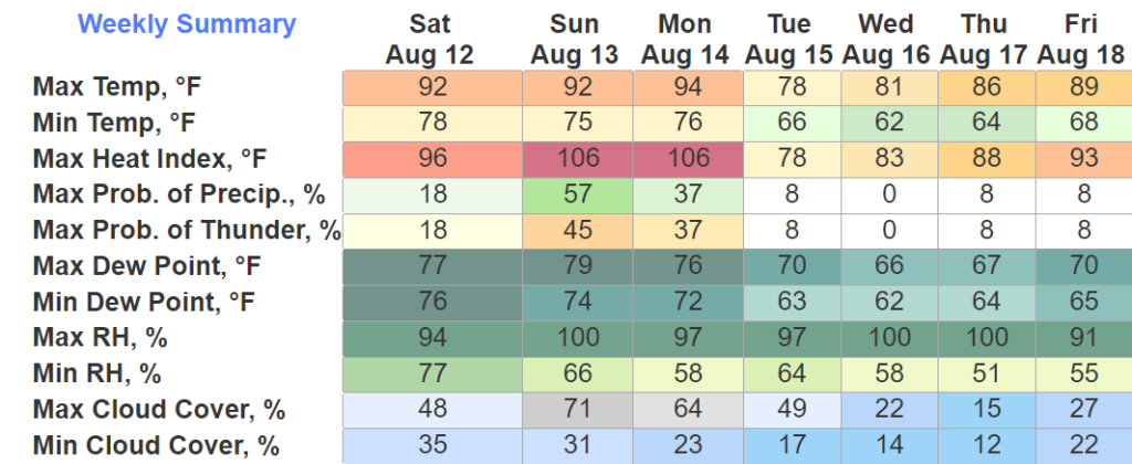
Dangerous heat conditions will accompany us today.
Both counties are under an Excessive Heat Warning from now until 8pm Friday.
“dangerously hot conditions with heat index values up to 112° expected”

Dangerous heat conditions will accompany us today.
Both counties are under an Excessive Heat Warning from now until 8pm Friday.
“dangerously hot conditions with heat index values up to 112° expected”
We have three consecutive days of severe weather chances and/or dangerous heat. Let’s discuss.

Both counties are under a Severe Thunderstorm Watch until 4pm today. Main concerns are damaging straight-line winds and hail. Not concerned with tornadoes. Updates are constantly flowing, stay connected to our Twitter for frequent updates.

You may see “haze” in the forecast. It’s from the Canadian wildfires.
Likely more noticeable in Davidson than WillCo. No Air Quality Alerts in effect, but people with respiratory issues still may need to take it a little easier outdoors.

If you have yard work, (crunchy) grass to mow, today and tomorrow are the days. No rain chances.
Thursday thru Saturday high temps will be flirting with the century mark.
An Excessive Heat Watch has already been issued for Thursday. I imagine one will be issued for Friday and Saturday. “Dangerously hot conditions with heat index values up to 113° possible.”

Well, I don’t bring much good news.
I suppose I could bring up the fact that it’ll be dry today thru Wednesday.
But some rain would make me say hooray.
I reckon I could say it’ll only be high 80’s/ low 90’s until Wednesday.

Majority of morning round of showers/storms missed us to the east. Still can’t rule out a couple stray showers/storms.
The absence of rain this morning will allow our temperatures to get into the low to mid 90’s this afternoon, paired with dewpoints in the low 70’s = heat index values around 100°. Take breaks if you have to be outside.

Today we’ll have a calm, but warm day. High temps in the low 90’s, rain very unlikely.
Sunday, I think we can divide into three parts – Morning, Afternoon, and Evening.
Sunday Morning:
Low Wattery chances today, best chances will be afternoon and evening. Last day of below average temps for the foreseeable future, summer is finally going to summer.
Almost non-zero rain chances for Saturday, heat turns up into the low 90’s.

Today and Friday will be similar. Low Wattery chances, temps slightly below average. Not too shabby for late June.
Saturday our weather pattern shifts. Rain chances clear out and it’ll start to feel like summer. Heat index values will start to push the upper 90’s. These numbers will relax a bit as we get to Tuesday and Wednesday, as the dewpoints will go from the low 70’s to the mid 60’s.
Happy Summer That Doesn’t Feel Like Summer! Summer officially began at 9:58am. Today thru Friday will not feel like summer at all. Barely making it into the 80’s, however this will be accompanied by some Wattery chances.
You must be logged in to post a comment.