
Nice calm Friday night. Just what the doctor ordered.
Severe Storms Saturday?
The Storm Prediction Center has all of Middle TN outlooked with a 5% chance of damaging straight-line winds and/or severe hail within 25 miles.
Our chance for severe weather will likely arrive in the form of a MCS, AKA Mesoscale Convective Systems. For us, these often come down I-24 and tomorrow looks like it’ll follow suit.
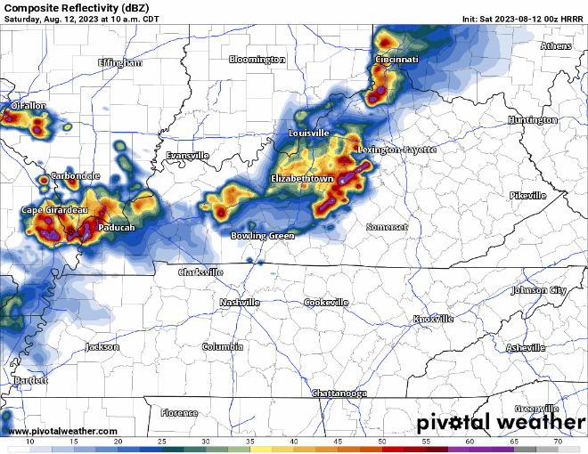
HRRR model (above) thinks a broken line of storms moves thru our area sometime in the lunch – afternoon timeframe. Models have a hard time handling systems like these, very difficult to nail down an ETA until you can see it on radar.
Main threat will be damaging straight-line winds and hail. We are not outlooked with any tornado probabilities.
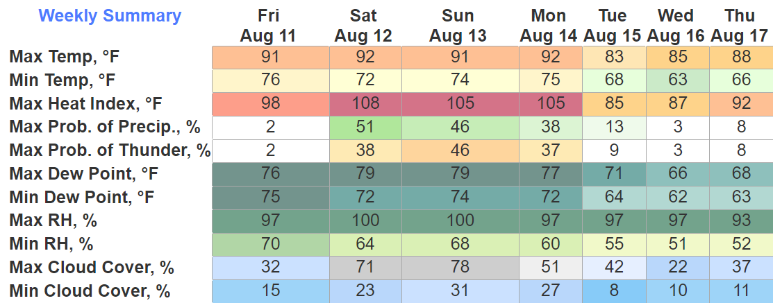
Besides the storms, dewpoints will be hanging out in the mid to upper 70’s. That paired with temps in the low 90’s will put heat index values around 105°. Gross.
Sunday Storms
Although not outlooked for severe storms, strong ones are still possible, particularly in the afternoon/evening.
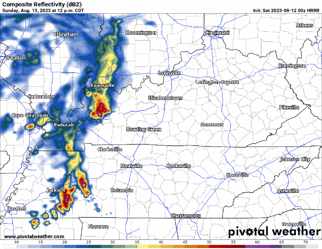
HRRR model (above) gives its best guess on how the radar will look. Maybe some gusty winds, heavy rain, and frequent lightning.
More Severe Weather Possible Monday
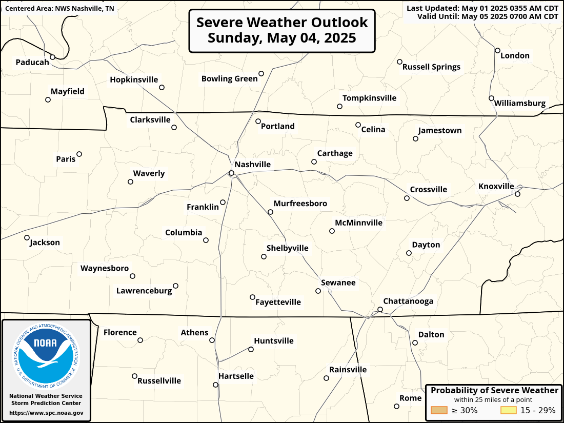
All of Davidson and the northern half of WillCo. have been outlooked with a 15% chance of severe weather within 25 miles.
Details are still fuzzy, we’ll know a lot more in the coming days and keep you posted.
Cooler and drier weather accompany us after the active weekend + Monday.
Quick References:
Weather changes constantly.
Follow @NashSevereWx on Twitter for any changes to this forecast.
Live coverage during tornado and severe thunderstorm warnings:

Look good.
Support the mission.

We are 100% community supported. No ads. No subscription fees. Keep it free for everyone.


Categories: Forecast Blogs (Legacy)
You must be logged in to post a comment.