
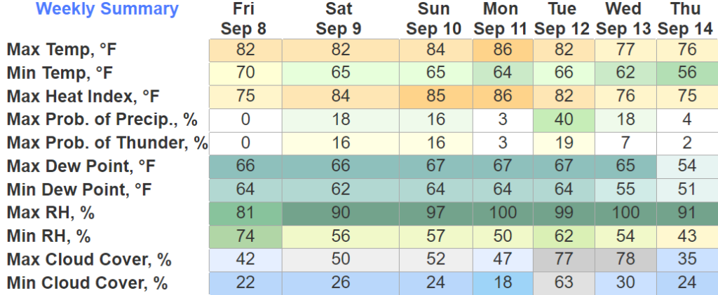
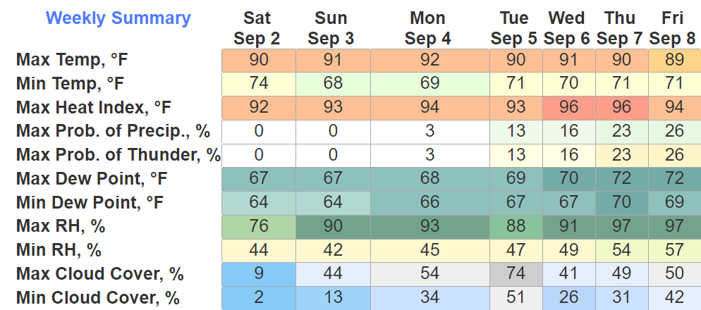
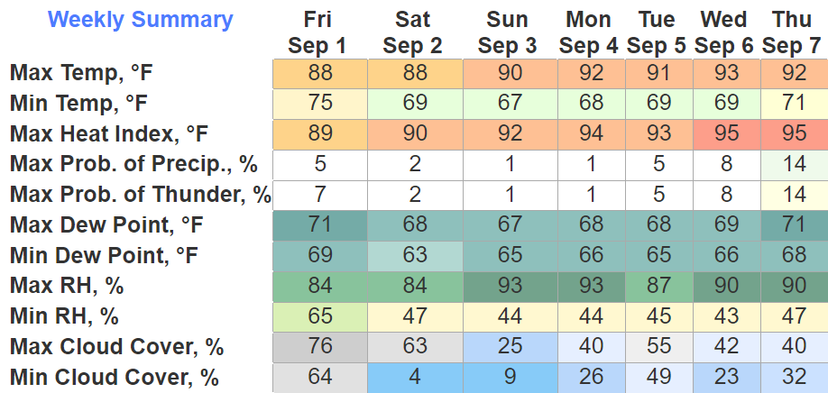
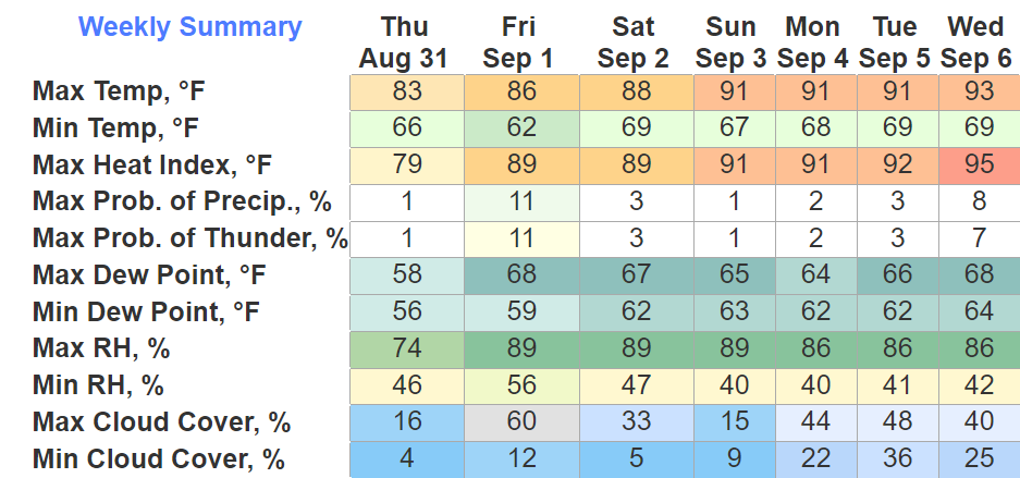
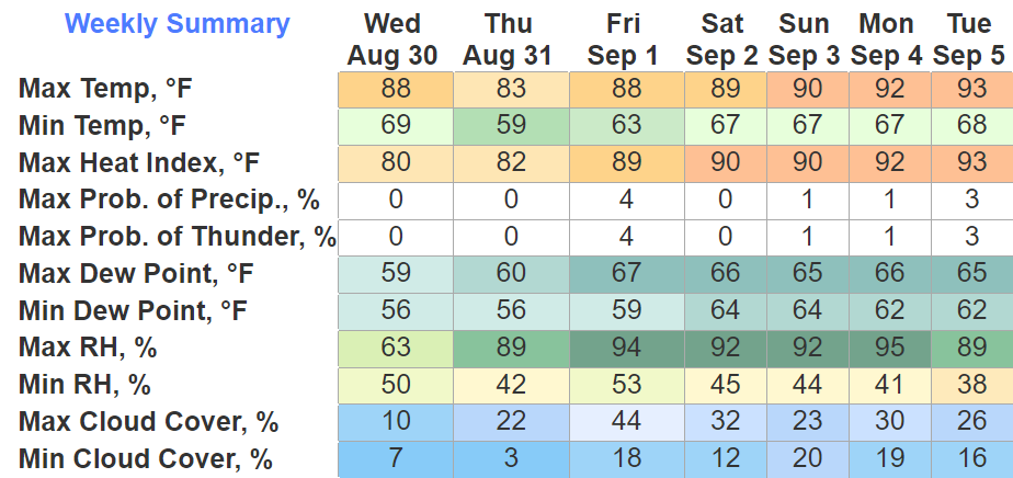
Beautiful day today, and this will likely be a continuing pattern for the weekend.
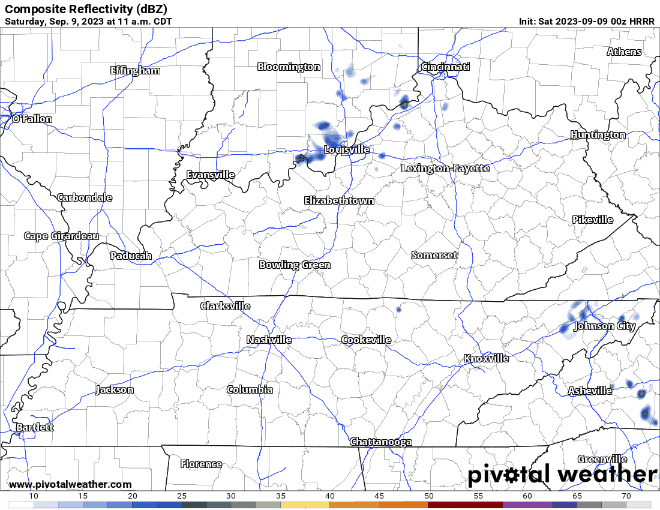
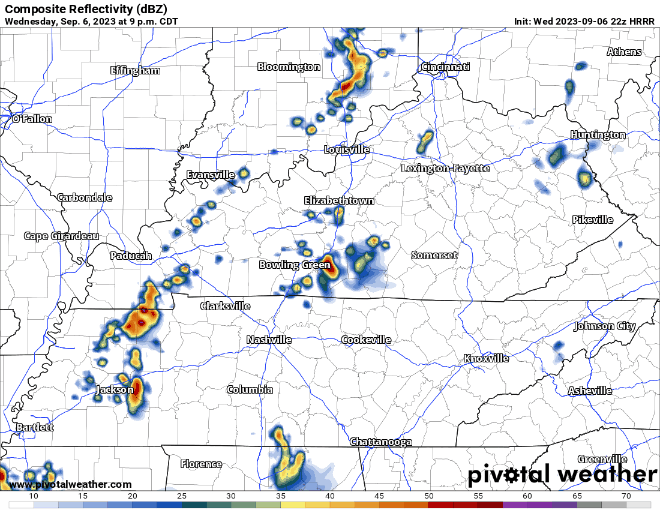
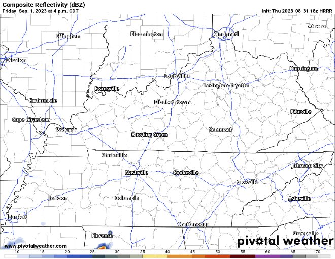
The HRRR model (above) shows all the activity tomorrow staying to our east. I highly doubt one will sneak over our way, but I suppose we can’t totally rule out a stray shower or storm. No need to alter plans.


You must be logged in to post a comment.