
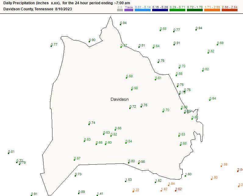
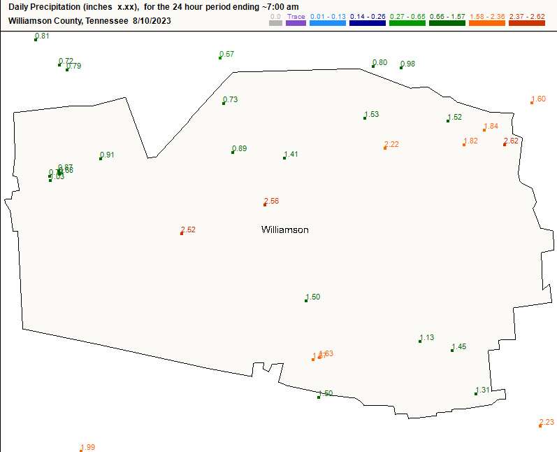
If you slept through the storms early this morning, grats. The lightning output was pretty incredible, and we saw a brief wind gust that damaged a tree or two in S Brentwood.
Decent rain amounts too, especially in central Williamson Co.
Weekend Storm Chances
This time of year, the door opens for Mesoscale Convective Systems. These MCSs are commonly in the form of I-24 Specials… storm complexes that come down I-24 from NW to SE. These complexes are not typically handled very well in computer models.
We’ll be watching for the possibility of one or more of these storm complexes Saturday and again on Sunday. Then, a cold front on Monday. Storm chances each day. More details later as they come into view.
Quick References:
Weather changes constantly.
Follow @NashSevereWx on Twitter for any changes to this forecast.
Live coverage during tornado and severe thunderstorm warnings:

Look good.
Support the mission.

We are 100% community supported. No ads. No subscription fees. Keep it free for everyone.


Categories: Forecast Blogs (Legacy)
You must be logged in to post a comment.