
An approaching cold front will bring us a cool down, but first it will threaten us with severe weather.
Similar to yesterday we think is mostly a non-tornado event.
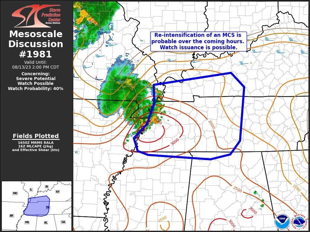
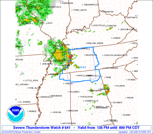
Currently, the hot and humid air and abundant sunshine are adding instability to our atmosphere. A severe thunderstorm watch has been issued by the storm prediction center.
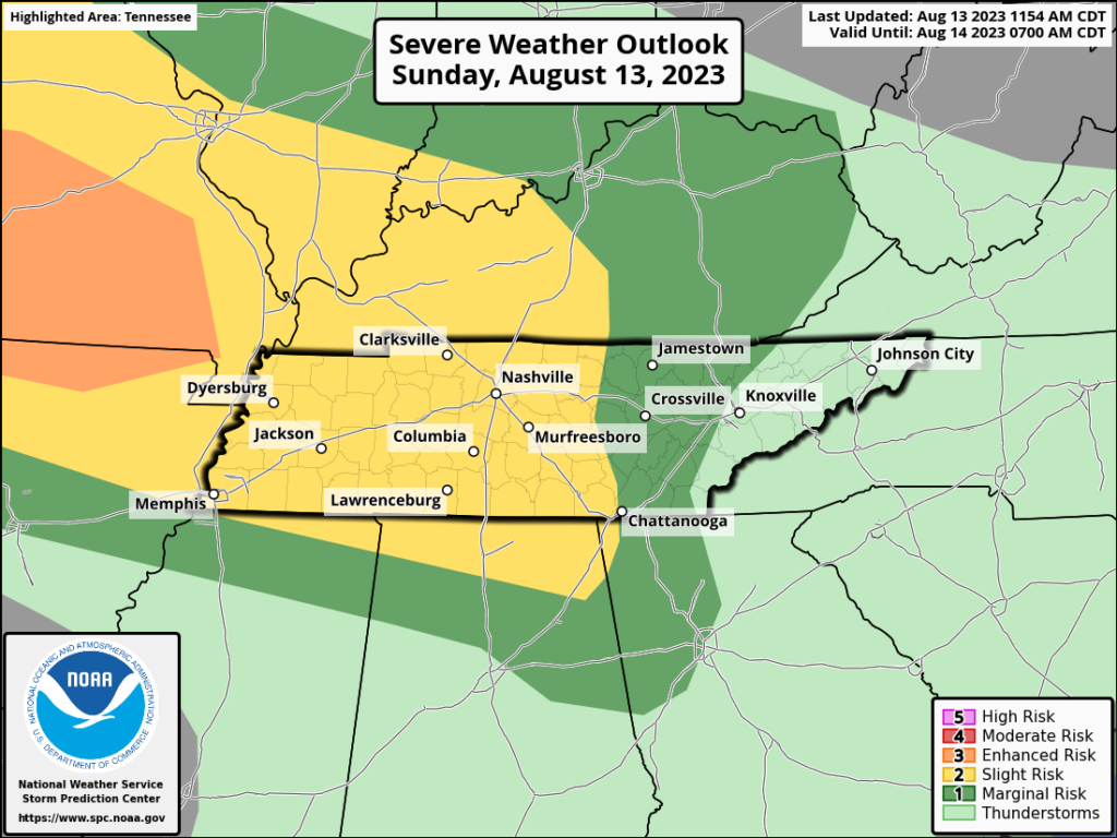
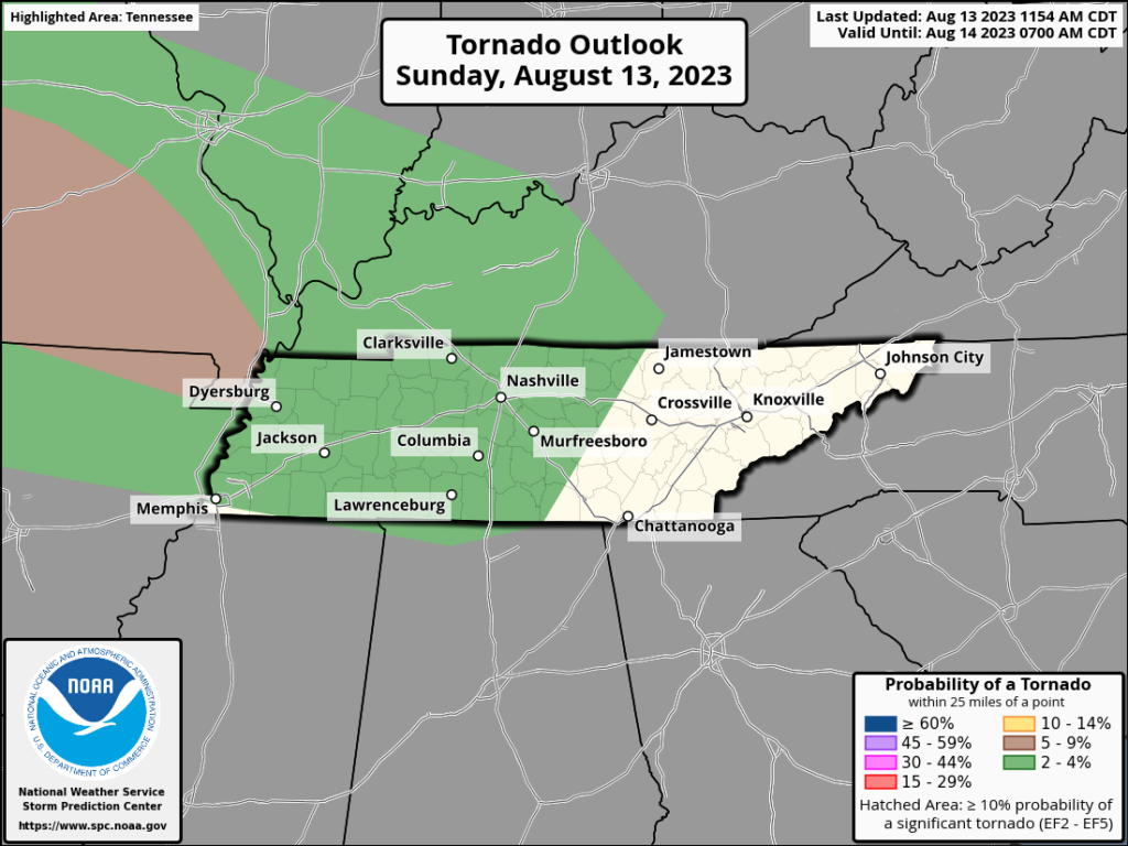
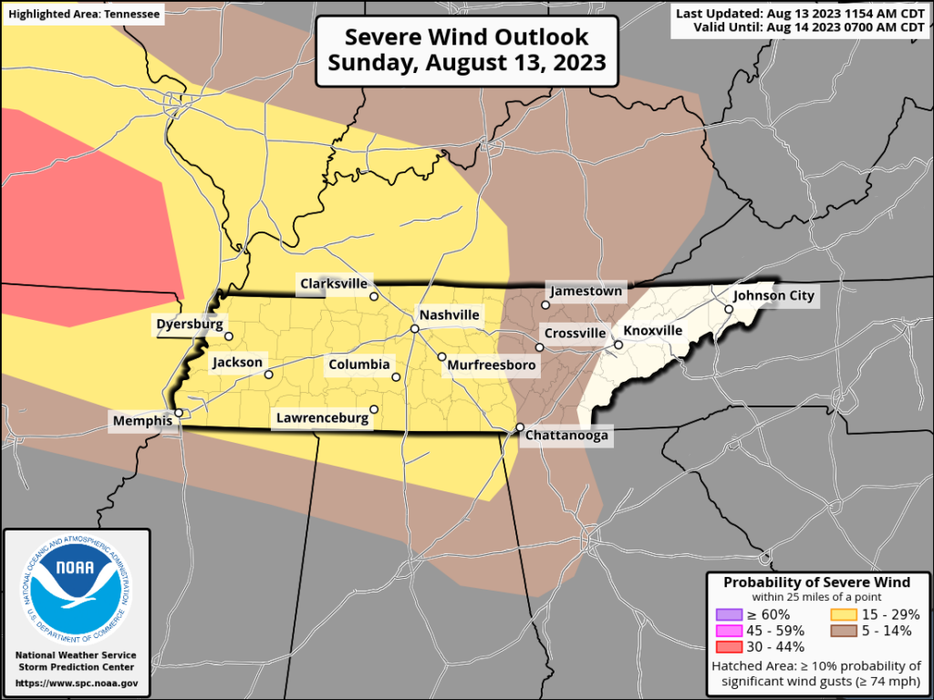
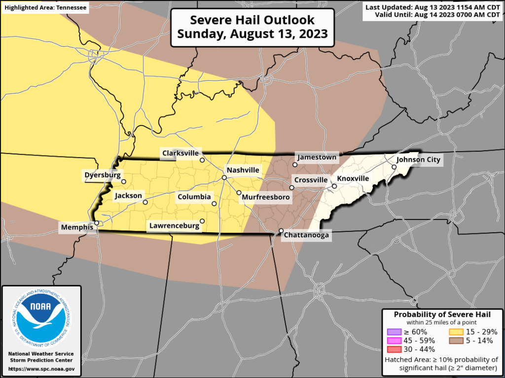
Speaking of SPC, their probabilities for severe weather are represented below. 2% tornado, 15% for damaging wind and hail occurring within 25 of a point in the area.
In addition to the risk above, flash flooding is also possible. We got a lot of rain yesterday, and ponding in all the usual trouble spots could be a bit worse than usual. Remember, don’t drive on flooded roads. Turn around, don’t drown.
Now let’s cover timing…
It’s really hard for weather models to predict what happens in MCS systems in such a chaotic convective atmosphere. Storms and quickly pulse up and down and have less than predictable movement of individual pockets of air within the line. Now that storms in W TN have formed, we can see their speed and trajectory. Looking at the current storms and the model predictions, the heaviest impacts get to the I-65 corridor btw 3-4pm. HOWEVER, some storms may form ahead of the main line. Anything that forms ahead of the main line would be a very likely candidate for shenanigans. We’ll be watching.
Following this afternoon line, another round of severe weather is possible in the wee hours of tomorrow morning. We’ll expect similar hazards to those mentioned above. After the afternoon round, we’ll look at tomorrow morning in more detail.
What’s next?
You may say to yourself, “But Will, when will this streak of severe weather end?”. The answer is Tuesday. Tuesday my friends. That’s the day we’re looking at for relief from the heat. Let’s hang on until Tuesday. We’ll be on twitter when the going starts to get rough, and on YouTube live if we have a warning.
Quick References:
Weather changes constantly.
Follow @NashSevereWx on Twitter for any changes to this forecast.
Live coverage during tornado and severe thunderstorm warnings:

Look good.
Support the mission.

We are 100% community supported. No ads. No subscription fees. Keep it free for everyone.


Categories: Forecast Blogs (Legacy)
You must be logged in to post a comment.