
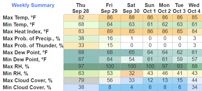
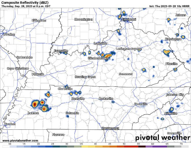
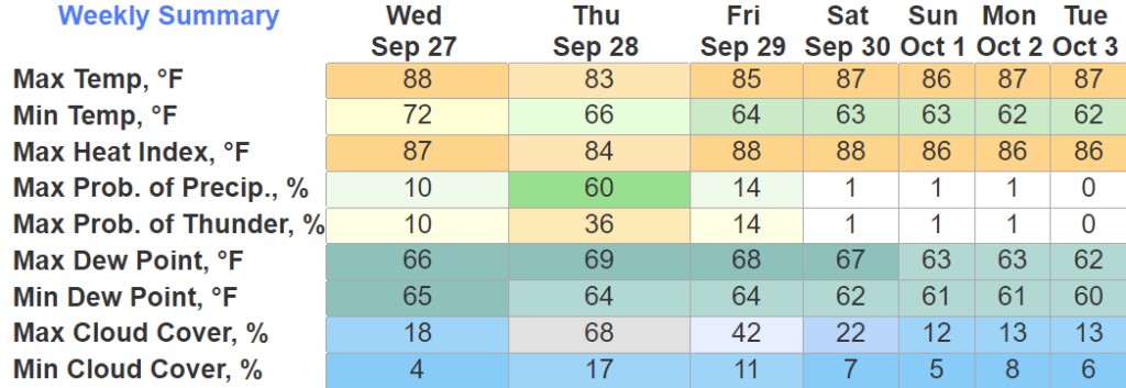
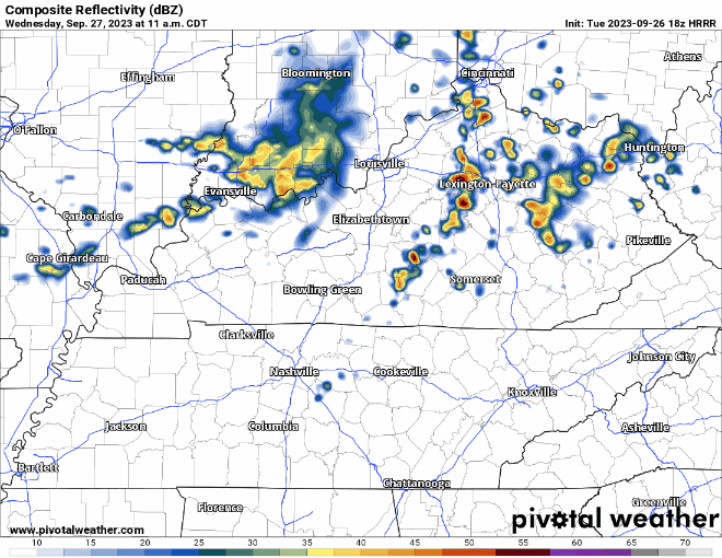
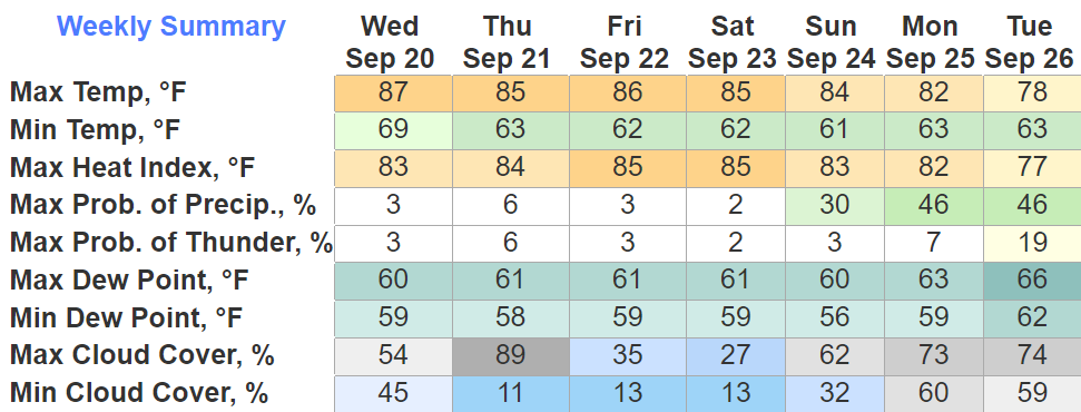
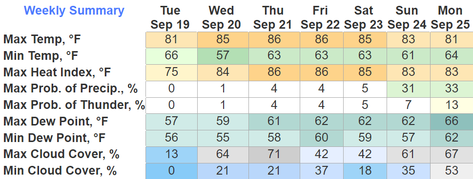
The rain we saw this morning will be the last we’ll see for a while. Rainfall totals range from 2″+ in Northern Davidson Co. to 0.06″ in far SE WillCo.
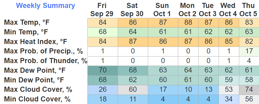
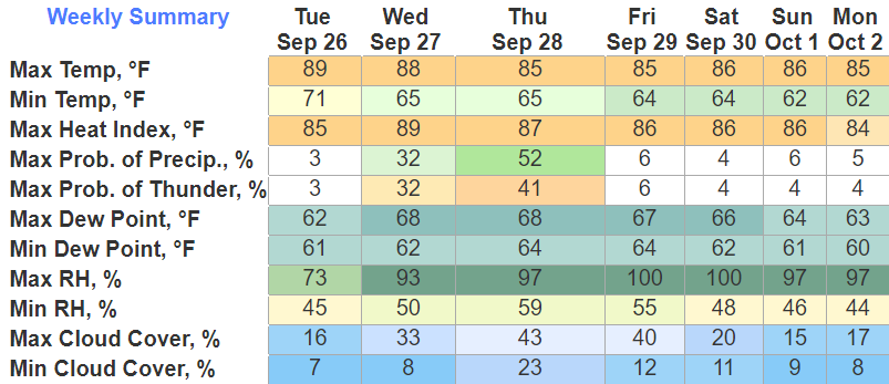
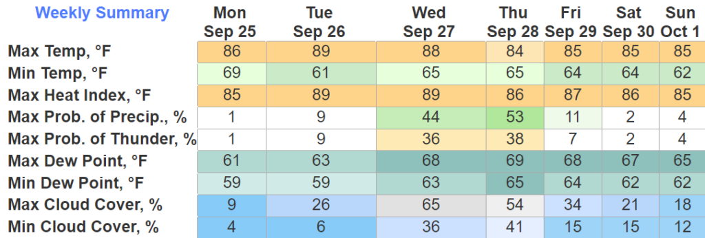
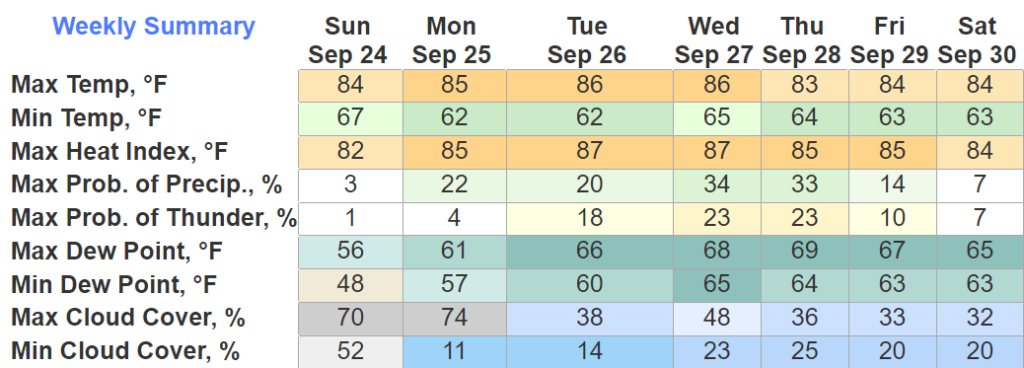
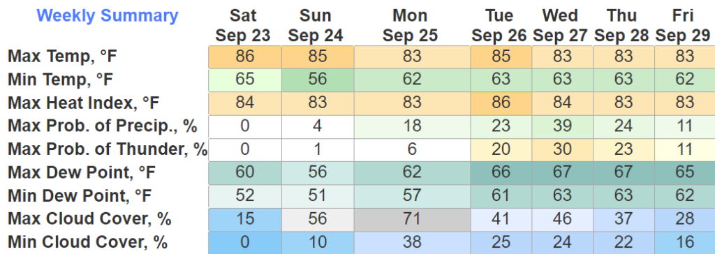
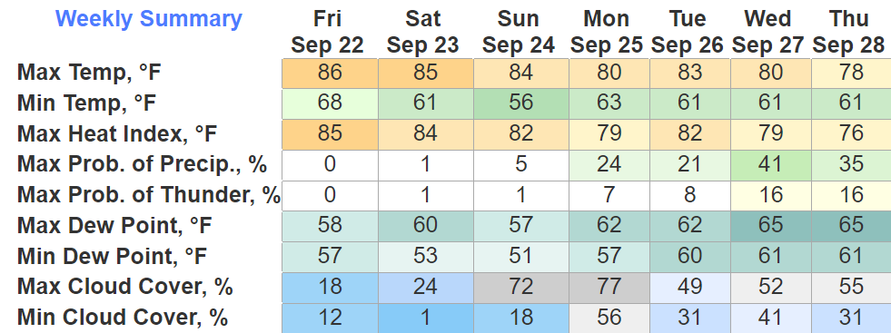
Next 6 days will be dry and not a lot like fall. High temps in the mid to upper 80s, with dewpoints in the mid 60s. Not the most ideal end to September.

You must be logged in to post a comment.