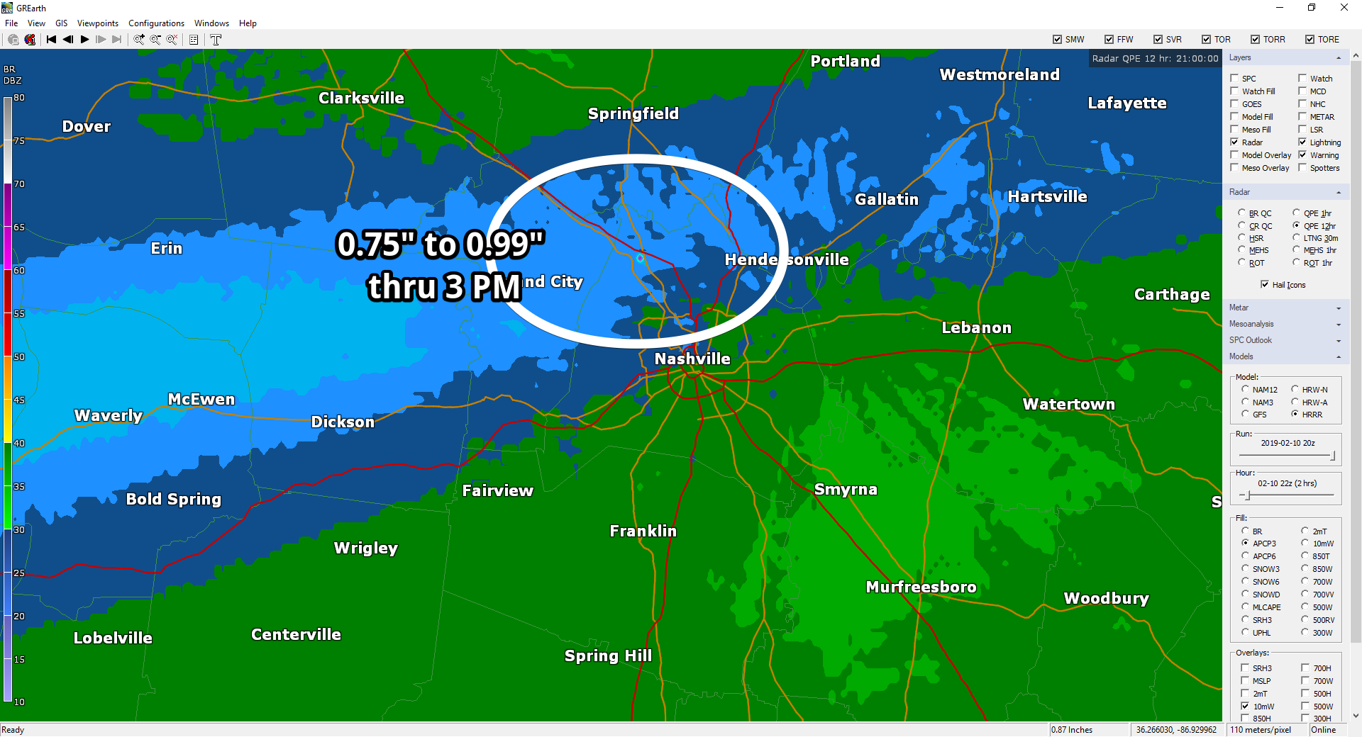
It’s been raining most of the day along and N of I-40. Rainfall through 3 PM:
More rain is on the way.
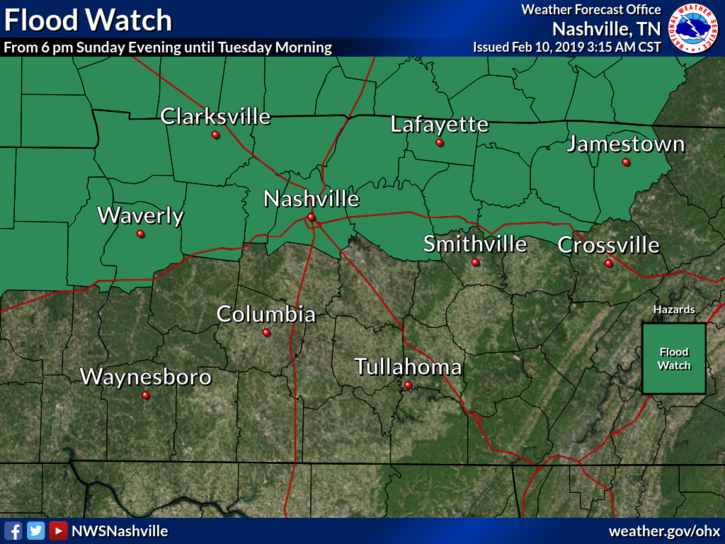
A Flood Watch goes into effect tonight through noon Tuesday for Nashville, but not Will Co.

It’s been raining most of the day along and N of I-40. Rainfall through 3 PM:
More rain is on the way.
A Flood Watch goes into effect tonight through noon Tuesday for Nashville, but not Will Co.
Expect off and on rain today with temps in the 40°s.
A Flood Watch goes into effect tonight through “late Monday night” for Nashville, but not Will Co.
2″ to 4″ of rain is expected in the green-shaded areas.

As I write it’s 25° with an uncommon northeast wind. No worries, we’re warming up.
Yesterday, Mayor Briley allocated money to modernize the sirens. A big step forward well celebrated on Twitter because previously, modernization had support but no money.
If you stepped outside early this morning, this may have been your reaction:

Old Man Winter is back. We are only going to reach a high of 37º this afternoon with plenty of sun. A north-northwest wind around 10 mph is making it feel sub-freezing.
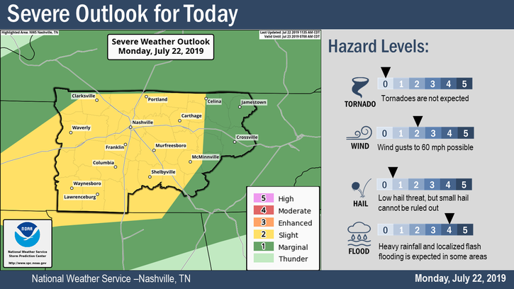
A flash flood watch is in effect from 3 PM through late evening for Davidson County. Williamson is excluded from this watch.
From NWS Nashville:
Up to 1 inch of additional rainfall will fall in areas that already have saturated ground conditions from yesterday`s heavy rainfall. Street flooding will be a big hazard for travelers. Low lying areas and poor drainage areas will be at risk for flash flooding. Also watch for flooding along small streams.A wind advisory is in effect from 10 AM until 7 PM tonight for both counties. As a cold front approaches today, we’ll have sustained winds 20 to 30 mph with gusts up to around 40 mph. After rainfall begins, winds will begin to decrease.
For the first half of this forecast, you will once again read the words “rain,” “muggy,” and “warm” (“thunderstorm” is also now in there, more details on that risk below!). However, bear with me for just a little bit, because we will finally have some upcoming changes in the weather at the very end of the week!
Not much in the way of sunshine is expected as we are looking at the potential for cloud cover throughout today. Rain chances will be associated with this cloud cover; isolated showers and perhaps a few rumbles of thunder will be possible, with a greater chance of rain during the overnight hours. High temperatures could reach into the 70s today across most of our area, along with dewpoints hanging out in the 50s to lower 60s.
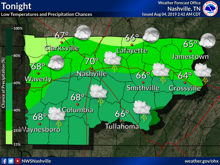
Temps remaining mild through the rest of the day until tonight when temps drop down in the low to mid 50s. Rain chances including a few isolated showers persist overnight as clouds continue to cover the Middle Tennessee region.
It’s going to be a wet week with spring-like temps. If you’ve ventured out today you know that that’s been our story so far. It will be 66º and breezy today and down to 55º tonight. This story continues the rest of the week.
Warm week ahead. Cloudy tho.
Check out these high temps:
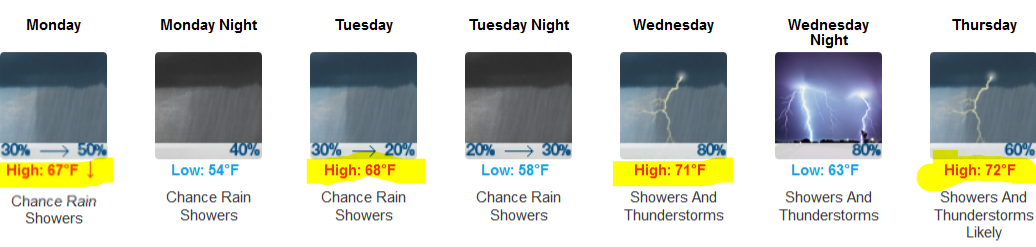
That’s 15° to 25° above normal.
A few no-rainout showers Monday. ETAs a bit of a mess.
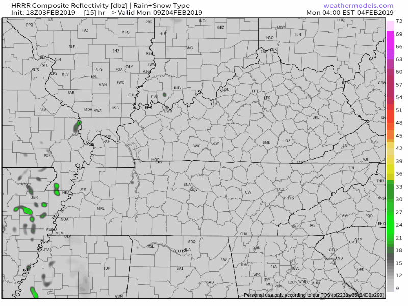
HRRR model scatters rain thru the day:
NAM3 model thinks late morning/lunchtime will be wet:
You must be logged in to post a comment.