
Friday
Happy end of the work week everyone! Lots and lots of sun for the rest of today. Temperatures will rise up to near 91° for the high, combining with lower dewpoints in the low 60s to make way for a great evening for some outdoor plans.

Happy end of the work week everyone! Lots and lots of sun for the rest of today. Temperatures will rise up to near 91° for the high, combining with lower dewpoints in the low 60s to make way for a great evening for some outdoor plans.

Today is one of those days when, after commuting with the windows down, you peer out the office window and wish you were outside! Temps bottomed out at 58° in Nashville early this morning just before the sun came up. With low dewpoints, it was perfect.
As of 8:00 AM CST, it may feel a little chilly thanks to a cold front that moved through earlier this morning.
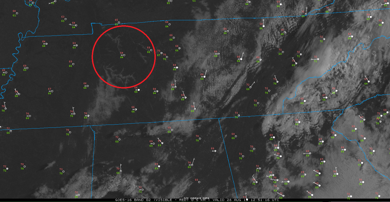
Above you can see our current temperature (number in red) is 70°F with a dewpoint around 67°F (number in green.)
Bear with me for a minute, because we have one more day of potential showers thanks to a cold front.
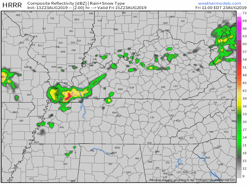
The HRRR models predicts a few showers later this afternoon into the evening:
The NAM3 model agrees:
If you have a case of the “Monday’s” today, the weather certainly isn’t helping out.
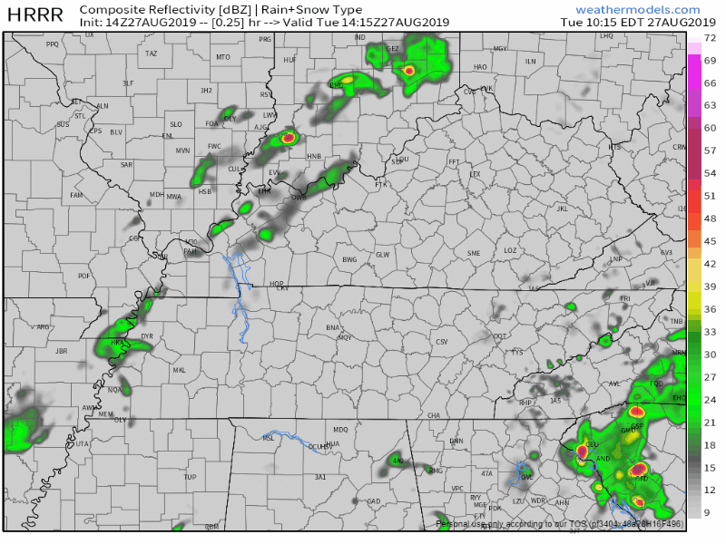
Widespread rain and a few thunderstorms are the story for today, especially during the late morning and early afternoon hours. The latest HRRR model shows rain being mostly light, except for a couple areas of heavier rain, and it mostly moving out of the area around 5PM-6PM:
Let’s begin by speaking nerd to you. May you find this oddly compelling.
“A strong upper trough is situated over the Great Plains and will propagate eastward today and tonight while focusing much of the existing moisture across the region. Convection is likely today and tonight and even into Monday before the shortwave pulls east of the region.’ @ NWS-Nashville
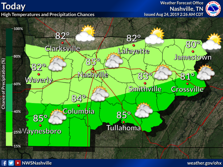
The heat is going to be a little bit more tolerable with the high around 85°F.
Models are quiet. Not expecting rain but can’t rule out a small shower. Clouds shaded the sun this morning but I think it’ll peek out this afternoon. Humidity is tolerable.
Rain, rain go away. I know it’s Friday and the start of the weekend, but outdoor plans might be out of the question for this evening.
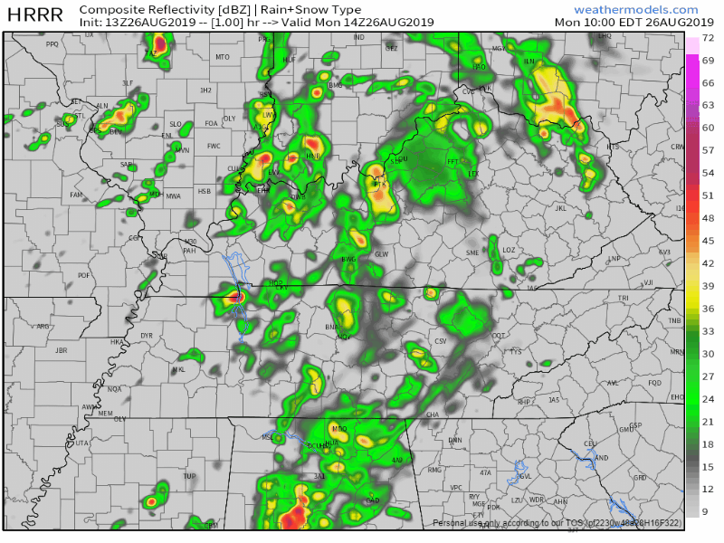
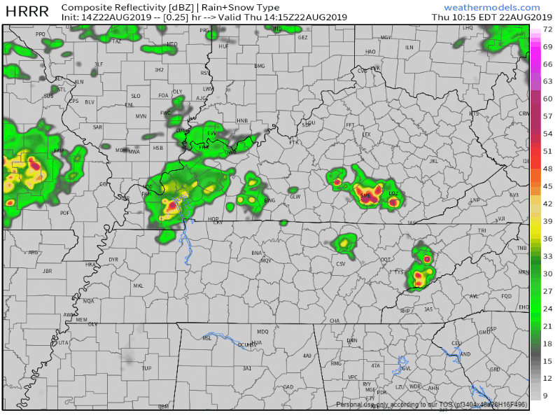
Scattered showers and thunderstorms will be moving through Middle Tennessee mainly after noon and into this evening. Here’s the latest HRRR model, showing these pop up thunderstorms putting a damper on our Friday afternoon and evening:
High temperature for today? 92°.
Dewpoint temperatures? Lower-70s. In other words, gross.
Scattered showers and storms? Possible.
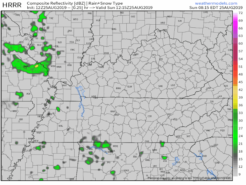
The HRRR model thinks we could see a couple of showers today, with a majority of the rain moving into the area tomorrow morning.
Another hot and steamy day is on tap as winds from the south continue to pump hot and humid air into the region. High temperatures will top out at 96 degrees with heat index values between 100 and 104. This is right below the threshold for a Heat Advisory, but it will still be oppressive out there.
You must be logged in to post a comment.