

Rain Beginning Overnight
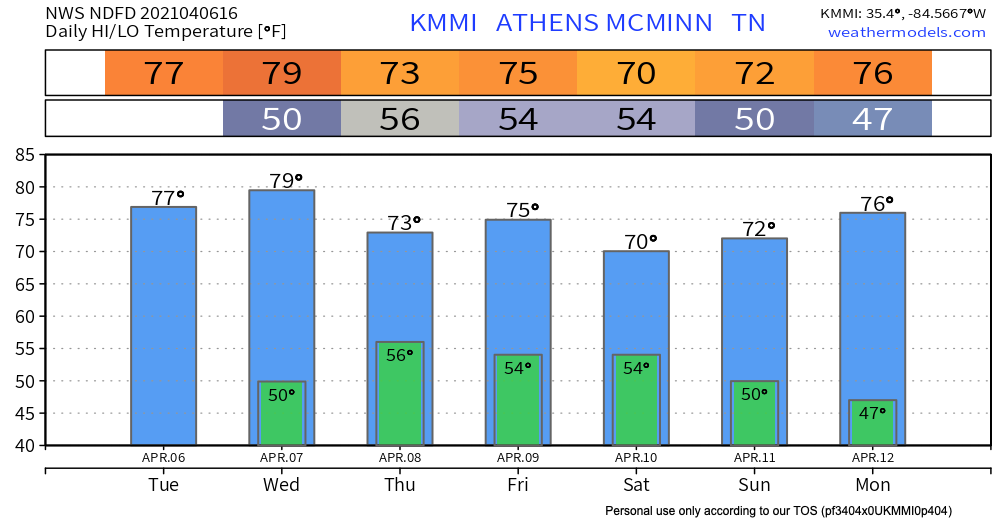
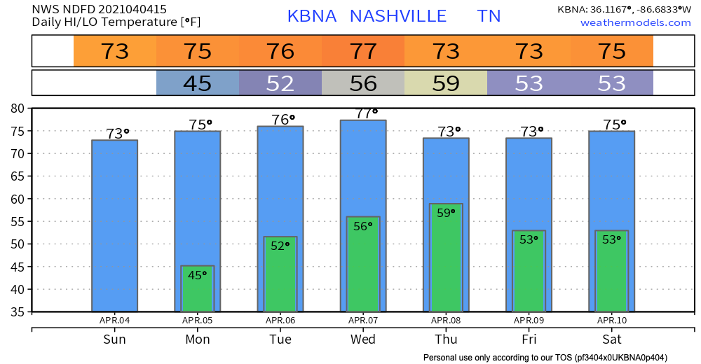
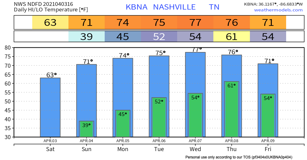
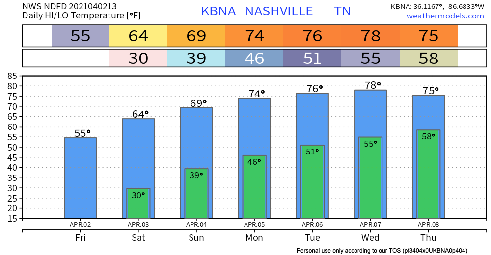
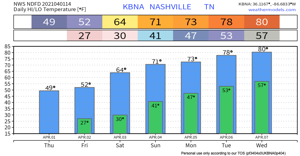
Wednesday should remain warm and dry until this evening. Rain will move into Middle Tennessee tonight.
Timing
The HRRR shows rain approaching both counties just before midnight. Rain should last through the overnight hours and clear by the morning.


You must be logged in to post a comment.