Heavy Rain Friday - Saturday, Storms Saturday May Be Severe. ETAs, Hazards, Probabilities.

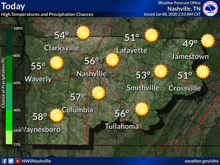
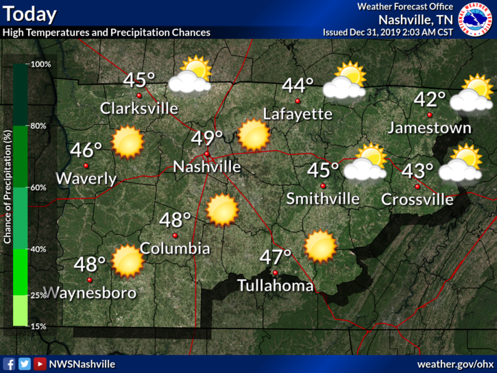
Today is the Best Day of This Forecast

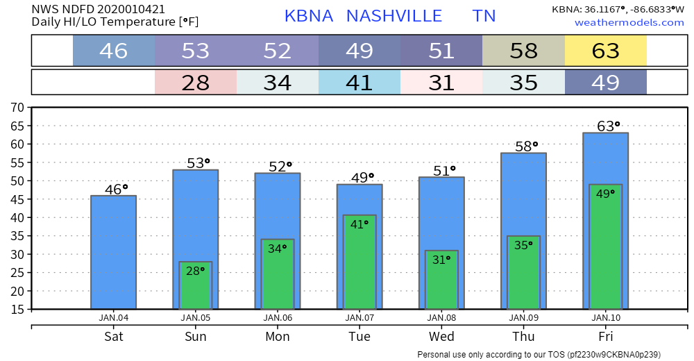
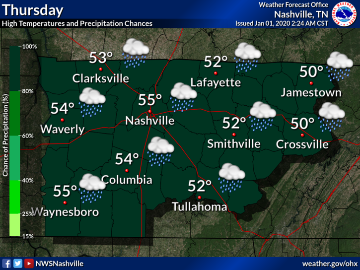
Windy, Afternoon Up To 63° Thursday

Gusts up to 30 mph possible.

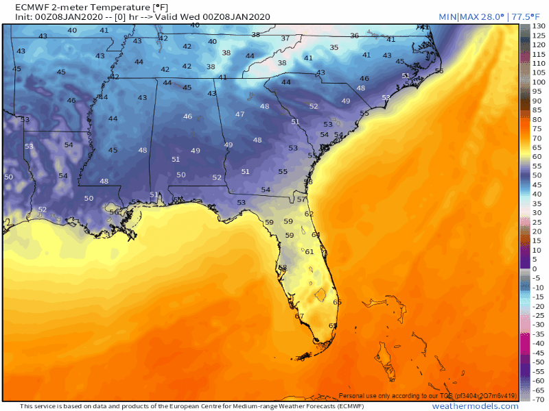
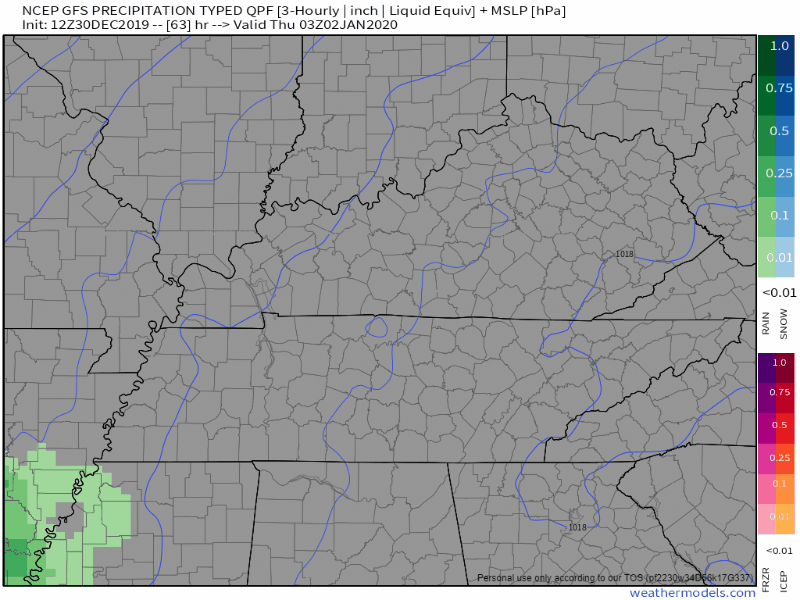
This warm in January? Something is up.

What’s up is a cold front coming through late Saturday night. Watch the cold air race in at the end of the Euro model below:

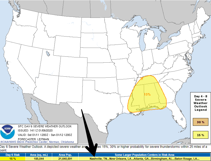
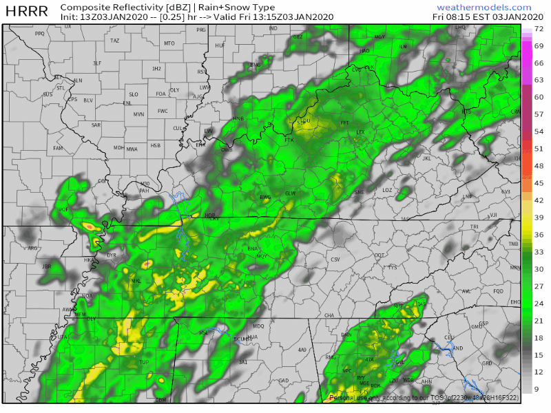
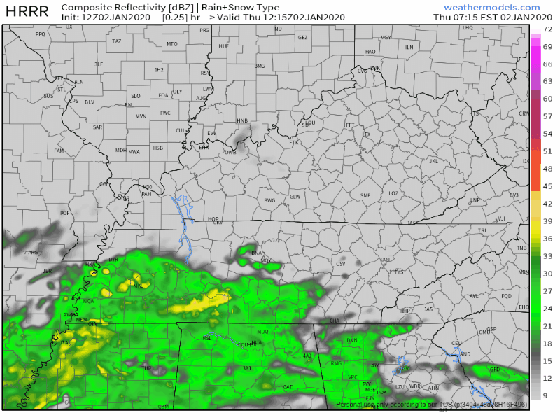
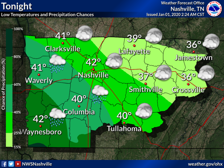
Before the cold front: rain Friday, heavy rain and storms – possibly severe – Saturday. read more

Dry And Warm Through Thursday, Heavy Rain And Storm Potential This Weekend

Calm And Sunny Through Thursday

The next few days in Middle Tennessee are going to be pretty nice. No rain in the forecast over the next couple days. We’ll continue to warm from our high today of 51°, and into the mid 50s and low 60s by Thursday. read more

Sun Today, Rain Overnight, Bigger Rain Possible This Weekend

Today

Plenty of sun today with a high temp around 51°. Not cold, but not hot.

Good idea Olaf.

Quick Shot of Rain Tonight

A low pressure system is getting its act together today down to our SW. This will move overhead and off to the NE overnight tonight, bringing a quarter inch or so of rain with it. Shear will be decent, but instability will be lacking, so we’re not expecting any snarky storms. read more

Sunny Skies Abound!

Clear and Dry (mostly)

Sunny skies for days as high pressure abounds today and the majority of this week.. High temperatures during the day will stay in the low to mid 50’s, lows around freezing. Except for a chance for showers overnight on Tuesday, we’ll be dry. read more

Another Heavy Rain Event Friday-Saturday.

Graupel, a sleetlike winter Sonic ice haily thing, fell today.

Precip/graupel was heavier NE of us, but it’s all moving out. Splat:Melt.

Cold tonight/overnight into Sunday morning. Low near freezing, will feel colder than that. read more

Rainy Today With Flood Watch Through The Afternoon, Possible Wintry Mix Saturday, Dry For Sun. And Mon.

All Rain Today, Flooding Possible

Periods of heavy rain will continue throughout much of the day. Urban and river flooding is still very much a risk. Middle Tennessee is under a Flood Watch through this afternoon, as the rain begins to become less widespread. read more

Heavy Rain Today and Tomorrow; Flood Watch

Rain, Flooding Possible Thursday thru Friday

Rain is already moving into the area this Thursday morning. It will last through Friday.

The HRRR model shows rain all of Thursday, before dispersing on Friday:

The NAM3 model agrees:

Heavier rain should move out by Friday afternoon (as of right now), and the rest should leave by Friday night, though we could see some lighter lingering showers into Saturday. read more

Heavy Rain Incoming. Flood Watch Thursday & Friday.

Happy New Year!

Cold morning temps will rebound nicely into the mid-50°s this afternoon.

Rain approaches overnight tonight into Thursday morning.

Flooding Concers Begin Thursday

Rain starts Thursday morning.

Rain heaviest Thursday afternoon and evening. read more

Cool and Sunny Start to 2020; Rain to End the Week

Cool but Clear New Years Eve

Most of the clouds have finally cleared out.

Current temperature at 2:35 PM: 48°.

Overall, a cool but nice day to close out 2019.

Going out tonight to celebrate?

Temperatures will drop to a low of 32° just before sunrise Wednesday, so be sure to bring an extra layer of warmth. read more

Dry Through New Years, Rain Returns Thursday And Friday, And Weather App Lies

Cooler And Dry Through New Years Day

Now that all the excessive rainfall has moved on out of Middle Tennessee, cooler temperatures are going to stick around with us over the next couple of days. Due to all of that rain, some rivers and creeks are still pretty high, so rivers such as the Cumberland and Harpeth currently have flood advisories attached to them for elevated levels, although neither river is forecast to reach flood stage. Careful on the greenway near Percy Priest Dam, however. Portions of it will be impacted. read more