Cool & abundant sunshine for the weekend

Today

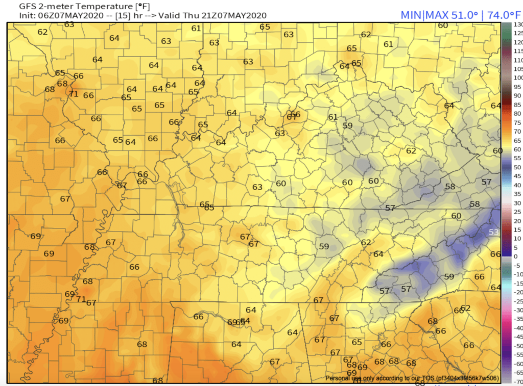
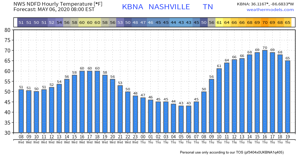
With an abundance of sunshine this morning, temperatures are climbing quickly. Highs today will only warm to the upper 50โ€™s to lower 60โ€™s. There will be a light breeze, too.

Today’s warm up

The average high temperature in Nashville for May 9 is 77ยบ, so we are quite a bit below that mark today! read more

Settings Records for Latest Freeze this Weekend?

Today

Rain will continue this morning into the mid/late afternoon with winds around 15mph.

The rain will clear out and temps will drop into the 30’s overnight.

Above is a short range forecast from the NWS of the extent of precipitation we will receive in the next 12 hours.

Tonight/Saturday morning

Friday’s rain will result in a cold front that will bring the frost we are expecting Saturday morning. A freeze warning that has been issued by the National Weather Service from 1am until 9am Saturday. read more

Rain Friday, Frosty Saturday Morning.

Beautiful today. Friday not so much!

High Thursday: 69ยฐ. Low humidity, too.

Clouds increase tonight ahead of rain arriving Friday morning.

The HRRR model thinks it’ll be raining when you wake up, heaviest by late-morning, then slowly tapering off mid-afternoon into the evening. read more

Colder, Rain Friday, Frosty Weekend?

Light showers this morning will give way to partly cloudy skies this afternoon.

High temperatures will be in the low 60s.

Temps bottom out in the low 40s early Thursday morning at the airport (areas away from the city might see a return to the 30s). Some areas may hit the upper/mid 30s before or around sunrise Thursday. read more

Rain Clearing Out Today, Returns Friday

After the past two rounds of severe storms that have come through the area, we’re finally getting a breather.

There will be a cold front passing through today during the morning and afternoon hours, which will bring us some spotty showers. Rain chances will diminish overnight. read more

Storms Move Out, Leftover Showers Exit Tuesday

Temperatures drop to 62ยฐ overnight with rain starting to wind down.

HRRR through 10:00 am Tuesday.

A few showers could hang around into Tuesday, but should be more off than on.

High of 78ยฐ.

A Few Sunny Days

Wednesday and Thursday look to be sunny days with highs in the mid to upper 60s before our next rain system comes in Thursday night into Friday. read more

More on those storms coming our way today...

We are at risk for severe storms this afternoon/tonight. There is a chance it could pass north of us, but it could pass right over us. Here is the timing along with the potential threats:

Timing

The approximate timing of the severe line is between 5pm and 10pm, though some isolated storms may move through the area earlier in the afternoon. read more

Calming down tonight. Few more rain/storm chances Tuesday, maybe Friday. Then colder.

Straight line winds today dropped trees, tore siding from the side of a house, chipped off shingles, and caused other property damage. The damage is everywhere across Davidson and Williamson Counties. Check our replies for more. read more

Storm(s) Today: Timing, Threats, Probabilities, Confidence, A Speedo. And What’s This About Near-Freezing Temps Saturday Morning?

Until early afternoon.

After that, it gets dicey. And BTW, humid today. One of the most humid afternoons of the year so far. Low 60s dewpoints.

But about the storms:

Outdoor activities and events may need additional lead time to enact safety procedures to prevent significant impacts. read more

Storms Possible Sunday Afternoon-Night

High temps today and tomorrow could exceed 85ยบ. Bring on the heat complainers.

A small chance for rain showers north of us. We don’t think it will sink south down here.

Sunday hail & wind timing and probabilities.

Sunday starts like today. read more