Active Weather This Weekend and Storms Possible On Mother’s Day

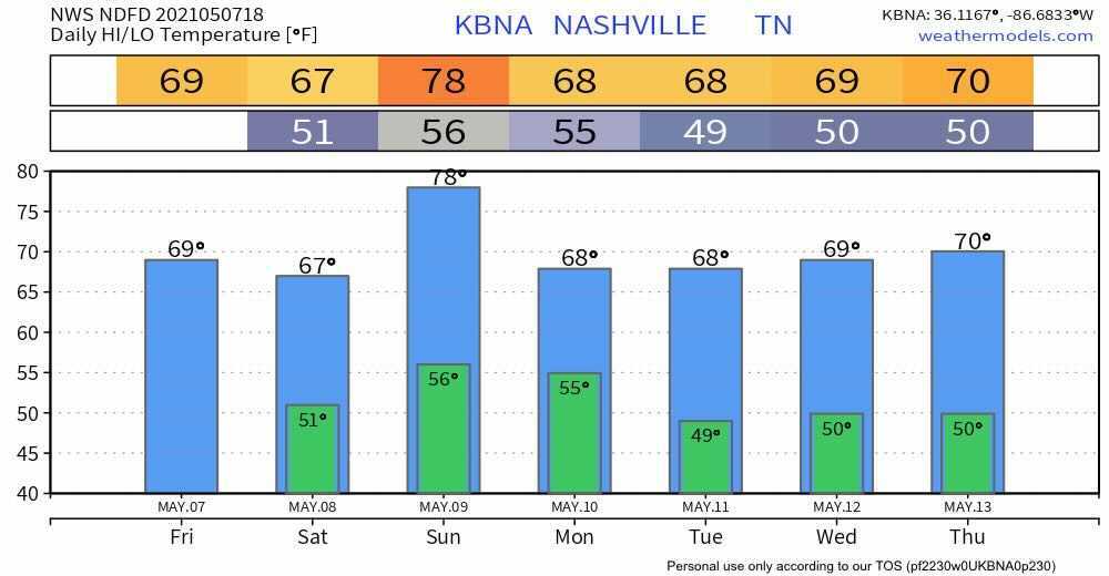
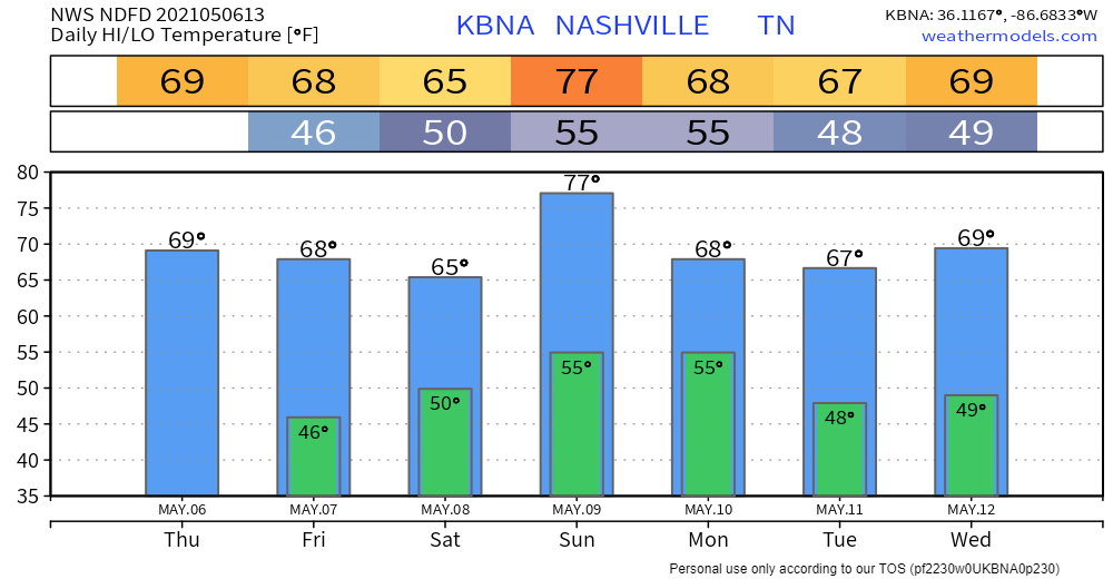
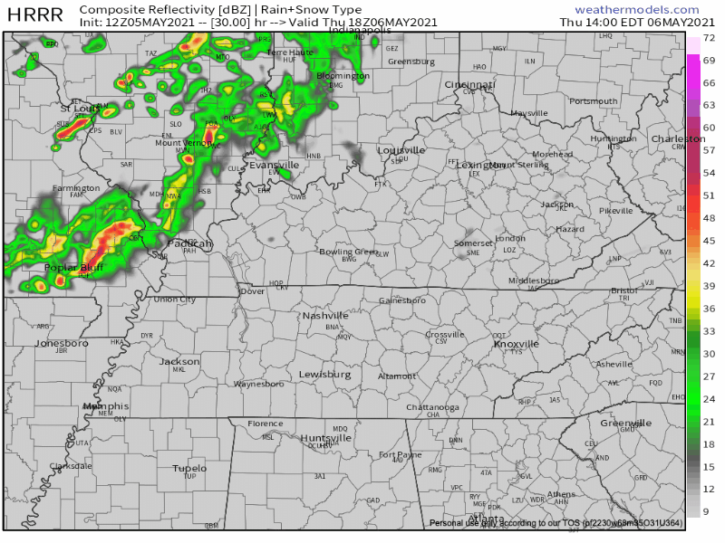
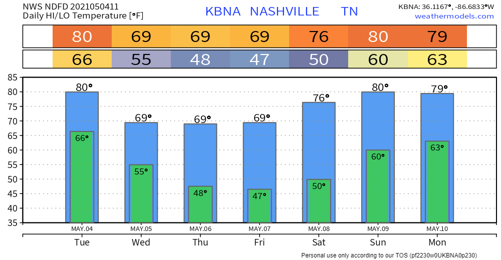
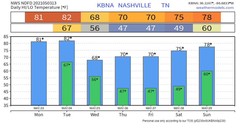
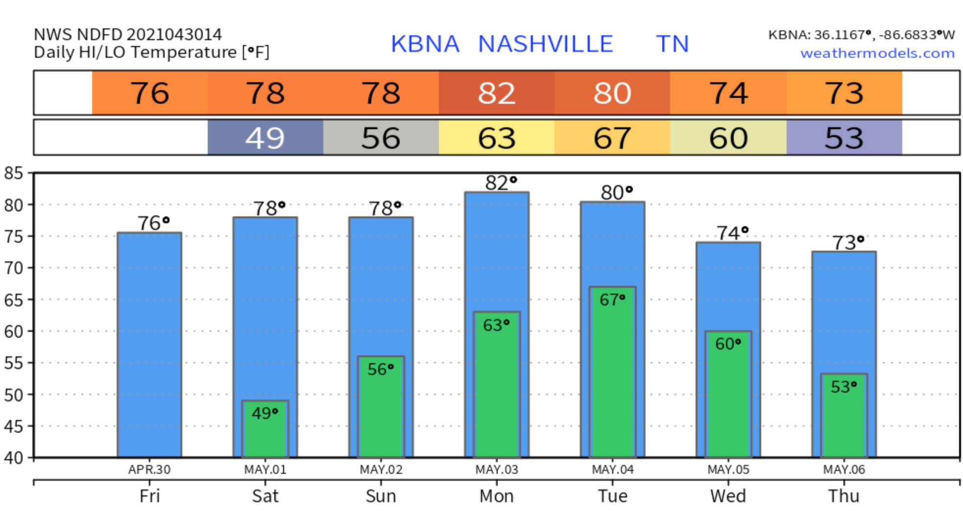
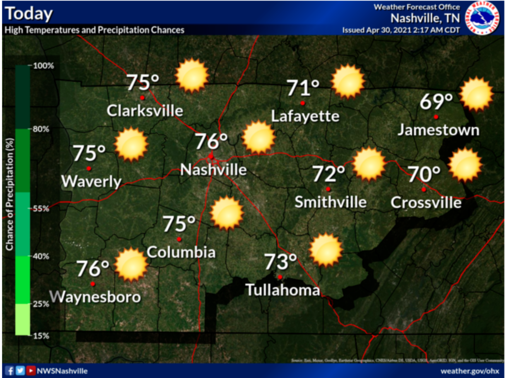
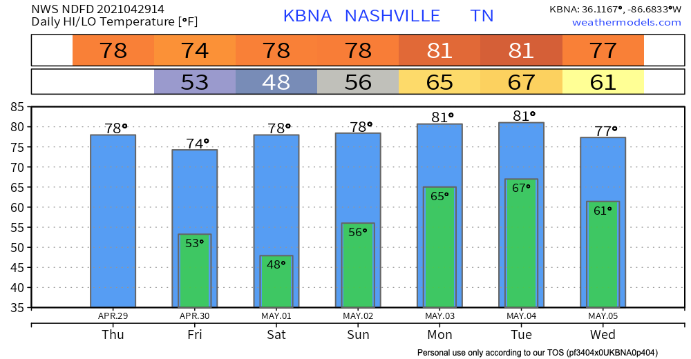
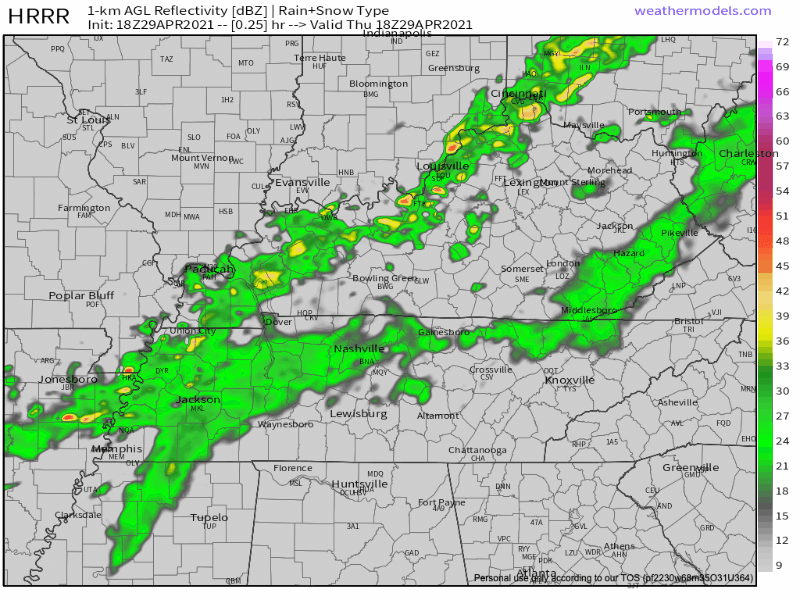
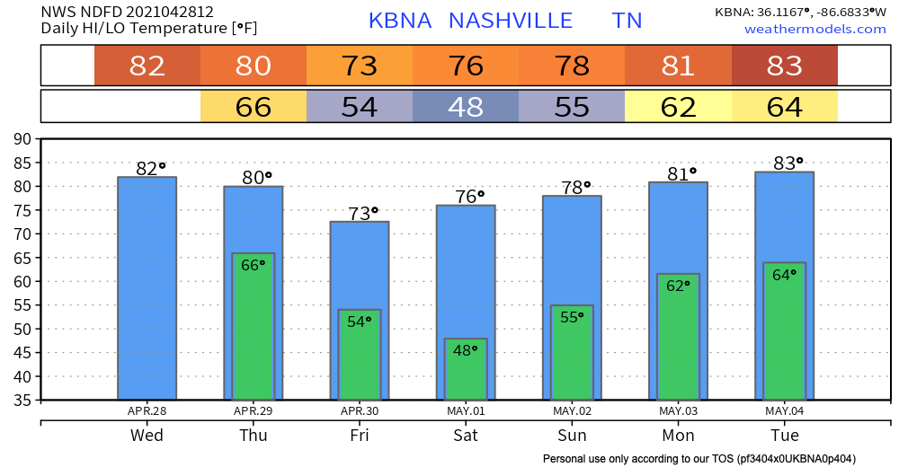
First of all… I hate the typical clip art on weather sites/apps, but I’m going to show it now because I think it give us a clue as to what to expect for the next few days.
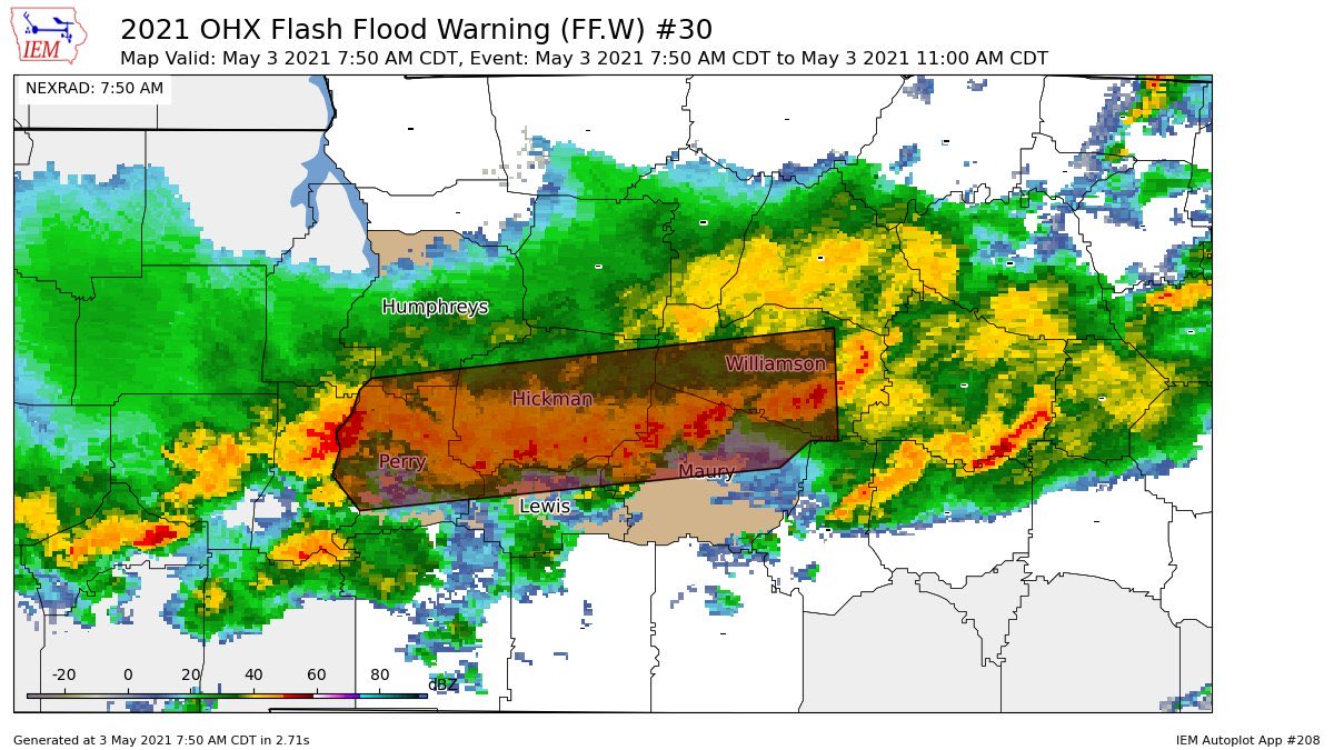
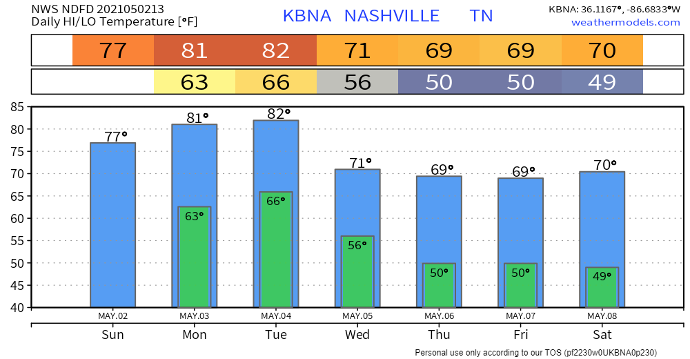
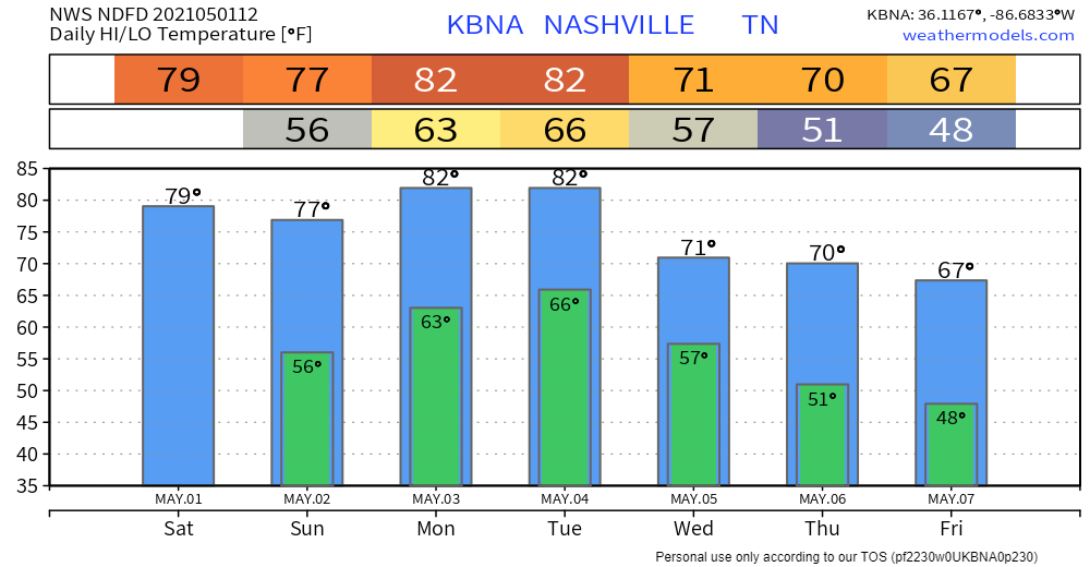
Rain

May is our wettest month, so it’s no surprise that we’ll see plenty of water in the coming days. read more

Storms Possible This Evening, Rain Chances This Weekend Into Next Week

Two Tornadoes in Davidson County on Tuesday

Two tornadoes touched down in northern Davidson County on Tuesday morning, according to a damage survey by NWS-Nashville. The first along a W to E path just north of I-24/Joelton. The other along Lickton Pike/Old Springfield Pike/Hwy 41 just N of Goodlettsville. Both were EF-0. They both occurred within the tornado warning that had been issued and were from the same storm. The first tornado touched down, lifted, then touched down again as it moved east. read more

Brief Shot At Storms Thursday, Weekend Rain Chances

Yesterday’s Severe Weather

Numerous National Weather Service damage surveys will get going over the next few days to determine what damage was caused by tornadoes and what damage was caused by straight-line winds. The damage can look similar, especially with weak rotation as we saw yesterday. But, trained eyes will sort it out. read more

More Storms Likely By Mid/Late Afternoon

Embracing uncertainty is hard, y’all. The HRRR model was hot garbage last night. It timed the morning line well but completely missed on overnight rain. It thought there would be a lot of it, and there was none of it. read more

48 Hours: Several Rounds of Storms Possible. Some Strong or Severe.

Most of Will Co is under a Flash Flood Warning this morning.

Image

Another 1″ to 2″ is expected as rain “trains” over the area. Training rain is like a train, it runs over the same tracks. Those in the Flash Flood Warning box above are the tracks. read more

Get Your NOAA Weather Radio & Wake Me Up Apps Ready

11 years ago today the 2010 Flood was showing itself. 1 year ago tomorrow, the derecho.

For the next two nights you’ll need to have your NOAA weather radio and Wake Me Up app (StormWatchPlus) ready. You’ll need them tonight and Monday night. read more

Monday Night Severe Weather Concerns.

No rain today.

Rain Sunday. Not enough to cancel plans but if you’re outside all day you’ll get wet.

Light rain arrives around lunchtime/Nashville SC kickoff. Then more light rain later Sunday afternoon. See below HRRR model. Some models have it earlier, others later than that. read more

Dry for Now, Active Weather for the Next Week

Off-and-On Rain (Low-End Severe Threat) This Evening, Active Next Week

Steady, light rain has overspread the area

Models aren’t good enough to determine whose track field will get rained out at what time.

But, really, the HRRR thinks this rain is going to hang around for the evening with several rounds of showers and maybe a storm. HRRR through midnight…

More isolated showers/storms should develop around rush hour. These could be a bit stronger than what we have seen this morning. read more

Showers (Maybe Storms) Wednesday and Thursday.

Scattered Showers Prevail Wednesday

Scattered showers are already popping up this morning. Expect this to continue throughout the day today.

The HRRR model shows most of the showers impacting Williamson/Davidson this morning and early this afternoon. The larger wave of rain this evening should miss us to the north. read more