
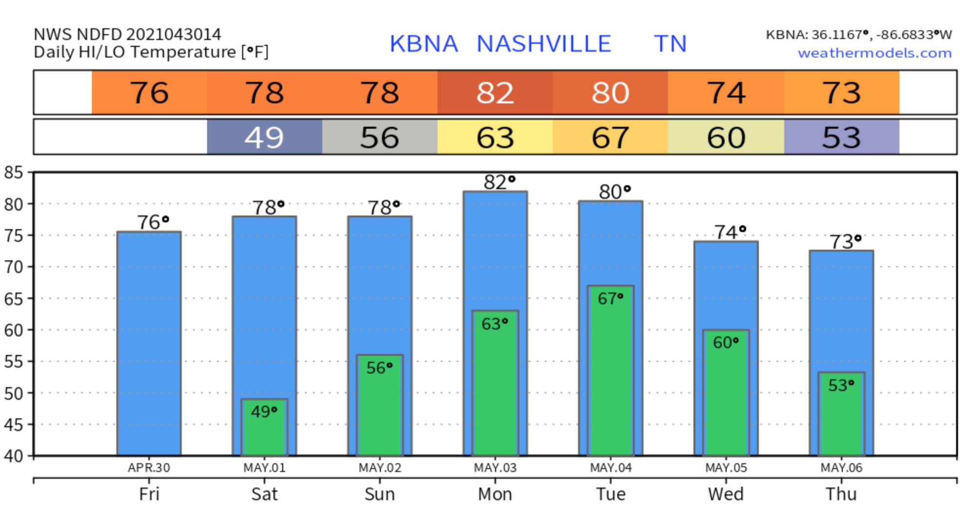

A nice and dry Friday in store to end the work week as high pressure builds in.
The cold front that passed through yesterday will make our temperatures a bit cooler today.
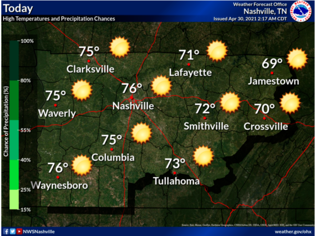
Same story in the forecast for Saturday. Sunny and dry conditions throughout the day, but temps will warm back up closer to the 80’s.
Active weather will return Sunday brining us decent amounts of rainfall and possibly some thunderstorms.
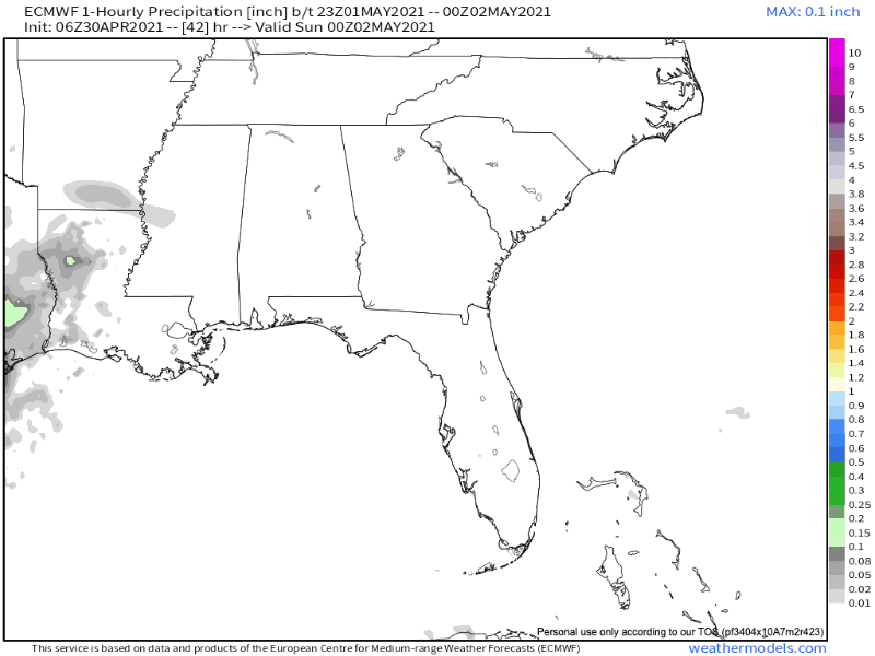
Primary timing for rain is looking to be after 2pm and continue the rest of the day and into the overnight hours.
Timing for any thunderstorms we may see is expected to be in the later evening hours after 8pm.
Into Next Week…
These showers and storms will continue into next week.
Monday looks to be an all day rain event with thunderstorms in the mix pretty much all day as well. Winds will be fairly high at 10-15 mph gusting 20 mph.
Tuesday showers and thunderstorms are expected once again and mainly all day.
More rain for Wednesday, but chances finally begin to decrease into Wednesday night.
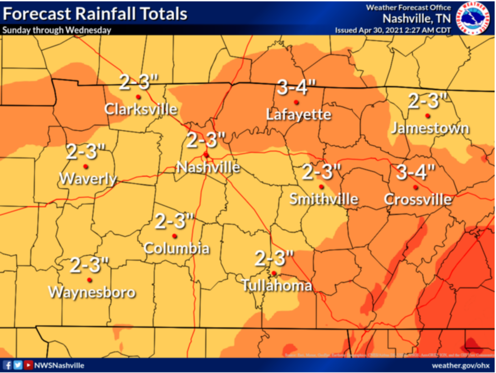
Forecasted rainfall totals have a pretty significant amount of rain expected to be accumulated over the next several days. (Sunday-Wednesday)
Thursday is the day we may finally see some clearing and the sun make an appearance since rain chances will finally be low enough for that.
Have a great weekend!
Categories: Forecast Blogs (Legacy)
You must be logged in to post a comment.