
Embracing uncertainty is hard, y’all. The HRRR model was hot garbage last night. It timed the morning line well but completely missed on overnight rain. It thought there would be a lot of it, and there was none of it.
The danger in Davidson and Williamson Counties from this morning’s storms is over. Rain will clear out well before lunch. The atmosphere will recharge and refuel for a second wave of bad weather this afternoon and/or tonight.
Two models have two different ideas about today.
The HRRR model thinks storms will come speeding out of the southwest and arrive 2-3 PM this afternoon. That’s just the latest HRRR ETA. Prior HRRR ETAs have storms arriving later.
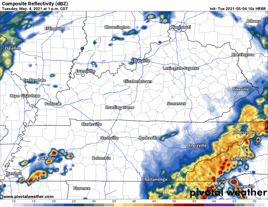
These storms will have plenty of energy to power them up. But wind fields do not look especially tornadoconcerning inside the HRRR model. The HRRR shows near surface winds blowing out of the WSW. There would be more concern if surface winds were blowing out of the south. Still, these storms will contain straight line wind and hail potential, along with frequent CG lightning and torrential downpours. And we can’t completely rule out a tornado within in the HRRR data.
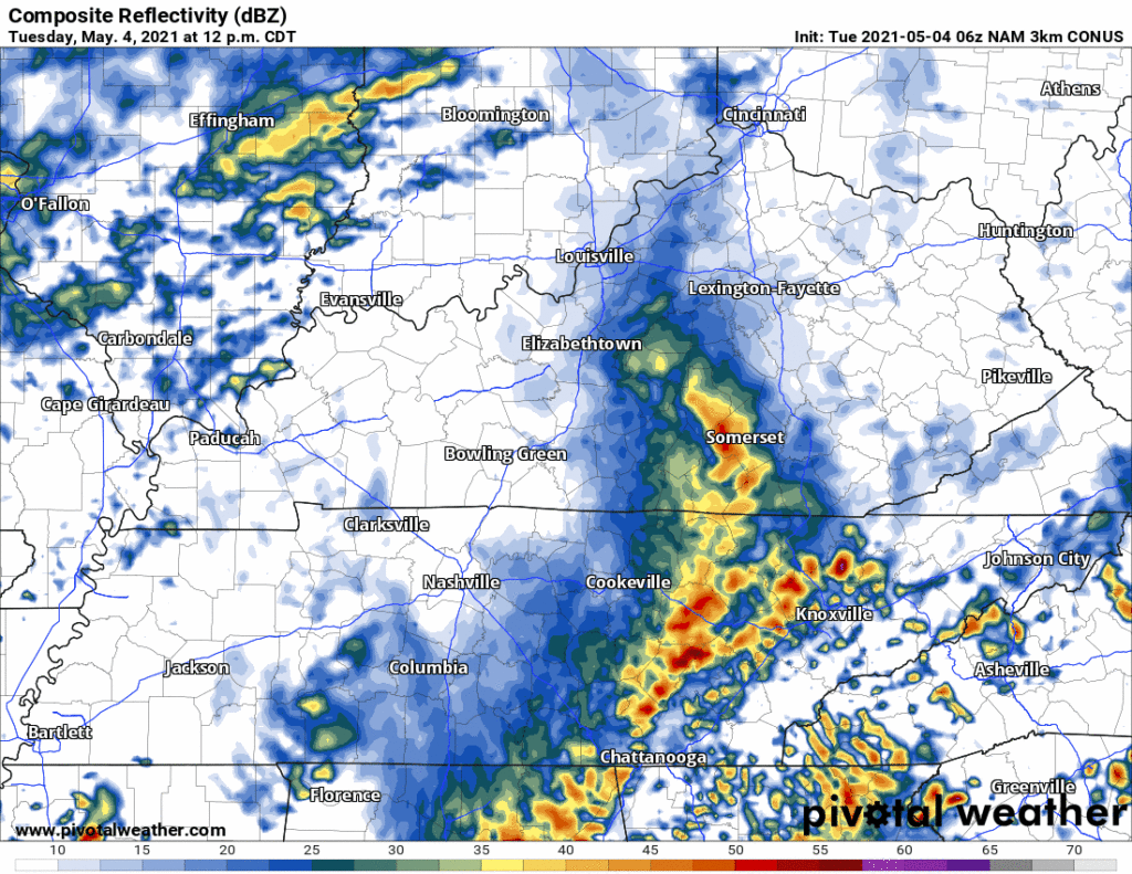
The NAM3 model has a different idea. It has a 5 PM ETA. It shows more southerly surface based winds, which would create a bit more of a tornado concern. But still, straight line winds and hail would be the main concerns.
Outdoor sports likely rained out tonight.
The Storm Prediction Center says 15% probability of damaging straight line winds, 5% probability of hail, and/or 2% probability of tornado within 25 miles of us today. Connect to us on Twitter for revisions and updates to this information. Timing, hazards, and probabilities may change as we go through the day.
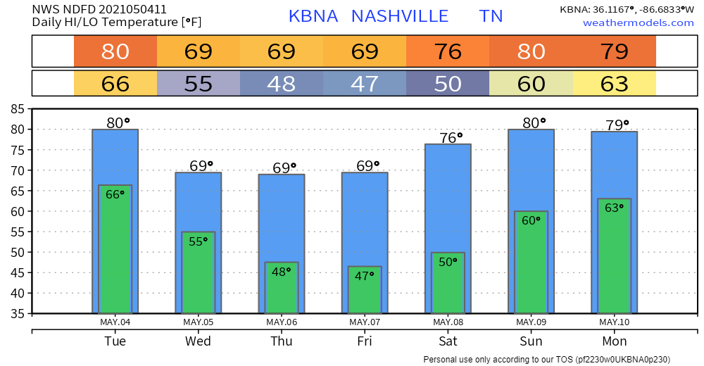
Rain ends late tonight, and we clear out until early next week. Cooler temps, too.
Categories: Forecast Blogs (Legacy)
You must be logged in to post a comment.