
Steady, light rain has overspread the area
But, really, the HRRR thinks this rain is going to hang around for the evening with several rounds of showers and maybe a storm. HRRR through midnight…
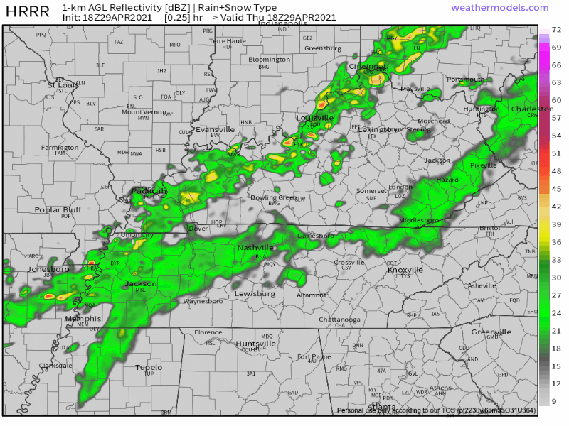
More isolated showers/storms should develop around rush hour. These could be a bit stronger than what we have seen this morning.
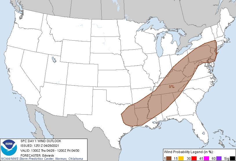
The most current SPC outlook has us in a 5% risk for damaging winds within 25 miles of your location. This is the main risk.
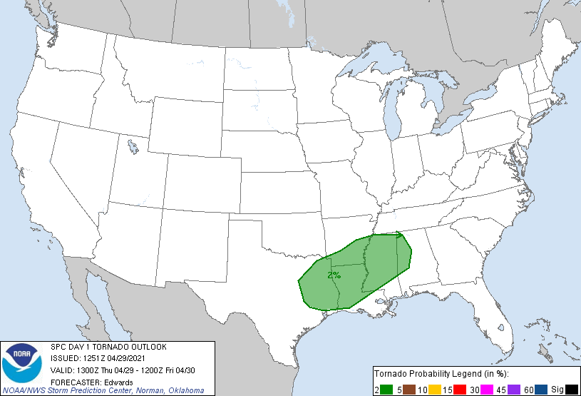
We are not included in the low end tornado risk.
Everything should exit around sunset.
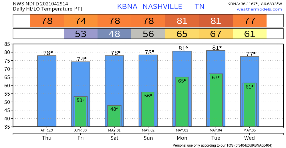
Dry Friday-Saturday, Unsettled Afterwards
We will dry out Friday and Saturday with more seasonal temps. 80s return early next week next week and with it comes more chances for rain.
The next surface system looks to spread into Middle Tennessee on Sunday, with multiple fronts/shortwaves affecting the mid state through Wednesday or Wednesday evening.
NWS Nashville AFD 04-29-2021
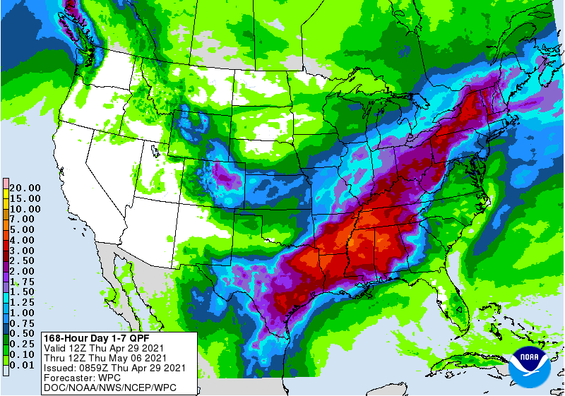
Current thinking is that we’ll have at least some chance for scattered showers over multiple days. Too early to know if we’ll have severe weather but a good amount of rain is likely.
2-4 inches is possible.
We will have a better understanding of timing and potential impacts in future blogs.
Have a great Thursday!
Categories: Forecast Blogs (Legacy)
You must be logged in to post a comment.