

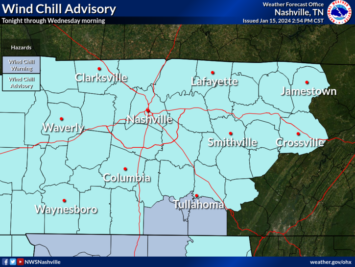
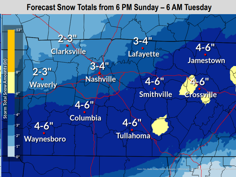
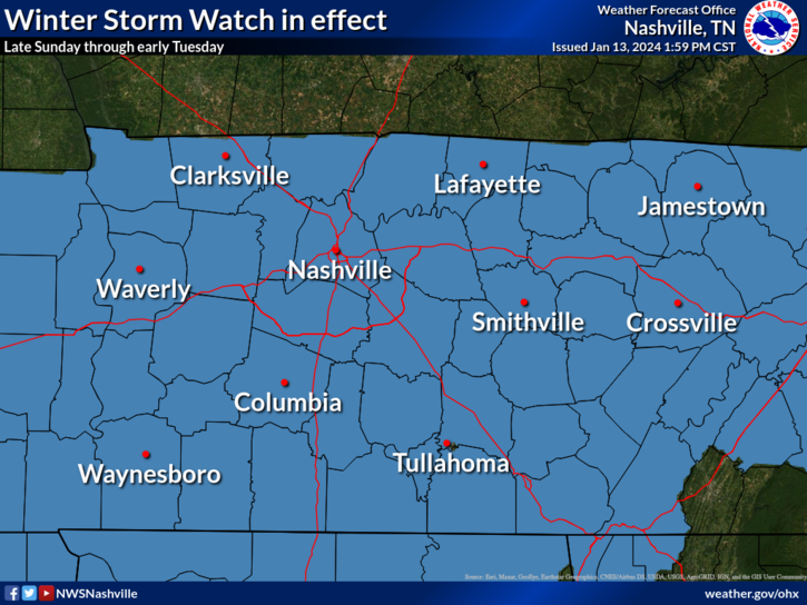
Wind Chill Advisory continues thru 10 AM Wednesday.
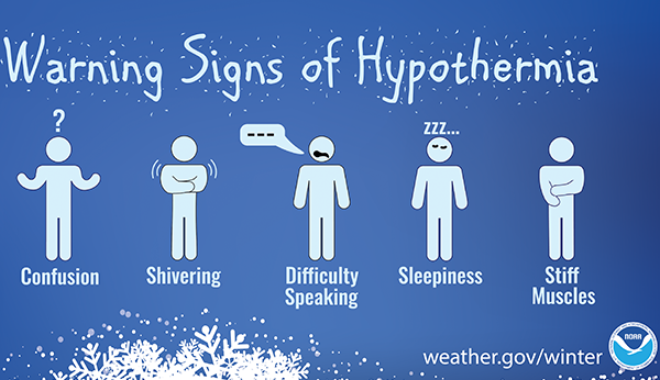
- “Wind chills as low as 15° below zero…plan on slippery road conditions. The cold wind chills could result in hypothermia if precautions are not taken.” – NWS Nashville
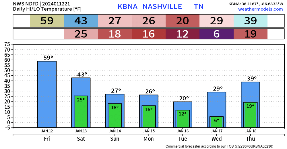
High temps only expected to make it to 18° today. Wind chills will be stuck in the single digits during the day.
Air temps tonight will be very close to 0°, your backyard may make it below zero.


You must be logged in to post a comment.