

Lots to talk about before we dive into the wintry weather potential.
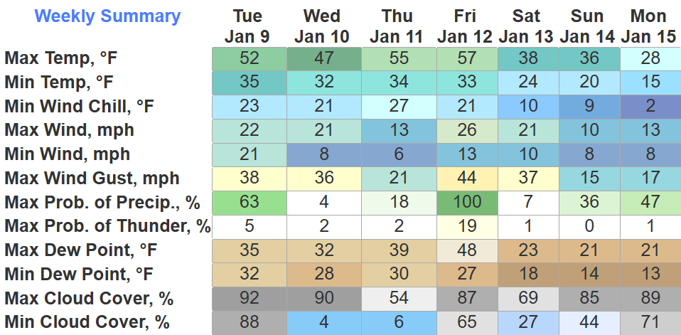
We still have a Wind Advisory to deal with until 6am Wednesday morning.
Wind gusts up to 40 – 45 mph are possible overnight. Could wake you up, but no need for concern.
Along with the wind, you may see a rain/snow mix this evening and tonight.
HRRR model shows precip will likely begin as rain, but as temps drop into the mid 30s, snowflakes will likely mix in. However, with surface temps above freezing, any snow will melt on contact with the surface. Maybeeeee briefly sticking to elevated surfaces if it falls fast enough, but no impacts expected.
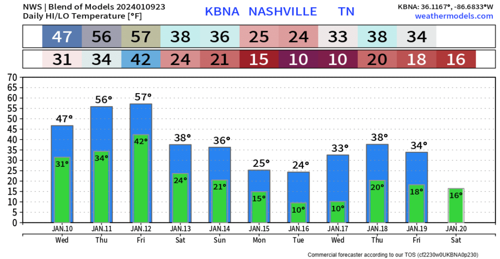
Wednesday and probably all of Thursday we will get to take a deep breath and enjoy the dry weather. High temps get into the mid 50s on Thursday.
Friday a low pressure system will bring more wind + rain, a very similar system to the one we just had/are experiencing.

Good news is, no severe weather is expected.
The Euro thinks rain, heavy at times, arrives Friday morning and is out of here by Friday evening. Wind gusts will likely be in the 30-45 mph range, a Wind Advisory may be needed…again.
And there is the possibility for some wrap around flurries Friday night, but no accumulation is expected.
Forecast subject to change. Stay tuned.
Looking At Very Cold Temps + Sn*w Potential
Snow is a very touchy subject here in Middle TN. You either hate it or wait all year for it. Whenever models start hinting at it, a whole bunch of talk happens. Fantasy-land snowfall maps are thrown out and people go bonkers. This possible event would be maybe Monday, maybe Tuesday, maybe neither. This is ~150 hours out, and truth is, no one knows quite yet. Overall confidence is very low in snowfall amounts, if any, this far out.
However, there is confidence in very cold temperatures early next week.
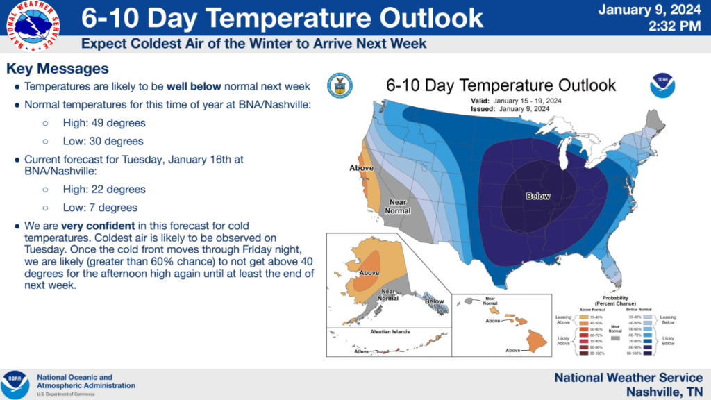
ETA for very, very cold air looks like Monday right now. Single digit lows are possible and temps may not get above freezing for a couple of days.
The Blend of Models suggests this Arctic air won’t be in a huge rush to get out of here, and may stick around a majority of next week.
Models are suggesting the possibility of moisture Monday/Tuesday. There is a lot of uncertainty about how much, when, where, etc.
*If* the moisture and cold air line up, then accumulating snow would be possible.
There are so many “ifs” that it is not worth talking about potential snowfall amounts just yet. If you are scrolling and see a snowfall map, close your eyes and keep scrolling. Don’t fall for it.
For now, the best thing to do is prepare for the very cold temperatures.
We’ll be watching trends with the models throughout the week. Let’s get through this week first.
Quick References:
Weather changes constantly.
Follow @NashSevereWx on Twitter for any changes to this forecast.
Live coverage during tornado and severe thunderstorm warnings:

Look good.
Support the mission.

We are 100% community supported. No ads. No subscription fees. Keep it free for everyone.


Categories: Forecast Blogs (Legacy)
You must be logged in to post a comment.