
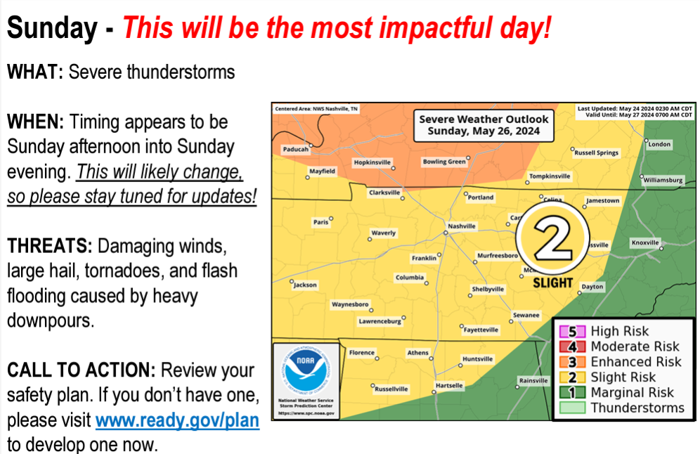
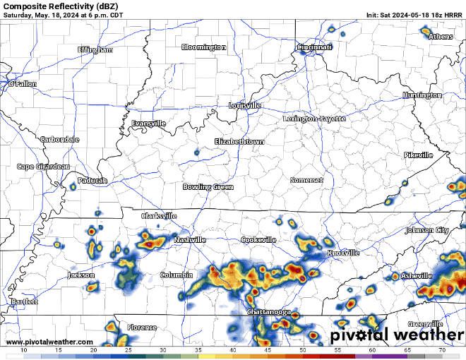
This afternoon/tonight. Clouds are limiting storm potential. Models think rain will fade through afternoon. Graduations tonight may be OK but we cannot rule out an isolated storm popping up.
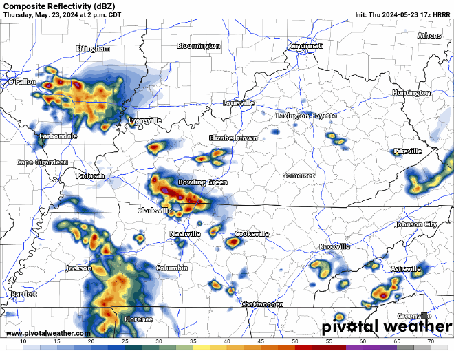
Storms overnight should mature over Kentucky and drop south. HRRR model ETA 3-4 AM. Lightning, heavy rain, strong straight line winds main hazards. Tornado risk much further west where only a 2% probability within 25 miles is outlooked.


You must be logged in to post a comment.