

[tminus t=”21-08-2017 11:58:00″ align=”left” omitweeks=”true” id=”Solar-Eclipse”/]
Today’s the Big Day!
And just like that August 21, 2017 is finally here.
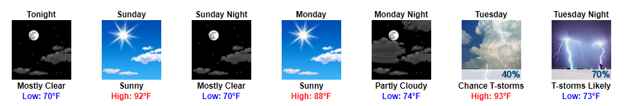
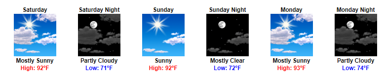
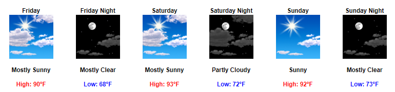
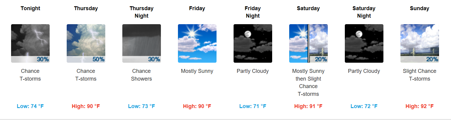
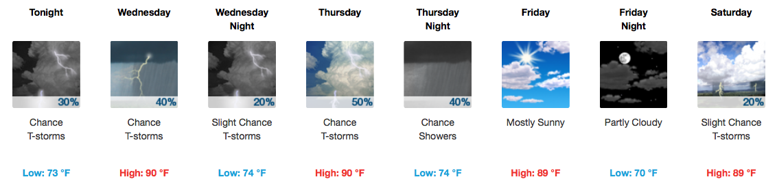
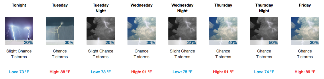
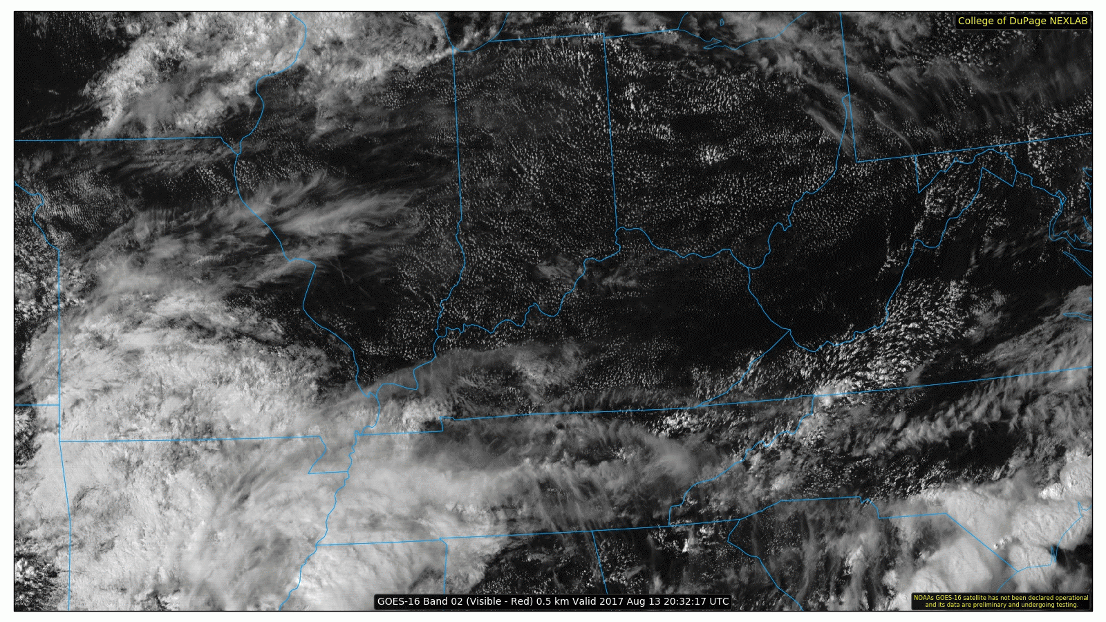
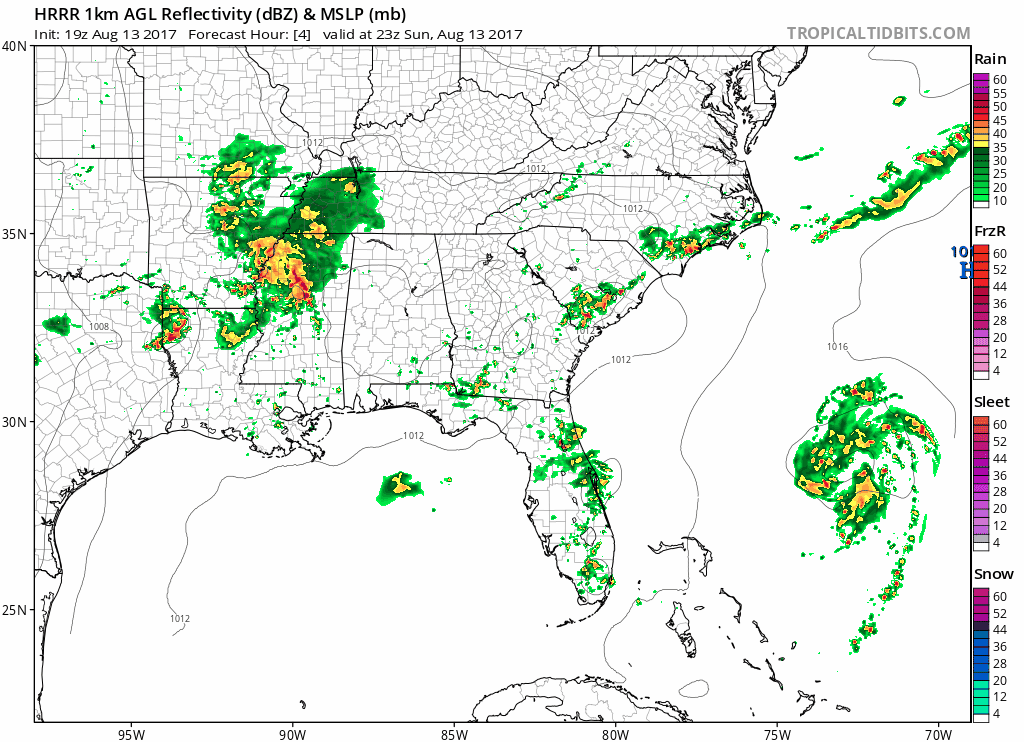
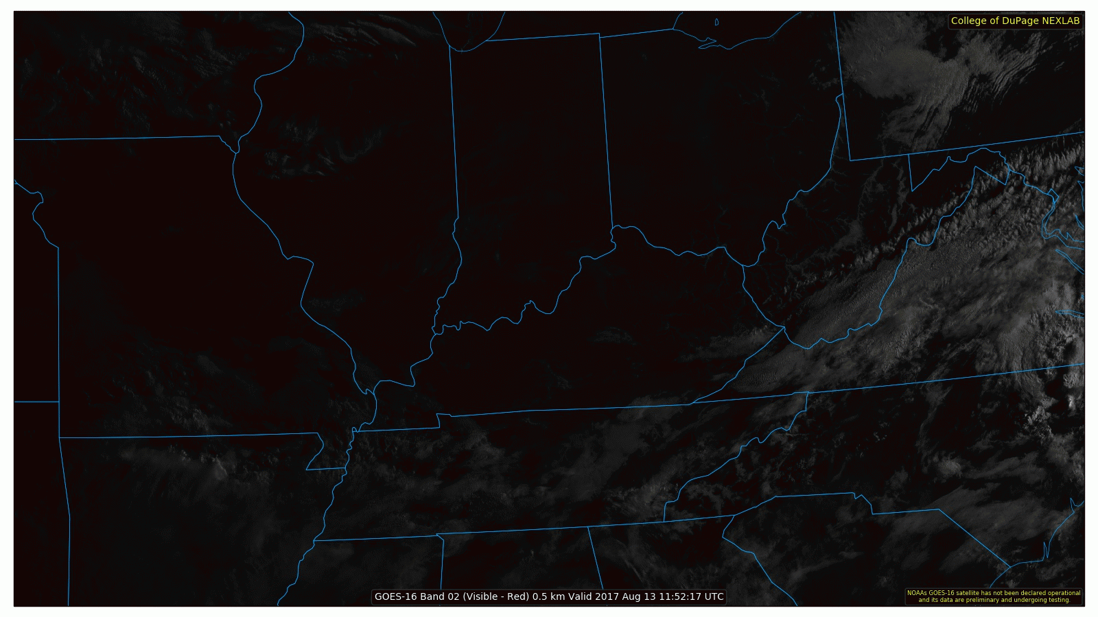
To answer the question “will a cloud be overhead during totality at my location”, the answer is we do not know. We cannot say whether a cloud will be at a certain location at a certain time. However, this is what we do know about the cloud factor for today.
You must be logged in to post a comment.